
.webp?language=en-US)
Advertisement
2019 ASLA Professional Awards
Explore:
General Design Category
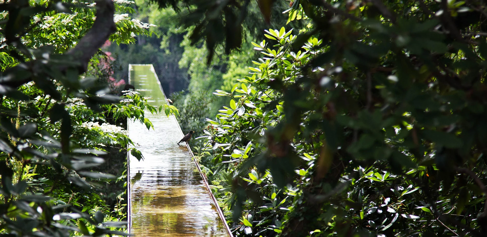
Heritage Flume
The Heritage Flume was sensitively constructed through a marginal forested dell and a little-used lawn, transforming these areas into an iconic element for Heritage Museums and Gardens. The design explores the intersection of American landscape history and contemporary design through the reinterpretation of the region's historic gristmill water flumes. The Heritage Flume enriches the multi-sensory experience of visitors, the garden's collections, and the museum's mission of sharing American history with future generations.
General Design
Honor Awards
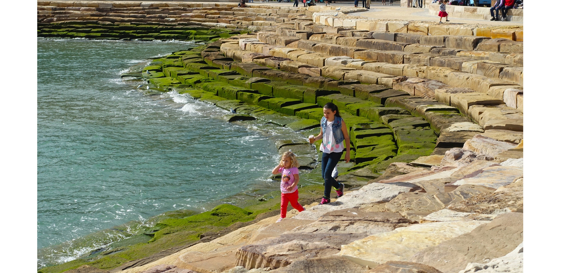
Barangaroo Reserve
Named for an influential Aboriginal woman of pre-colonial Sydney, Barangaroo is a globally-significant, 22-hectare waterfront renewal project that redefines Sydney Harbor. Barangaroo Reserve was the first phase in a 3-district master plan. The project re-created a "Club Cape" headland by transforming a concrete container port into a park with over 75,000 plantings native to the region. Guided by historical maps and paintings, the design of the headland includes a f
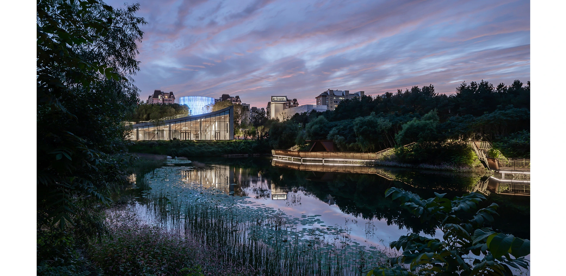
Changchun Culture of Water Ecology Park
Changchun Culture of Water Ecology Park is an urban regeneration project where was a water plant with an 80-year history. It has become a cultural and art community through transformation and functional replacement. In the design, the original ecological environment is preserved to the greatest extent, and the traces of history are respected to the greatest extent, and the contemporary lifestyle is maximized. The design highlights the three characteristics. Firstly
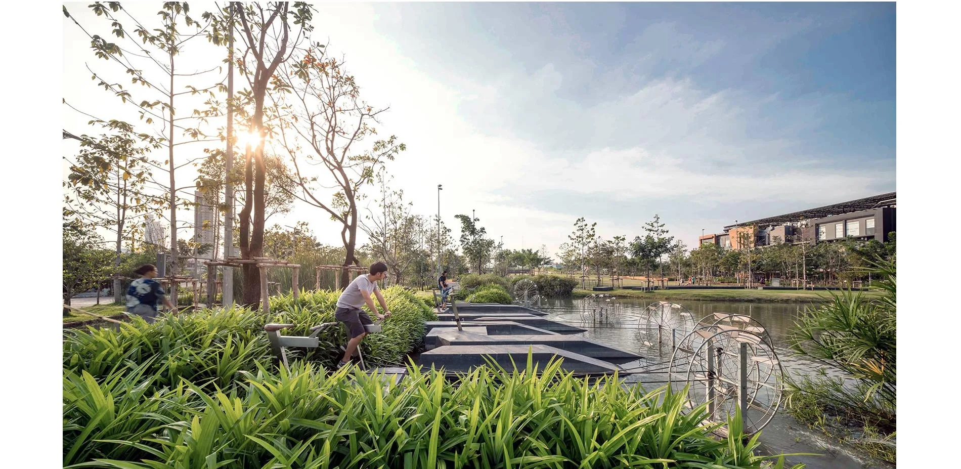
Chulalongkorn University Centenary Park
Today, as our constantly-fluctuating climate causes rising sea levels, storm surges, and unexpectedly heavy rainfall, low-lying cities across the globe are bracing for urban flooding disaster. As sea levels rise and concrete infrastructure multiplies, Bangkok is sinking two centimeters every year.
For the first time in 30 years of rapid urban development, an invaluable property at the heart of Bangkok—11 acres of land and 1.3 kilometers of the road— was not
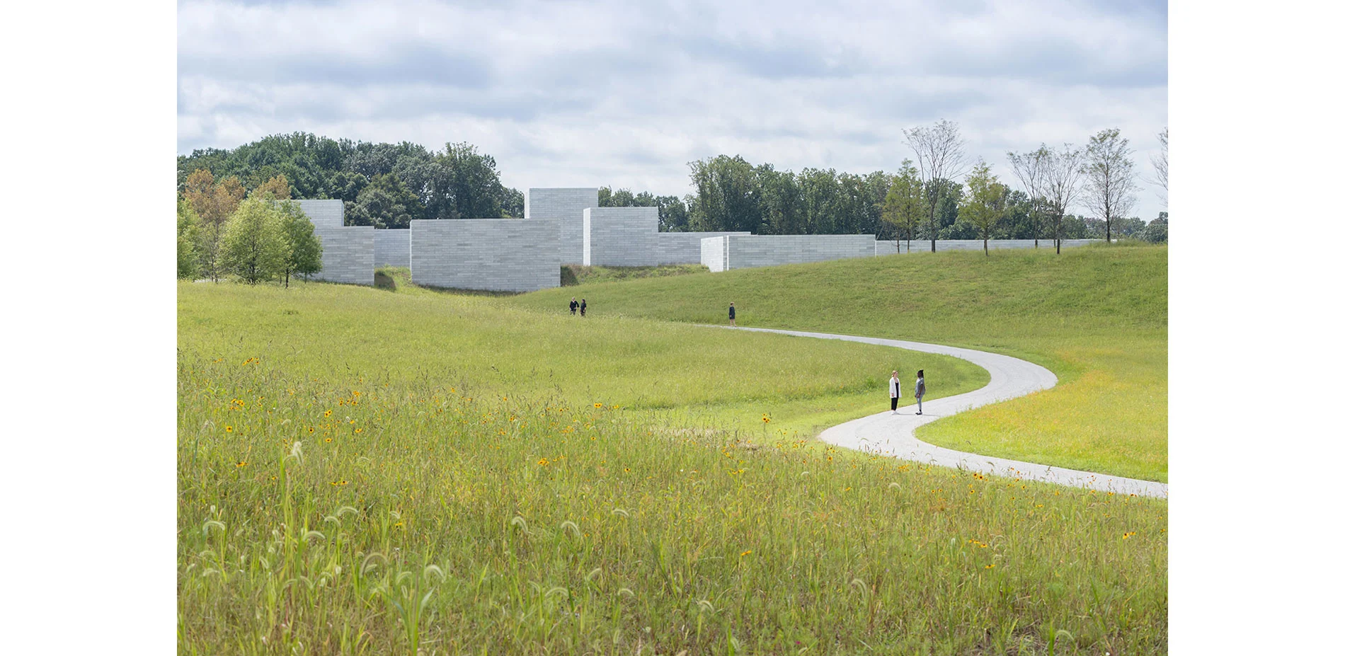
Glenstone
The Glenstone landscape integrates art, architecture and nature within a continuum of cultural experience and expression. An evolving spatial and sensorial journey unfolds as visitors leave their cars in the shade of a designed woodland and traverse this 200-acre designed landscape on foot. Through physical contact with the land as well as key moments of prospect across it, reflection on, and understanding of, landscape systems is foregrounded alongside world class
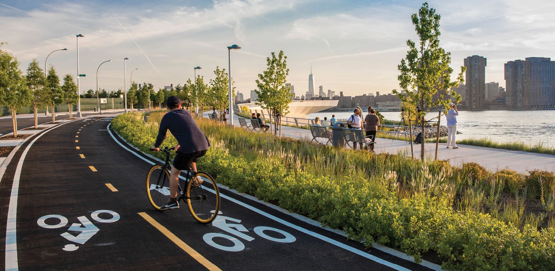
Hunter's Point South Waterfront Park Phase II: A New Urban Ecology
One of the city's most ambitious and complex developments in decades, Hunter's Point South Waterfront Park Phase II aspires to be a new kind of project. With its final phase complete, Hunter's Point South Waterfront Park stands as a global model for social, cultural and ecological resiliency at the urban waterfront. An aspirational and innovative blending of landscape, architecture and infrastructure has transformed this contaminated rail site into a verdant parkla
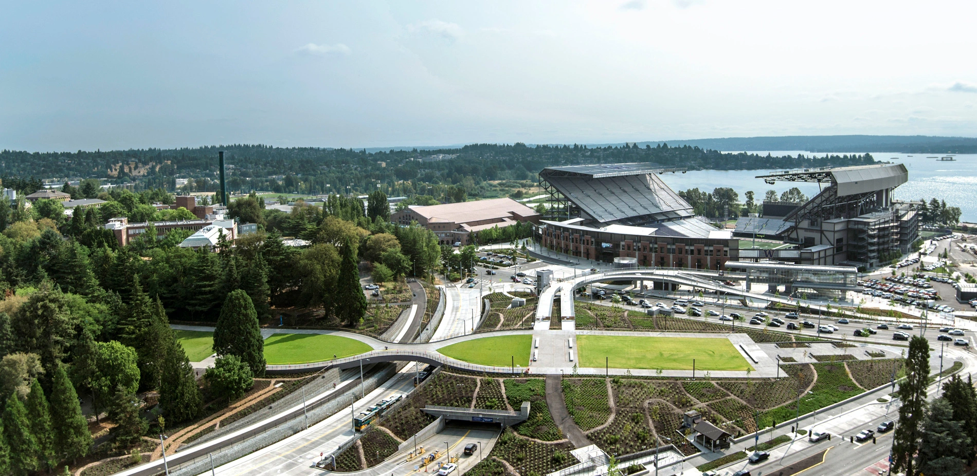
Lower Rainier Vista & Pedestrian Land Bridge
The University of Washington's Lower Rainier Vista Project extends and completes the Olmsted Brothers' historic vision for a monumental campus axis within the intersection of many transportation modes. The design references Collegiate Gothic forms and uses fine-tuned grading of the Vista to frame views, integrate modern infrastructure, and provide new ADA connections. A new land bridge facilitates multimodal integration of pedestrians, cyclists, buses, and automobi
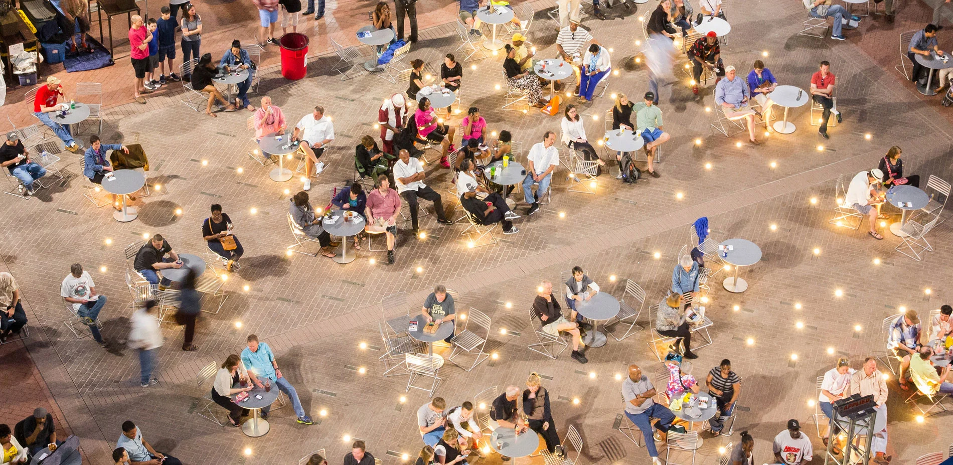
Sundance Square Plaza, The Heart of Fort Worth
Texans are famous for a charismatic hospitality that blends traditional values with a genuine good time. Fort Worth's Sundance Square Plaza is a prism for this practice at a large scale, a place where everyone can feel at home. The former parking lots on Main Street welcome thousands of visitors weekly to a dynamic tableau nestled within the rich architectural detailing of the city. Equally welcoming on a peaceful morning or a lively evening, the Plaza's water and
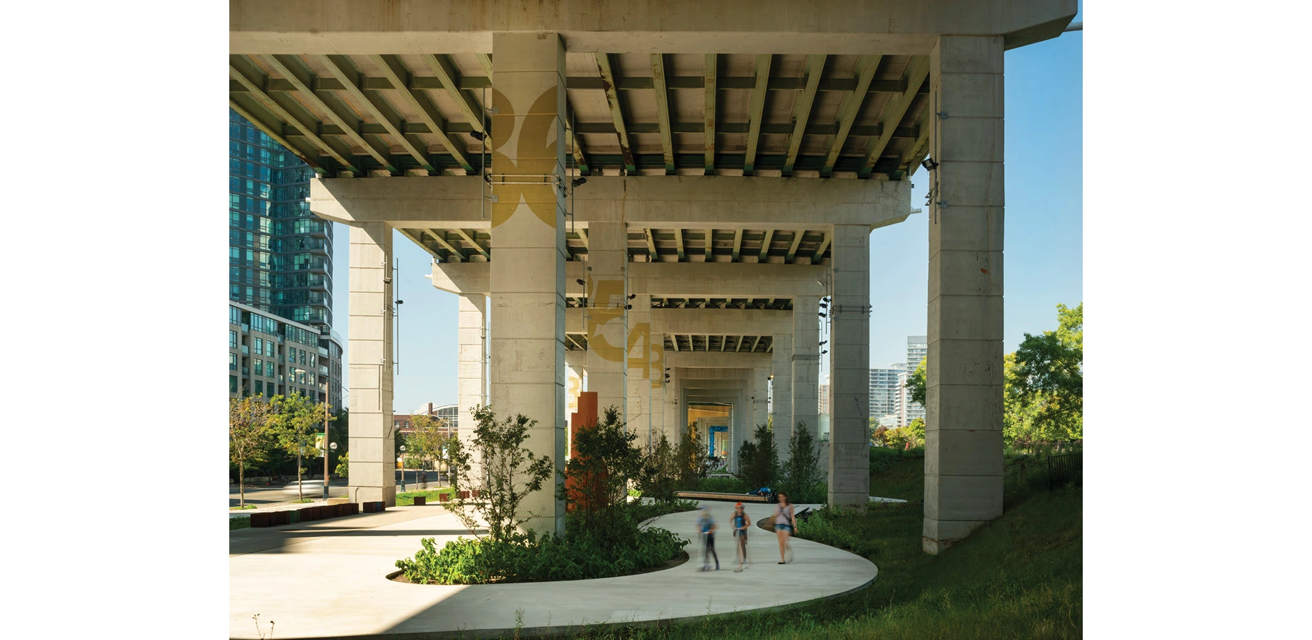
The Bentway
The Bentway re-imagines Toronto's most divisive symbol of 20th century transportation planning as a new model of shared public terrain able to capture the soul and spirit of the city. This project could only happen now because of a genuine need to be resourceful, innovative and bold with how we think about public space in our rapidly densifying cities. The project creates a 7 acre pioneering urban landscape conceived to support new forms of creative expression and
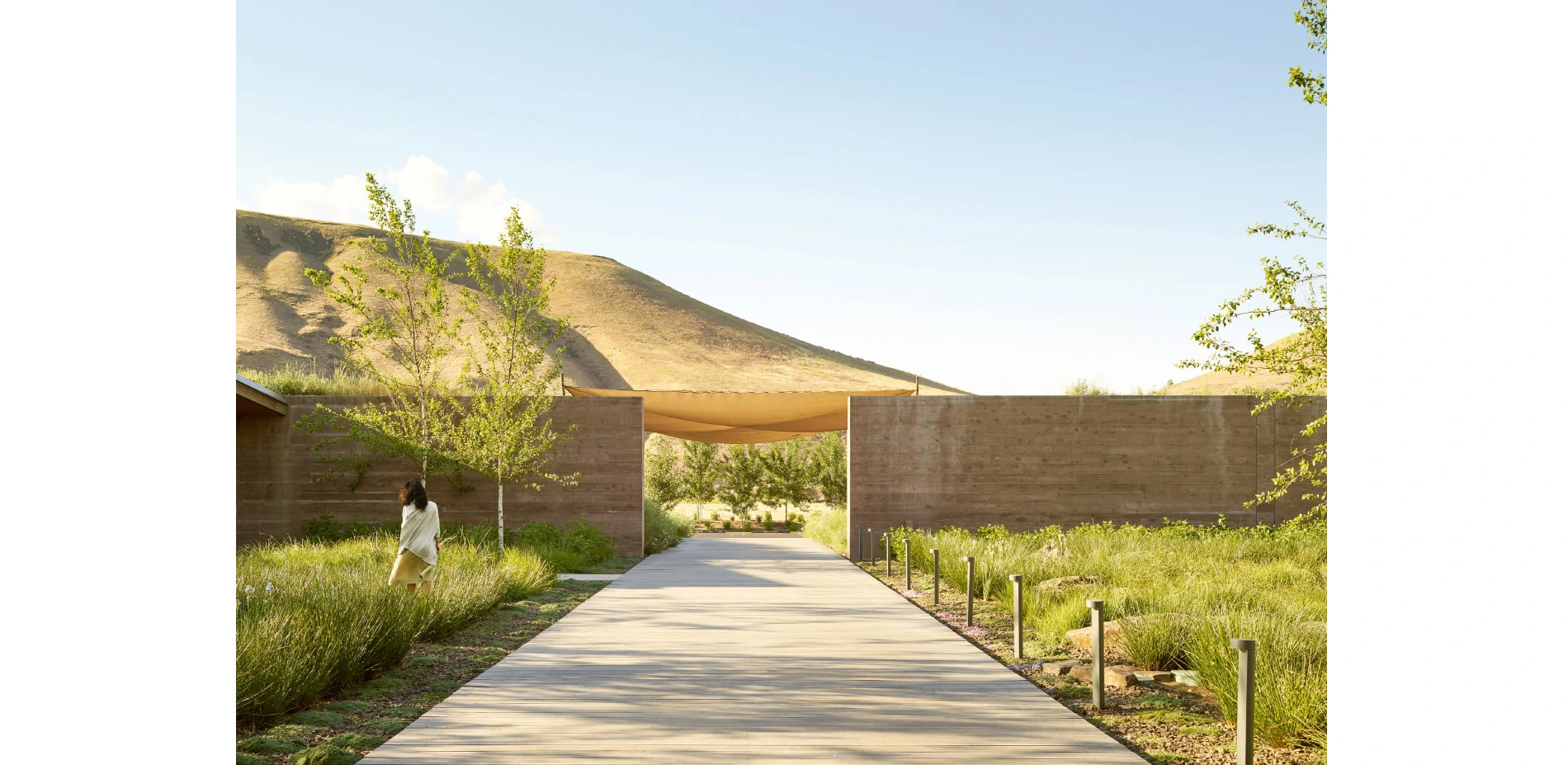
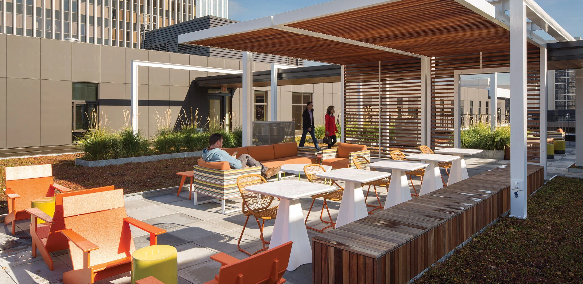
Washington Fruit & Produce Company Headquarters
Washington Fruit & Produce Company grows and ships premium fruit around the world. The owners wanted to create a work environment representative of the company and their connection to the area's agricultural history. Located in arid Eastern Washington, surrounded by a major highway and industrial fruit storage and processing facilities, a simple earthen landform of native plantings wraps the building and courtyard creating a lush green oasis. This calming setting p

Yellowhorn Farm Park: Battling The Threat of Desertification
The Yellowhorn Farm Park project, built in 2014, is a 150-acre hilltop of yellowhorn farmland located in Aohan County in Inner Mongolia, China. Inner Mongolia is China’s third largest province, and has been battling severe desertification for over a century. Over-grazing, logging, expanding farms, population pressure, wind, and drought have all turned this once-fertile grassland into sandy a plain. In the past 20 years, approximately three million acres of desert h
Residential Design Category
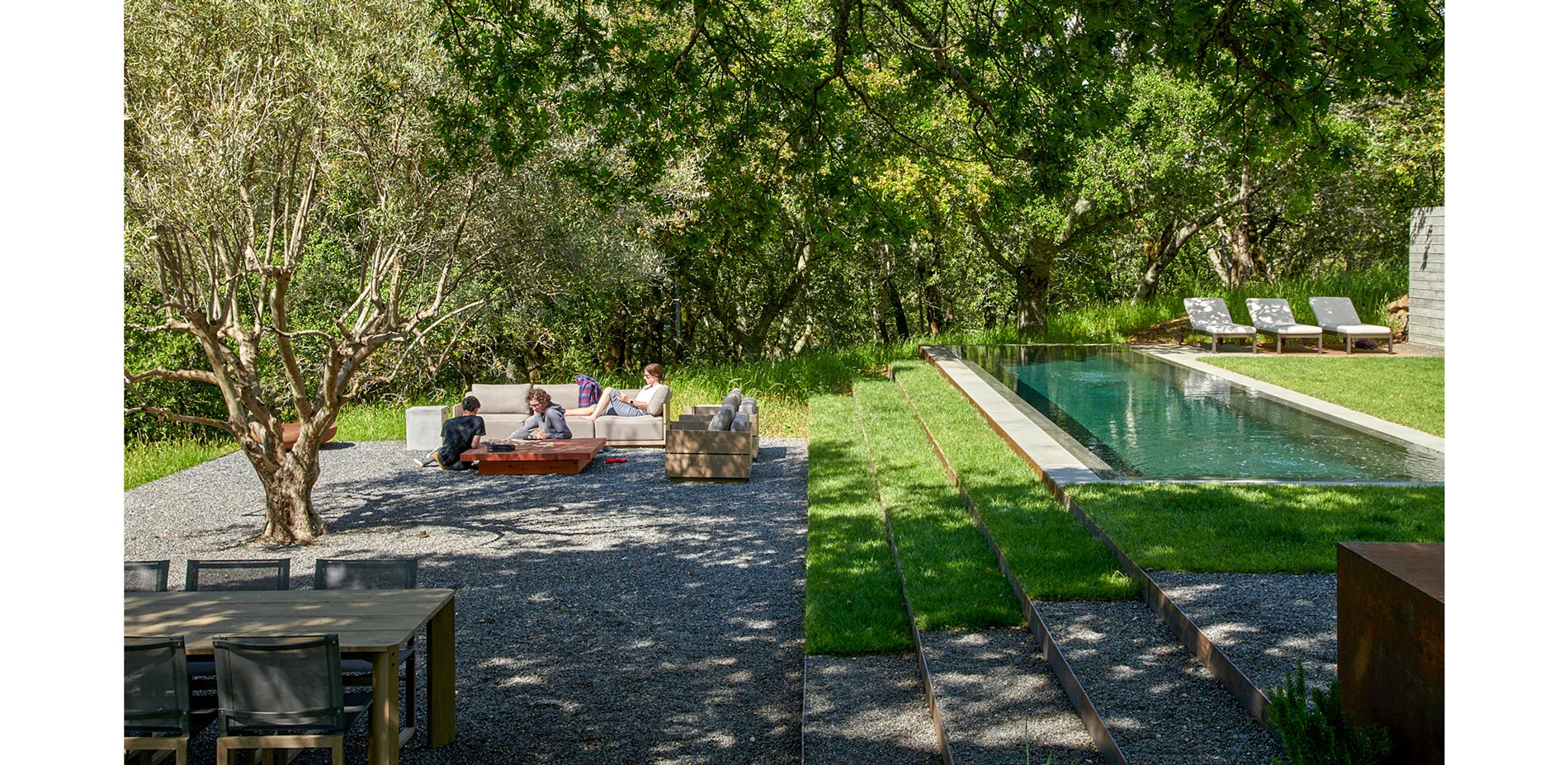
Sonoma Mountain
Situated on a 4-acre parcel within a 96-acre preserve on Sonoma Mountain, this hidden retreat offers private spaces for entertainment, recreation, and respite. A masterplan effort optimized the potential of the exterior spaces with adjacency to structures while hiding vehicles from sight, all along a sloping hillside. Elements of the site are organized along the sloping meadows amongst the predominant native Quercus agrifolia. Two small "weeHouse" structures, connective walks and steps, a pool, outdoor grilling area, privacy wall, and seating space are meticulously placed on and carved into the site, surrounded by re-sown native grasses. The dwelling spaces, both indoor and out, offer stunning valley views toward Matanzas Creek below.
Residential Design
Honor Awards
Hassalo on Eighth | From Urban Blight to LEED Platinum Neighborhood
Envisioned with ethos of an "eco-district," Hassalo on Eighth is LEED Platinum urban development with innovative sustainable technologies and amenities for renewable and clean energy, green roofs, a bike hub, and access to mass transportation. It is also one of the first and largest North American neighborhoods to treat and recycle wastewater on site. NORM, Natural Organic Recycling Machine, diverts away from the municipal sewer 100% of the wastewater generated in
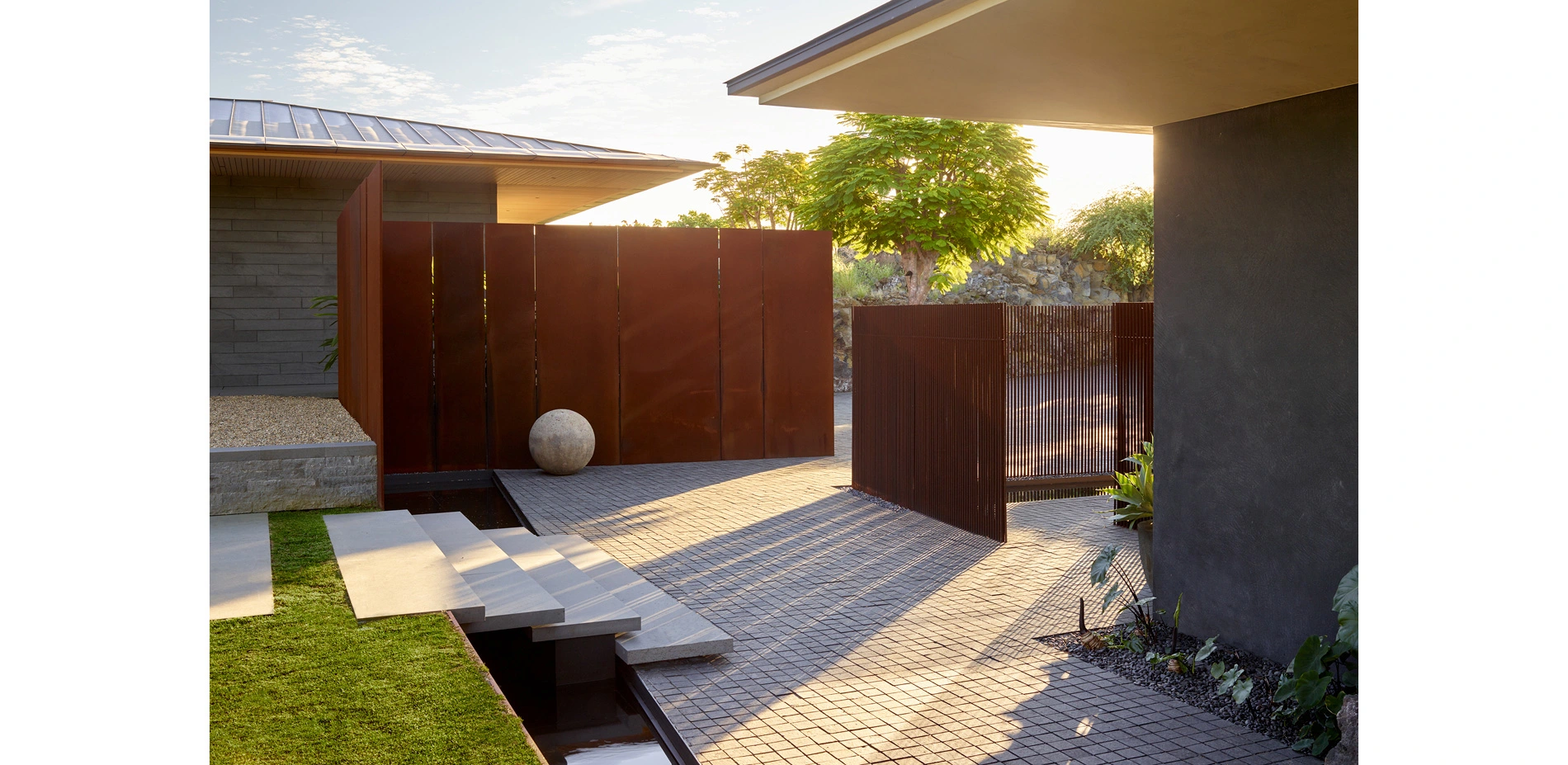
Kua Bay Residence
This single family residence on Hawaii’s dry, volcanic Kona shore draws on the elemental forces that shaped the land to contextualize its material design and embed human aesthetic experience within the landscape. The site is on a transect from a mountain top to the ocean, two extremes of the Hawaiian landscape. The design team collaborated to develop a series of indoor-outdoor living spaces that trace the narrative from mountain to ocean, taking cues from Hawaii’s
Plains | Prairie | Plateau: A Retreat at the Edge
Embracing Ecological Diversity
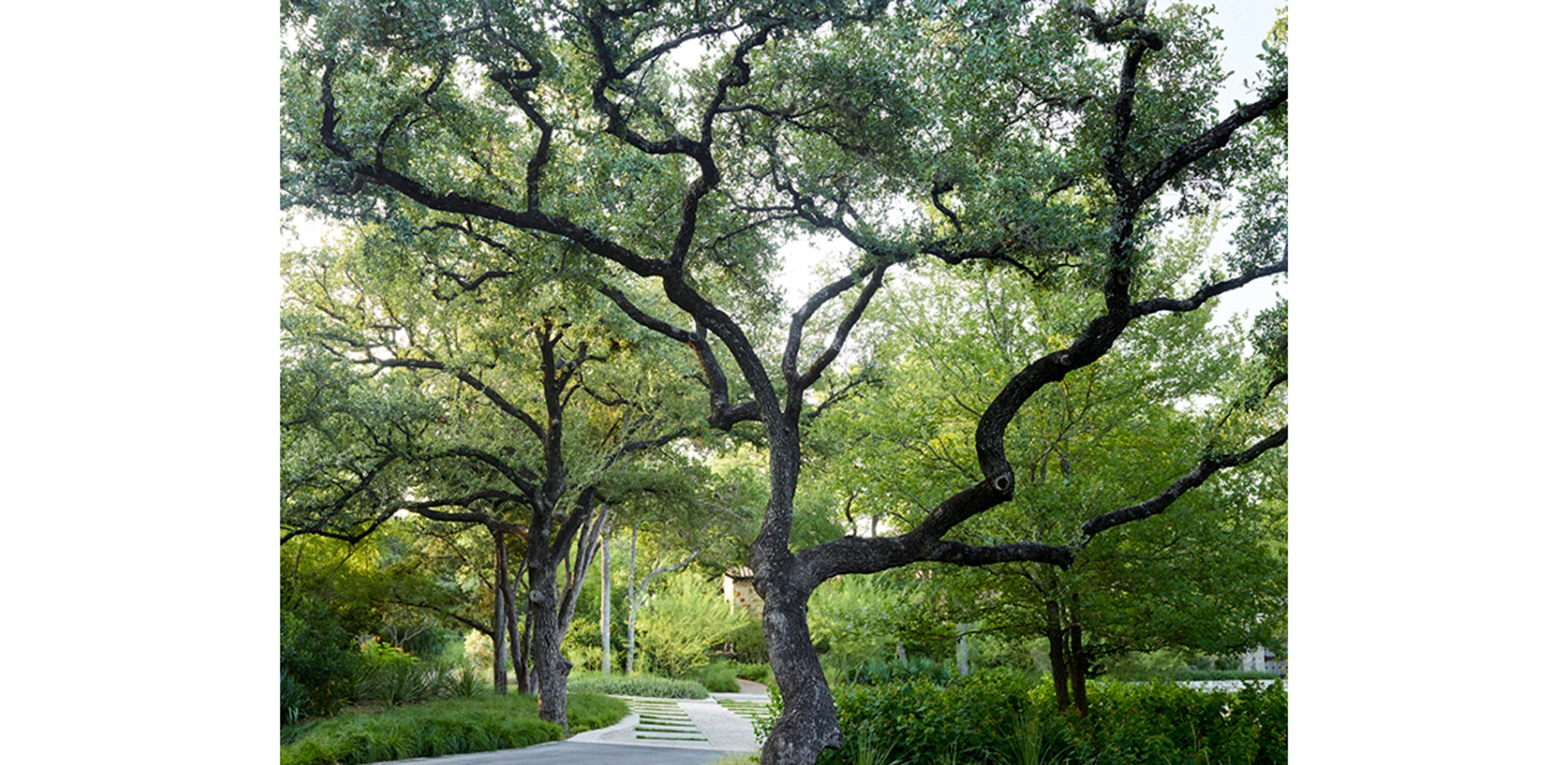
This residence is located just northwest of downtown San Antonio, Texas, in an unincorporated and undeveloped area known as Hill Country Village. Defined predominantly by larger residential parcels, Hill Country Village is home to many who work in San Antonio, and is an escape to a more rural Texas lifestyle. Our client purchased this home shortly after its initial construction. Our planning and construction efforts occurred
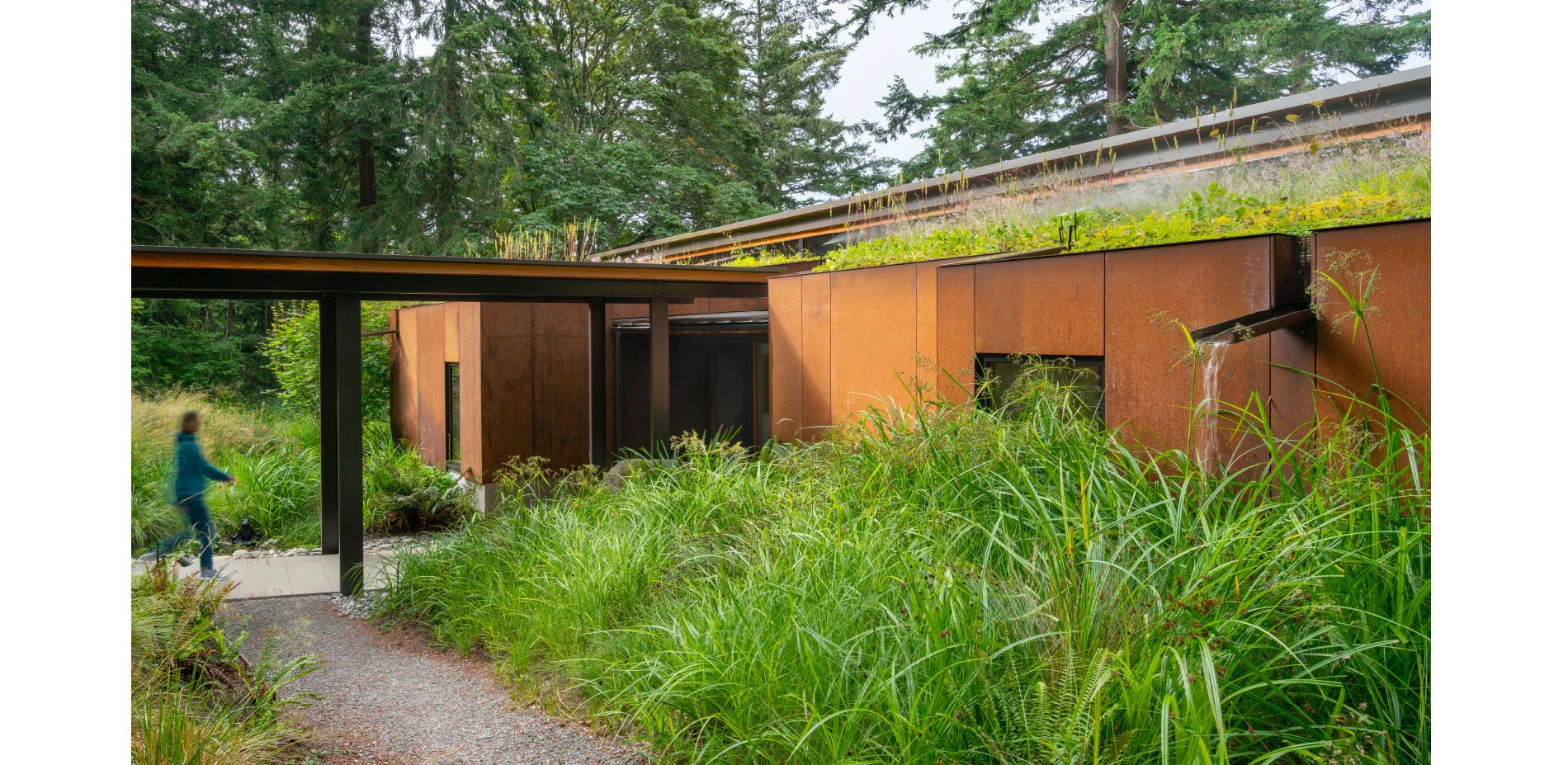
Whidbey Island Residence
The clients, a wildlife photographer and a blacksmith, relocated to this wooded 80-acre waterfront site on the southwest corner of Whidbey Island, a 20-minute ferry ride north of Seattle. They placed the majority of the site in a permanent conservation easement and retained an acre to build a 2,000-square-foot main house, guest cabin and workshop. They situated their home in a location that is not readily visible from the water, with the philosophy that that if the
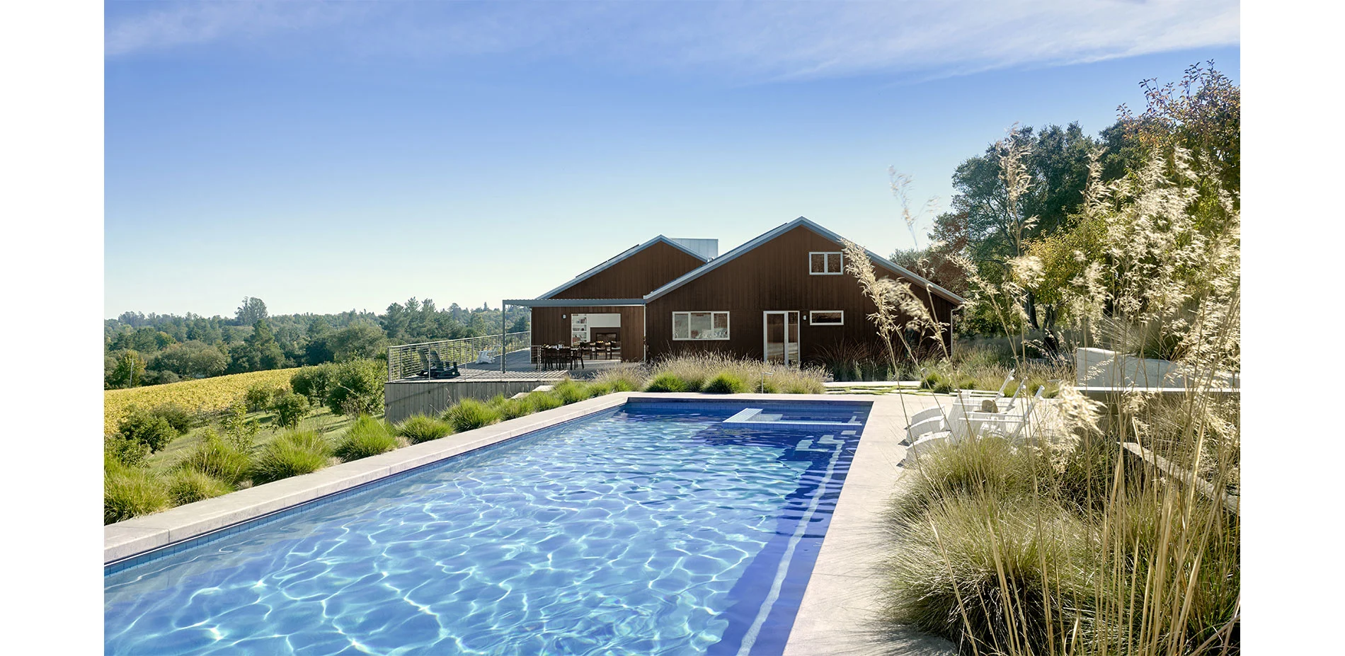
Where Agriculture Meets Coastal Woodlands
The three-acre site is at the intersection of coastal oak woodlands and cultivated fields of vineyards and Gravenstein apple orchards. The Gravenstein was the most widely grown crop in the small farming community of Sebastopol in Northern California during the early 20th century when much of the harvest was used for apple sauce and dried apples shipped to troops during WWII. Due to disease and lower yields, only a few orchards remain that have not been replaced by
Analysis and Planning Category
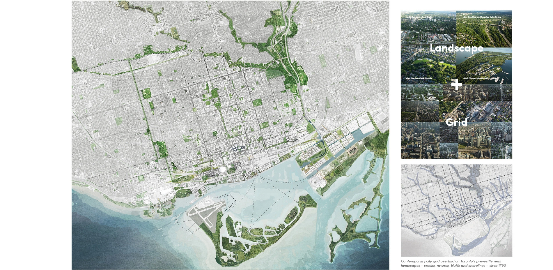
TOcore: Downtown Parks and Public Realm Plan
The Downtown Parks and Public Realm Plan addresses one of the most pressing questions facing Toronto: how can we re-imagine the public realm to enhance quality of life within a rapidly intensifying urban core?
As one section of a comprehensive plan for the growth and evolution of Downtown Toronto, the Parks and Public Realm Plan establishes a vision and framework to achieve an expanded, improved and connected parks and public realm network within the Downtown's mature urban fabric to support future growth. It is based on Five Transformative Ideas: The Core Circle, Great Streets, Shoreline Stitch, Park Districts, and Local Places. This set of integrated spatial transformations uncover the most iconic landscape experiences of the city and identify hidden opportunities within the Downtown's urban fabric. The Plan presents new ways of thinking about the public realm and landscape in the city, and provides a tactical dialogue about how we design, maintain and use our parks, streets and other open spaces to support urban life and achieve a bold and transformative legacy for future generations.
Analysis and Planning
Honor Awards
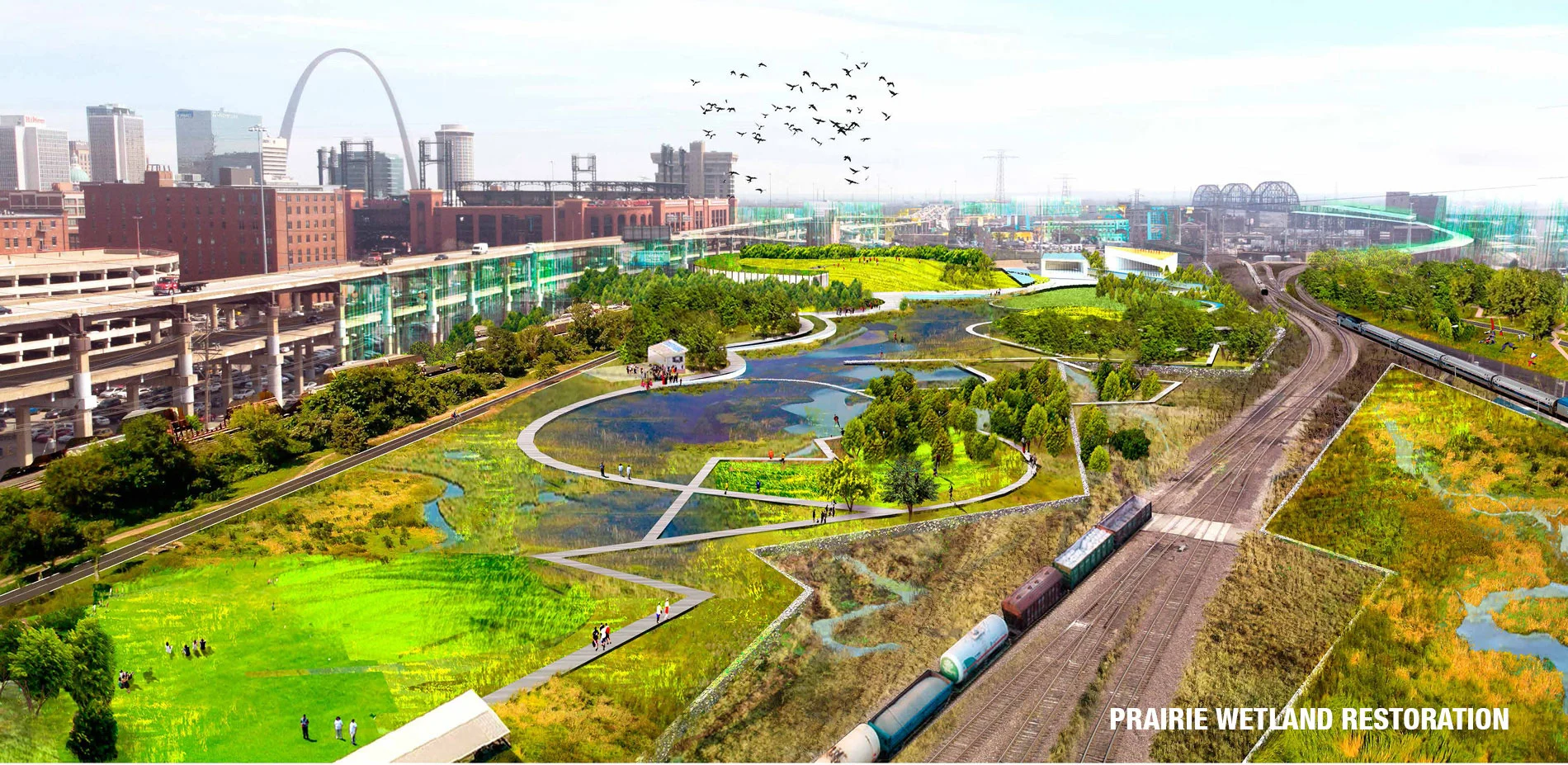
+StL: Growing an Urban Mosaic in St. Louis
Downtown St. Louis is divided. Today, a shallow valley running east to west from Forest Park to the Mississippi River through the center of the city holds the infrastructure of the 20th century: freeways slip fluidly alongside bundled freight, regional, and commuter rail, each with their attendant interchanges, grade-separations, switching yards, and security. These strands connect the city to its region but create a physical and psychological barrier be
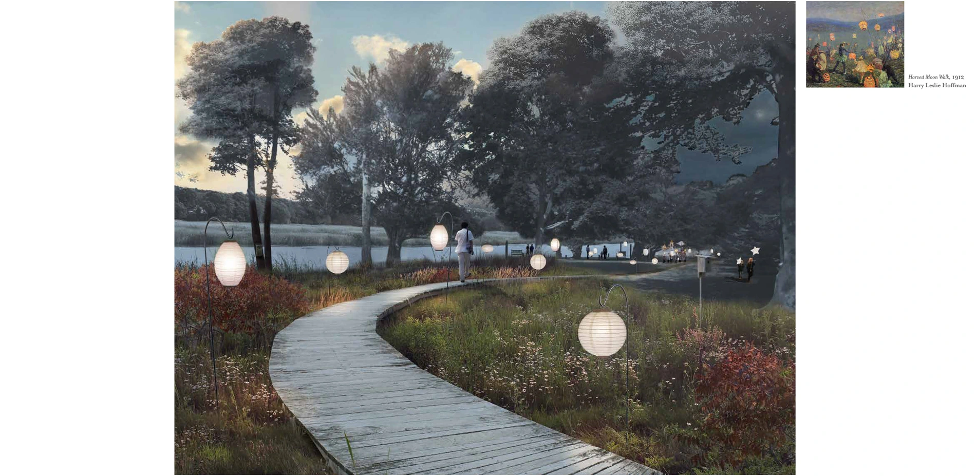
Florence Griswold Museum | The Artists' Trail: History, Ecology and Sense of Place
The Florence Griswold Museum in Old Lyme, Connecticut is the home of American Impressionism. The concept of The Artists' Trail and the ensuing Landscape Master Plan evokes the spirit of the historic site, integrated with a site-specific approach to restoration ecology. Landscape experiences will be choreographed along The Artists' Trail, providing visitors with a more authentic sense of the Lyme Art Colony and the site's cultural and environmental history. Overall,
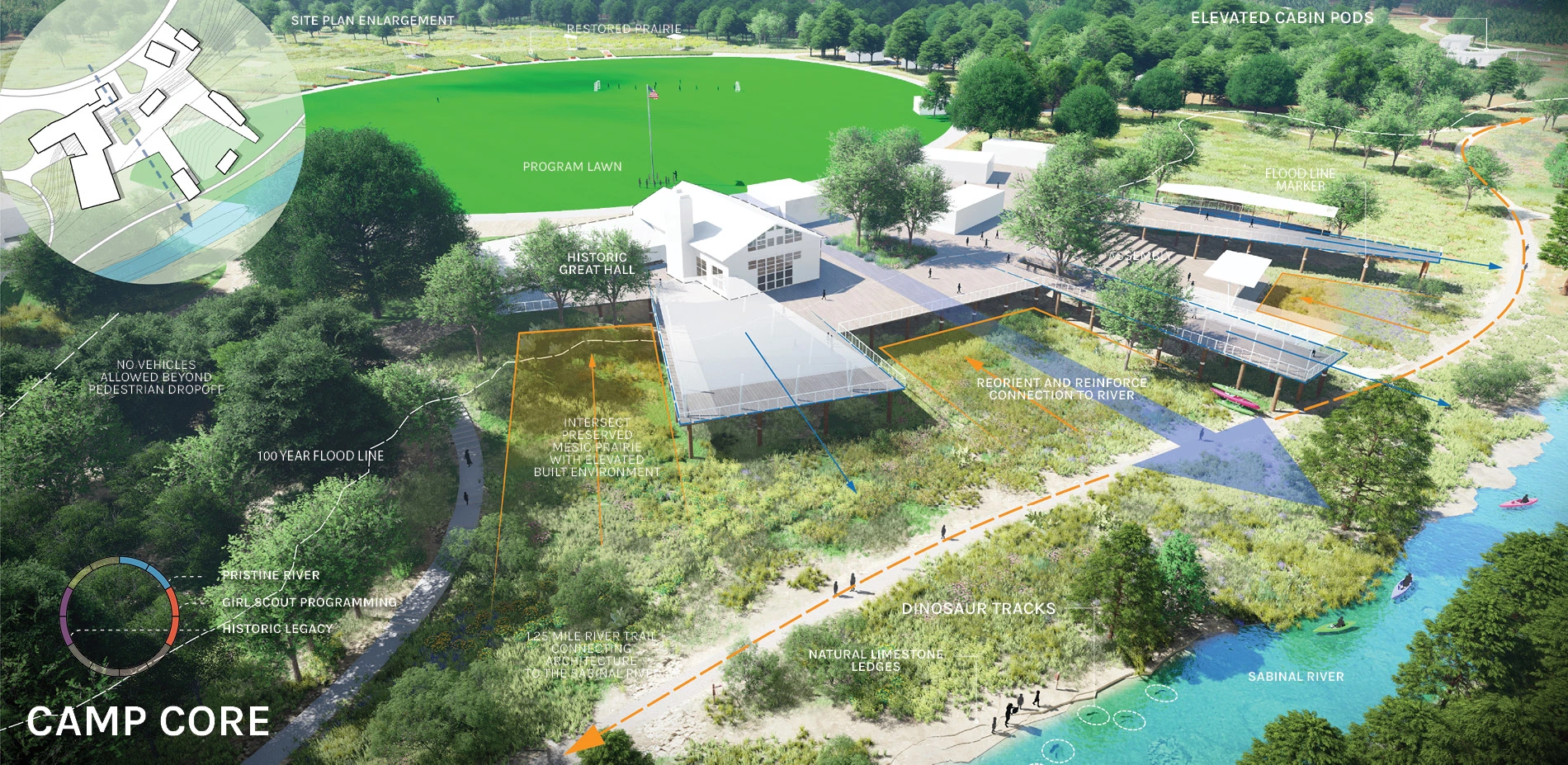
Girl Scout Property Planning: National to Local Strategies
The biggest challenge the Girl Scouts organization faces today is remaining relevant in the twenty-first century. Starting with a national analysis of trends, the planning team worked at the regional scale to introduce site experience as a primary determinant in property evaluation, portfolio strategy, and program offerings. This shifted the organization’s perception of how mission, site, and program work together across a system of sites to delivery dynamic experi
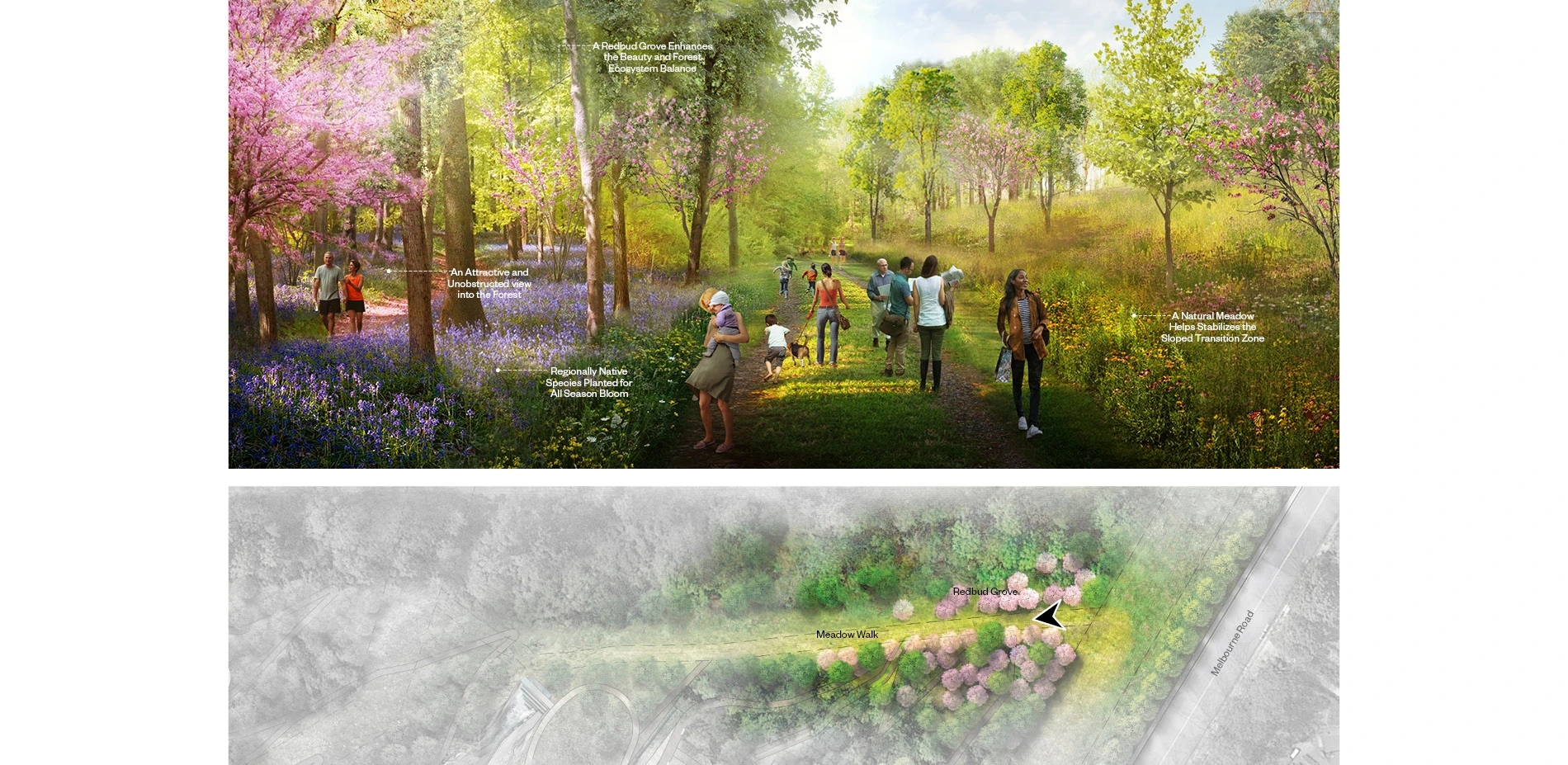
McIntire Botanical Garden: Masterplan for Resiliency and Healing
As a place of resiliency, discovery, inclusiveness, and healing, this master plan incorporates a vision for a premier botanical garden in Central Virginia that showcases the natural systems of the Piedmont region. Driven by the community's insights and aspirations, this masterplan activates the site's ecology in novel ways and guides the creation of a compelling new destination that builds social infrastructure and fosters social healing.
Defined by the site
Re-Storying the Knobs: A Master Plan for Bernheim Arboretum & Research Forest
As Bernheim nears its centennial, the Landscape Architects were commissioned to develop a master plan to strengthen the impact of Bernheim's mission and to further their strategic plan while ensuring financial sustainability. The master plan for Bernheim Arboretum & Research Forest sets a vision of "re-storying" the site by immersing visitors in diverse natural systems and curated horticultural experiences. New programs and facilities improve ecological systems and
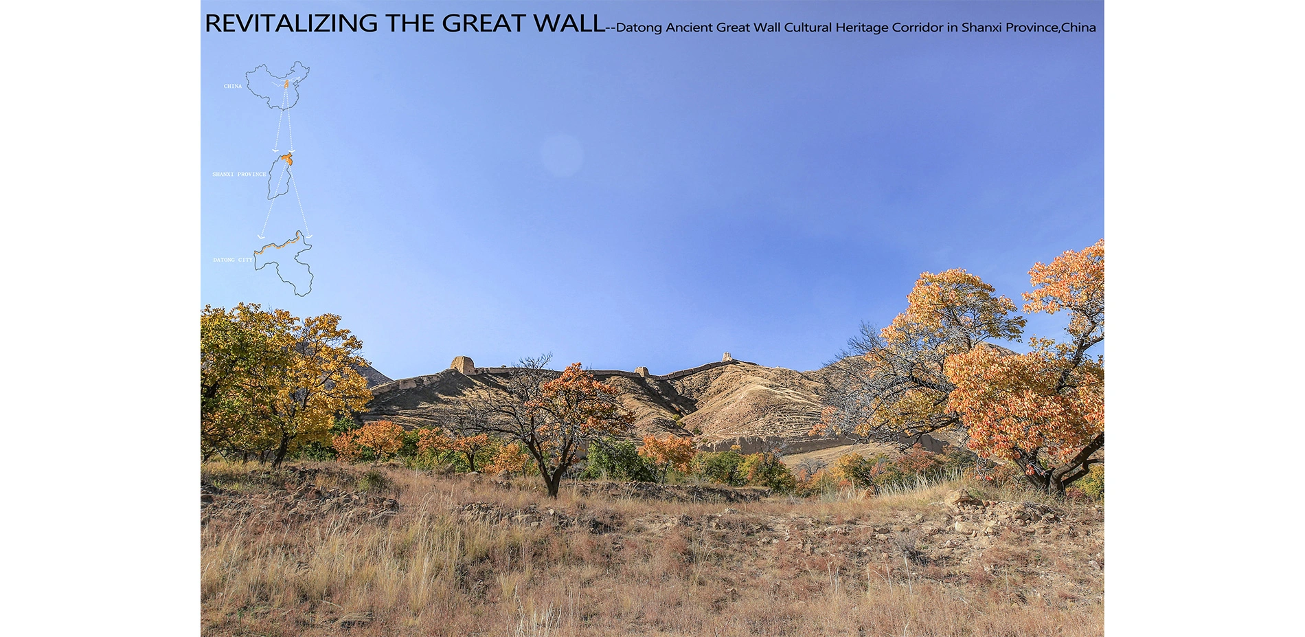
Revitalizing the Great Wall ---- Datong Ancient Great Wall Cultural Heritage Corridor in Shanxi Province, China
The Great Wall is a world cultural heritage, and a treasure of human civilization. The Datong Ancient Great Wall was mainly built in the Ming Dynasty (AD 1368-1644), and despite of all vicissitudes over history, its main parts have managed to remain till today. However, for all kinds of reasons, this cultural heritage has been constantly subjected to erosions and damages, and its surroundings now face deterioration of ecologicalenvironment, stagnation of tourism an
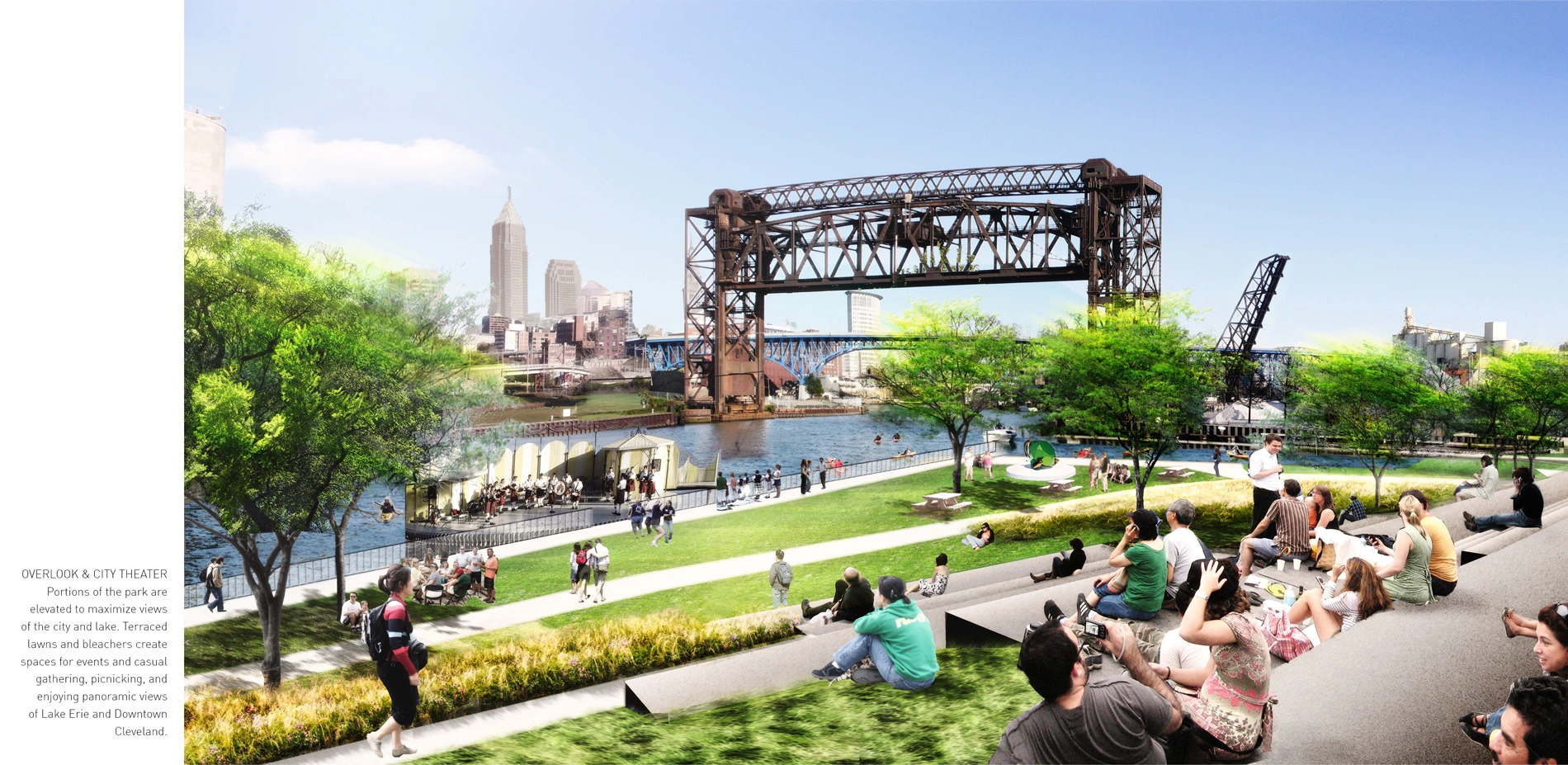
The Cleveland Flats Connections Plan: Connecting a Missing Link
The Cuyahoga River, famous for combusting throughout its industrial history, drains into Lake Erie through the Flats, a low-lying neighborhood in the heart of Cleveland. Bound by bluffs to the east and west, the Cuyahoga has historically divided communities: industrial, rail, and highway infrastructure associated with the river's function as a regional shipping corridor has landlocked the Flats from its waterfronts, created barriers among communities, and for decad
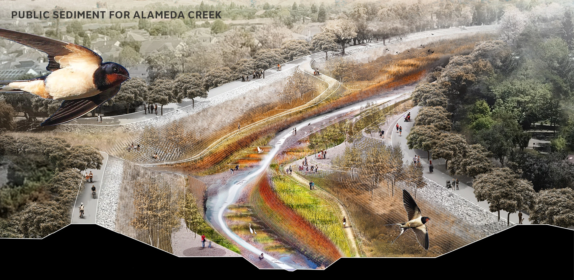
Public Sediment for Alameda Creek
The Bay Area's tidal ecosystems—its marshes and mudflats—are at risk of subsidence and drowning with low sediment supply and sea level rise. Public Sediment for Alameda Creek proposes that sea level rise adaptation must extend upstream, redesigning sediment flows to sustain tidal ecosystems and protect vulnerable communities. Public Sediment for Alameda Creek is a plan to reconnect the creek with the bay, provide a sustainable supply of sediment t
Research Category

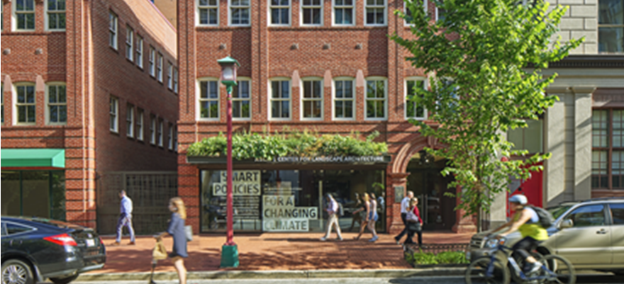
Site Commissioning: Proving Triple-Bottom-Line Landscape Performance at a National Scale
Site commissioning—the process of establishing and then field-verifying performance goals—is a mechanism for proving that investment in constructed landscapes is environmentally, socially, and financially worthwhile. The Site Commissioning White Paper, published in 2017 by the U.S. General Services Administration (GSA), proposes an agency-wide, site-commissioning process for GSA's future land development projects. This process has the potential to advance the effectiveness of the site design, construction, and management industries within one of the world's largest public real estate organizations, which in turn could positively impact landscape performance at a national scale. The white paper was developed through a unique collaboration between policy-makers, landscape architects, and 89 industry leaders. While written as a policy tool, the white paper's tone and graphic quality make it equally accessible to practitioners. The Site Commissioning White Paper uniquely demonstrates how landscape architects can help shape policy, thereby advocating for a more resilient built environment.
Research
Honor Awards
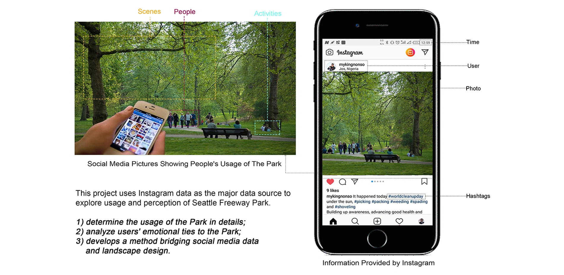
Using Social Media Data to Understand Site-Scale Landscape Architecture Design: A Case Study of Seattle Freeway Park
Social media is a fast-growing area in built environment studies to understand public opinions and space usage. To bridge the use of these huge, efficient, and ever-growing data sets to landscape practice, this research marks a pilot effort to study site scale landscape issues using social media data. Taking the Seattle Freeway Park as an example, 3314 Instagram posts from 2035 users over three years (2015-2017) were mined and categorized to answer three research q
Communications Category
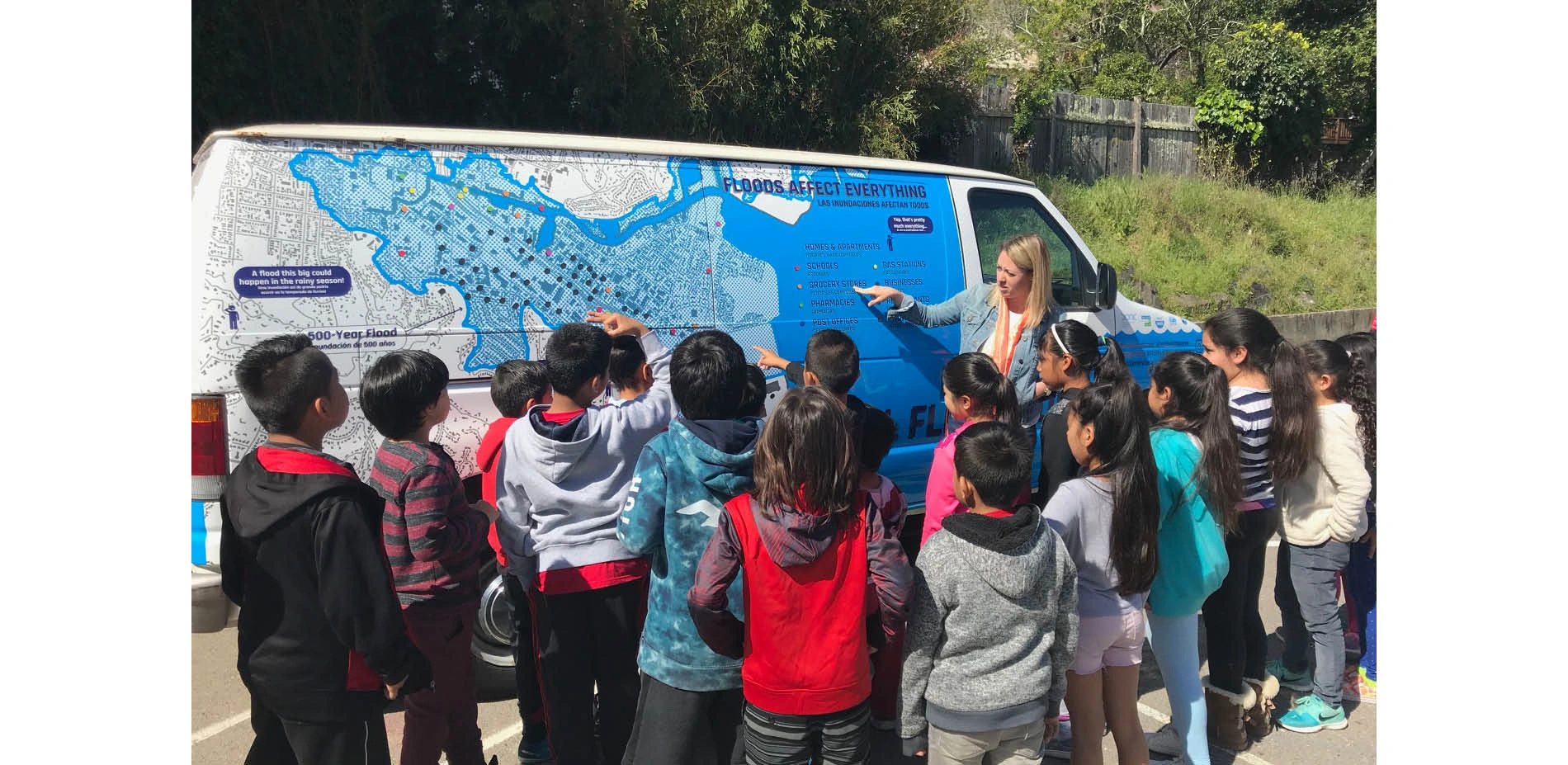
The FloMo: A Mobile Messenger for Sea Level Rise
The FloMo is a Trojan Horse to deliver a message of awareness and unity to a community of immigrants and businesses that are at risk of displacement or devastation by flooding and sea level rise.
The canal district in San Rafael California is home to a community of thousands of immigrants. Their community it tight knit, hardworking, and interdependent with a strong social structure. They are the workforce of the bay area, and critical to the regional economy; they live in an area below sea level and thinly protected by aging pumps and levees. A single flood event would devastate the community and its social cohesion. In time the whole community will inevitably be displaced by sea level rise if nothing is done.
Fun, informative, relatable, and bi-lingual the FloMo delivers a profound and simple message about climate change and flooding.
Communications
Honor Awards
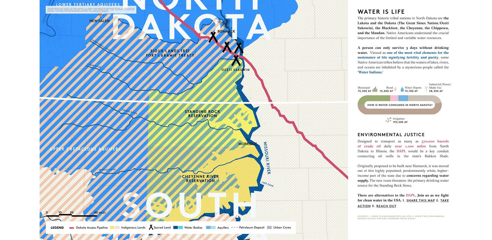
A Living, Breathing Movement: An Introduction to the Dakota Access Pipeline Issue
A series of interactive maps on the Dakota Access Pipeline route that illustrate the effects it will have on adjacent communities and beyond, as well as outlining opportunities for alternatives to fossil fuels along the DAPL route including wind and solar. Our strategy was to combine landscape architecture strategies with visual representation and community outreach practices to increase awareness on the critical issues associated with the environment, land use and
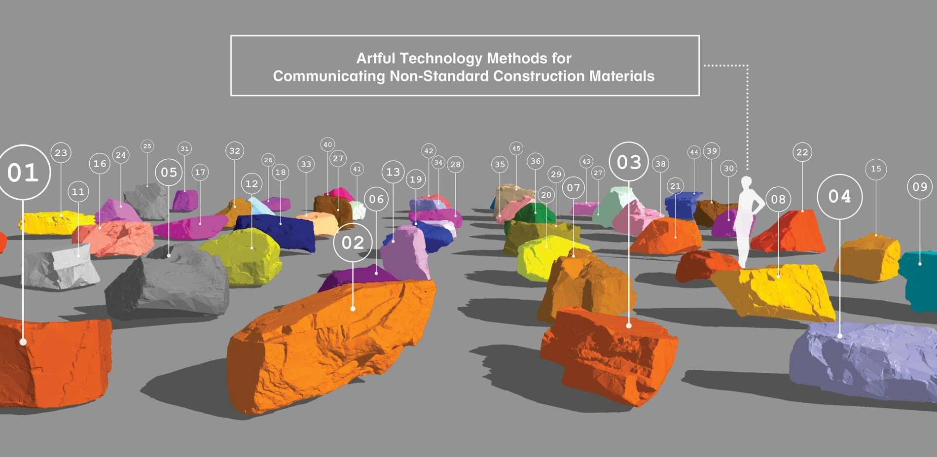
Artful Technology Methods for Communicating Non-Standard Construction Materials
Construction documents and specifications are effective at communicating design intent for commonly used materials (i.e. manufactured products) but are limited in their ability to connect artful intent, constructability and sequencing when using non-standard construction materials (i.e. irregularly shaped landscape boulders). Landscape Architects designs with non-standard media on a regular basis; plant material, sculpture, earth-forms and water features to name a
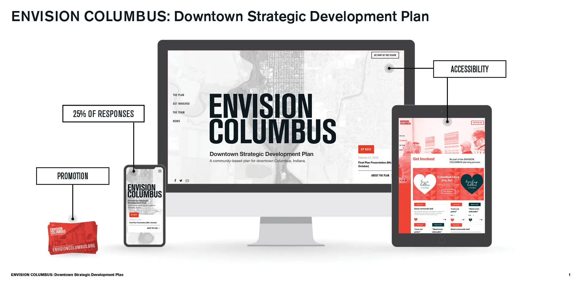
EnvisionColumbus.org: A Conduit for Alignment & Empathetic Outreach in Community Building
EnvisionColumbus.org is an interactive website designed to facilitate broad public engagement across a wide range of diverse constituencies during the creation of the new Downtown Strategic Development Plan for Columbus, Indiana. The website builds upon the City's legacy of centering the voices of citizens in shaping the City itself. It represents a twenty-first-century approach to the kind of community building and alignment that has defined Columbus's planning hi
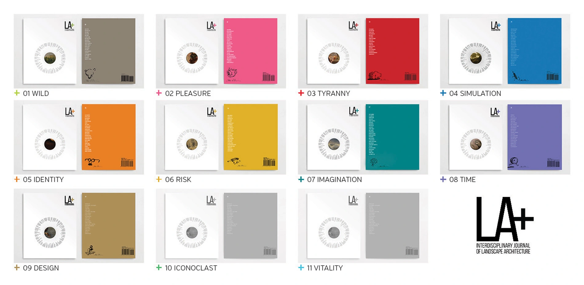
LA+ Interdisciplinary Journal of Landscape Architecture
LA+
(Landscape Architecture Plus) is the world's only interdisciplinary journal of landscape architecture. Launched in 2014 by the Landscape Architecture Department at the University of Pennsylvania, the journal's mission is to reveal connections and build collaborations between landscape architecture and other disciplines by exploring each issue's theme from multiple perspectives.Therefore, in addition to the design professions, each issue includes works
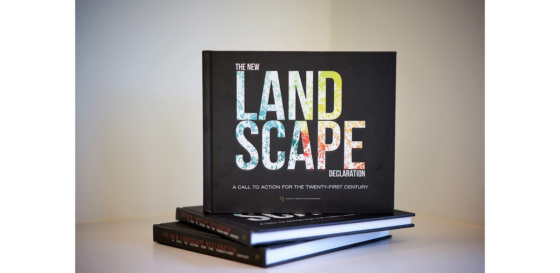
The New Landscape Declaration: A Call to Action for the Twenty-First Century
What is the role of landscape architecture today? On the eve of its 50th anniversary, the Landscape Architecture Foundation asked a diverse group of the world's leading landscape architects to reflect on the last half-century and present bold ideas for what the discipline should achieve in the future. Well beyond the public conception of the profession as "gardener" or "landscaper," these preeminent designers discussed their role in addressing weighty issues like c
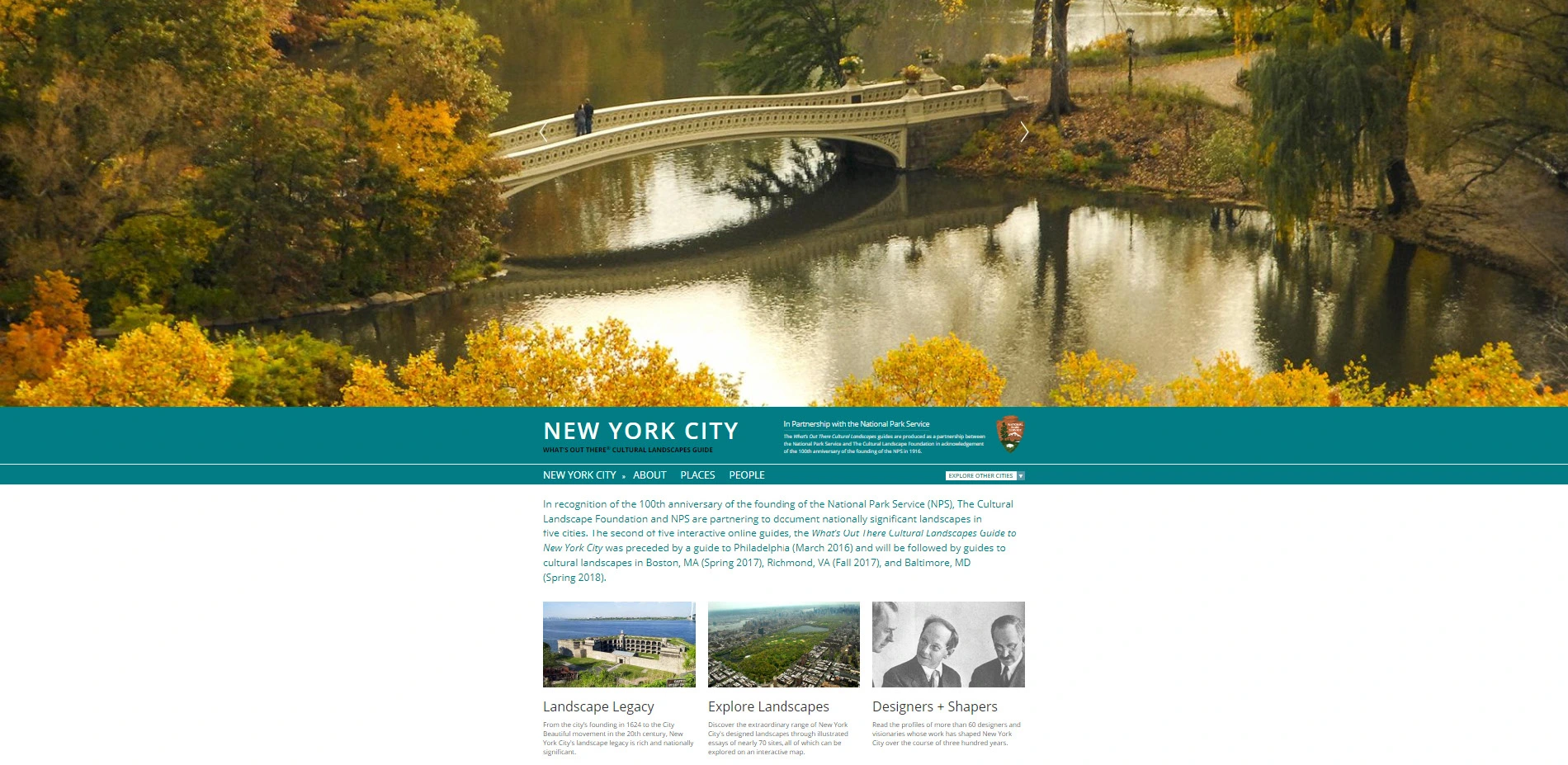
What's Out There Cultural Landscapes Guides
An outgrowth of The Cultural Landscape Foundation's What's Out There database, the What's Out There Cultural Landscapes Guides artfully present the landscape legacy of five of the nation's great East Coast cities. Produced in partnership with the National Park Service and offered free to the public, each online guide includes essays on scores of sites and their designers, comprising a visually engaging and constantly expanding digital inventory of
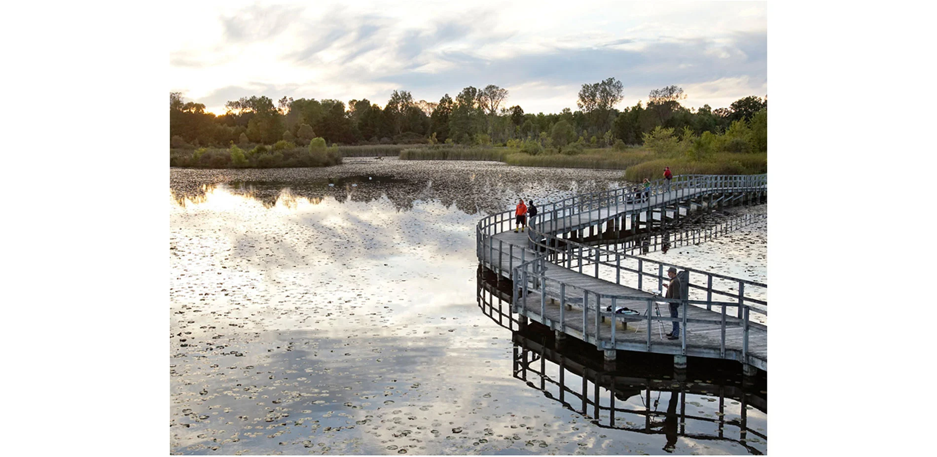
Crosswinds Marsh Wetland Interpretive Preserve
Originally created as recompense for wetland impacts during the expansion of Detroit Metropolitan Wayne County Airport, Crosswinds Marsh has transformed into a treasure valued by both human and natural communities. Celebrating its 20th anniversary as one of the largest self-sustaining wetland mitigation projects in the country, Crosswinds Marsh has become a national benchmark for ecological restoration and environmental design. Most notably, the project recreated ecosystems for hundreds of native flora and fauna species by restoring over 1,000 acres of historical wetland ecosystems from former agricultural and residential uses.
The technical design considered the pump-free hydrologic functions of the site to provide essential habitats that attract hundreds of animal species. While intentionally limiting direct human access, the site still serves as an invaluable educational and community resource with expansive permitted opportunities to observe critical habitat. The strategic site design also facilitated low-impact recreation like hiking, horseback riding, paddling, fishing and birding, leaving an indelible legacy that continues to offer numerous environmental learning opportunities for thousands of annual visitors to this day.