.webp?language=en-US)
Living Between Emergency and Normalcy—Rethinking the Versatility of Water in the WUI City of High Bushfire Risk
Guang Yang, Student International ASLA; Shuai Pan, Student International ASLA; Lanxin Zhong, Student International ASLA; Lihao Zhu, Student International ASLA
In response to the devastating Australian bushfires of 2019–2020, this proposal suggests strategic growth within wildland-urban interfaces (WUIs) that explores water resources as a means of living with the inevitability of bushfires—that is, living between states of normalcy and emergency, as opposed to the usual preventative approach. This hypothetical plan for Londonderry, New South Wales, calls for channeling existing waterways into navigable evacuation routes for people and animals, and irrigating firebreaks into the woodlands. Reshaped forest edges, planted with fire-resistant species such as cypress, enhance firefighters’ abilities to combat blazes while reducing resident vulnerability, combining with other tactics to make these WUI regions habitable while preparing for bushfire’s return.
Awards Jury
-
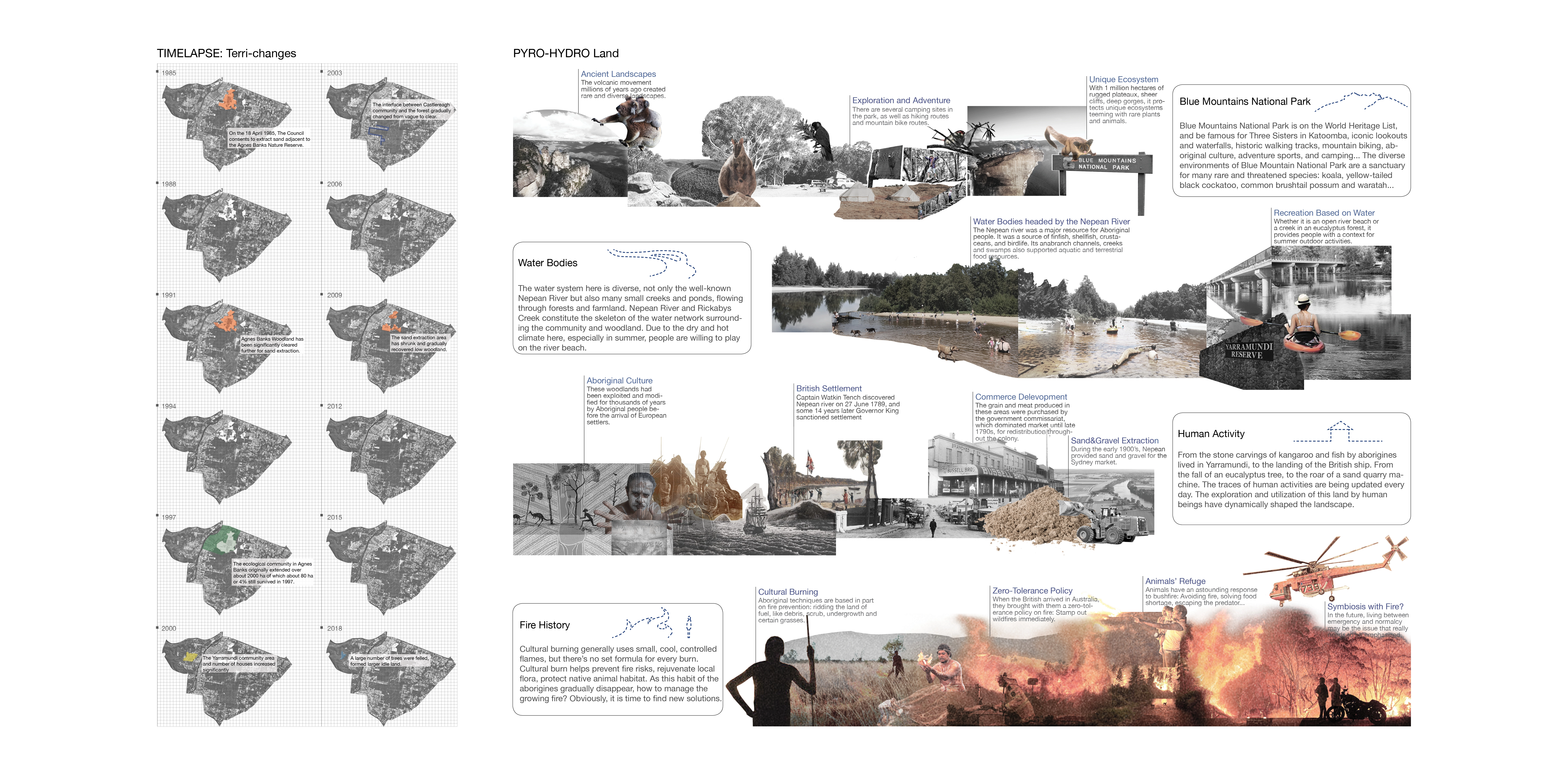
2019-2020 Australia Bushfire Season brought the most painful disaster to the continent in history. After the fire, properties and structures in the fire-prone areas were badly destroyed, also, several families lost their ones. Thus, there’s a voice being aroused to avoid living in the wildland-urban interface (WUI) areas. However, the strong and sophisticated aspiration in getting closer to nature and population pressure inevitably facilitate the development in the WUI areas.
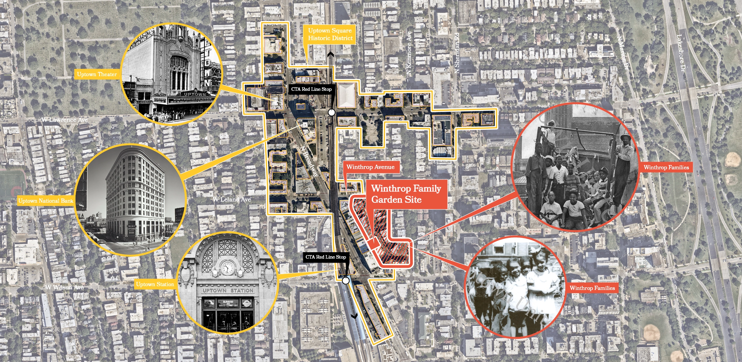
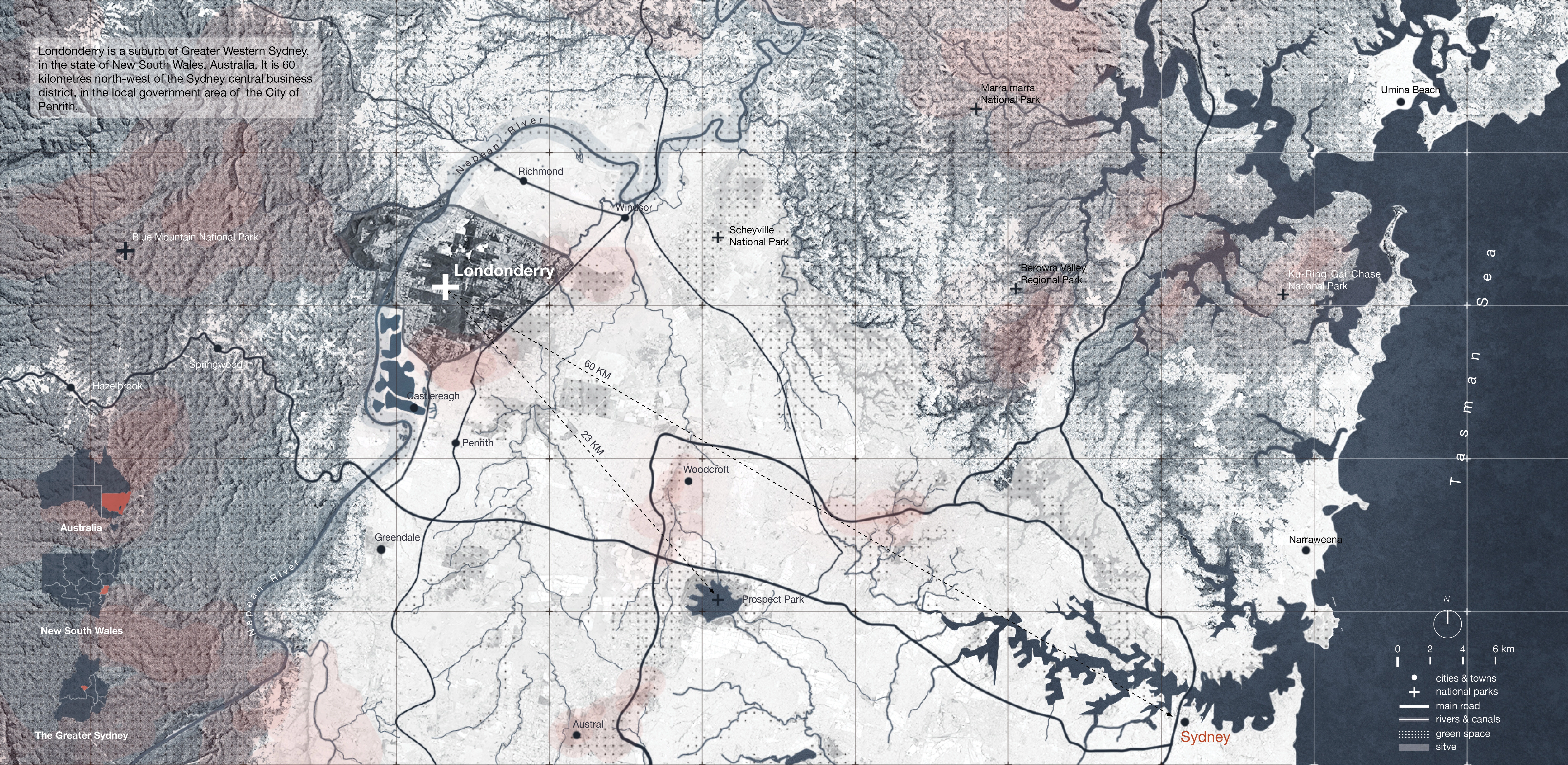
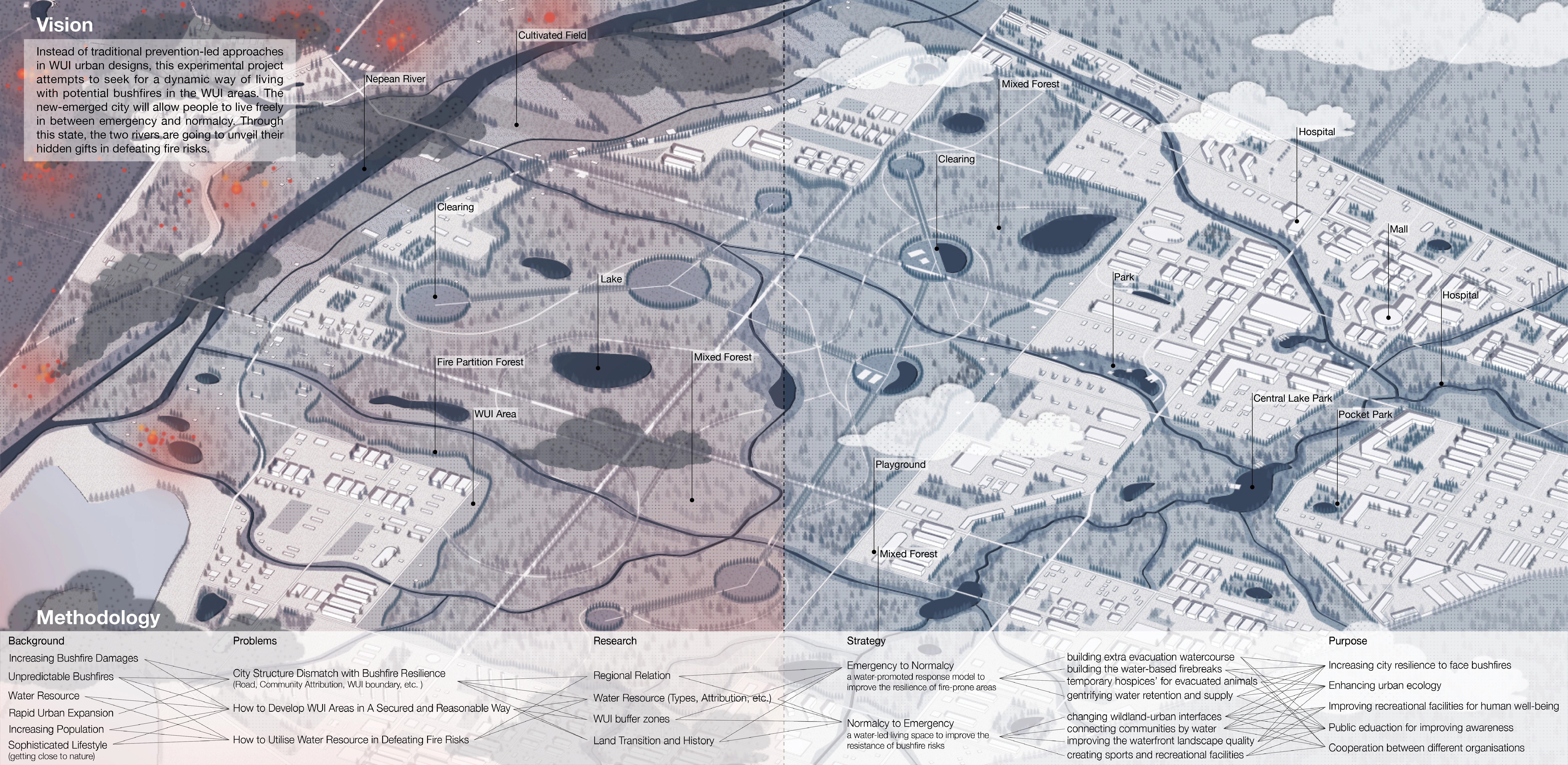
The project is located west to the Greater Sydney, between the City of Penrith and Richmond. It is a typical fire-prone zone in Sydney with two lively rivers passing through. Instead of traditional prevention-led approaches in WUI urban designs, this experimental project attempts to seek for a dynamic way of living with potential bushfires in the WUl areas. The new-emerged city will allow people to live freely in between emergency and normalcy. Through this state, the two rivers are going to unveil their hidden gifts in defeating fire risks. -
Project Background
Australia is historically one of the most affected countries by bushfires due to its dry summer and climate change in recent decades. While this seasonal disaster seems to become more and more inevitable in Australia. Even though some artificial ignitions are easily avoided by stronger regulatory systems, while the natural fires ignited by the high temperature or lightning are hardly predicted and eluded.
Due to the unpredictable nature of bushfires, some suggest that living in the fire-prone areas or WUI areas rises the great risks in damaging properties and structures, as well as human lives. On the contrary, with the rapid urban expansion and increasing population pressure, the city has no choice to settle their residents to further land. Some cities in Australia, like Sydney, which are surrounded by dense forests are forced to develop their WUI areas. Interestingly, even though bushfire risks are rising in those areas, people who want to live in such suburban areas with great natural scenes are increasing as well. Thus, this project eagers to explore a viable solution to develop new cities in WUI areas with inevitable bushfires.
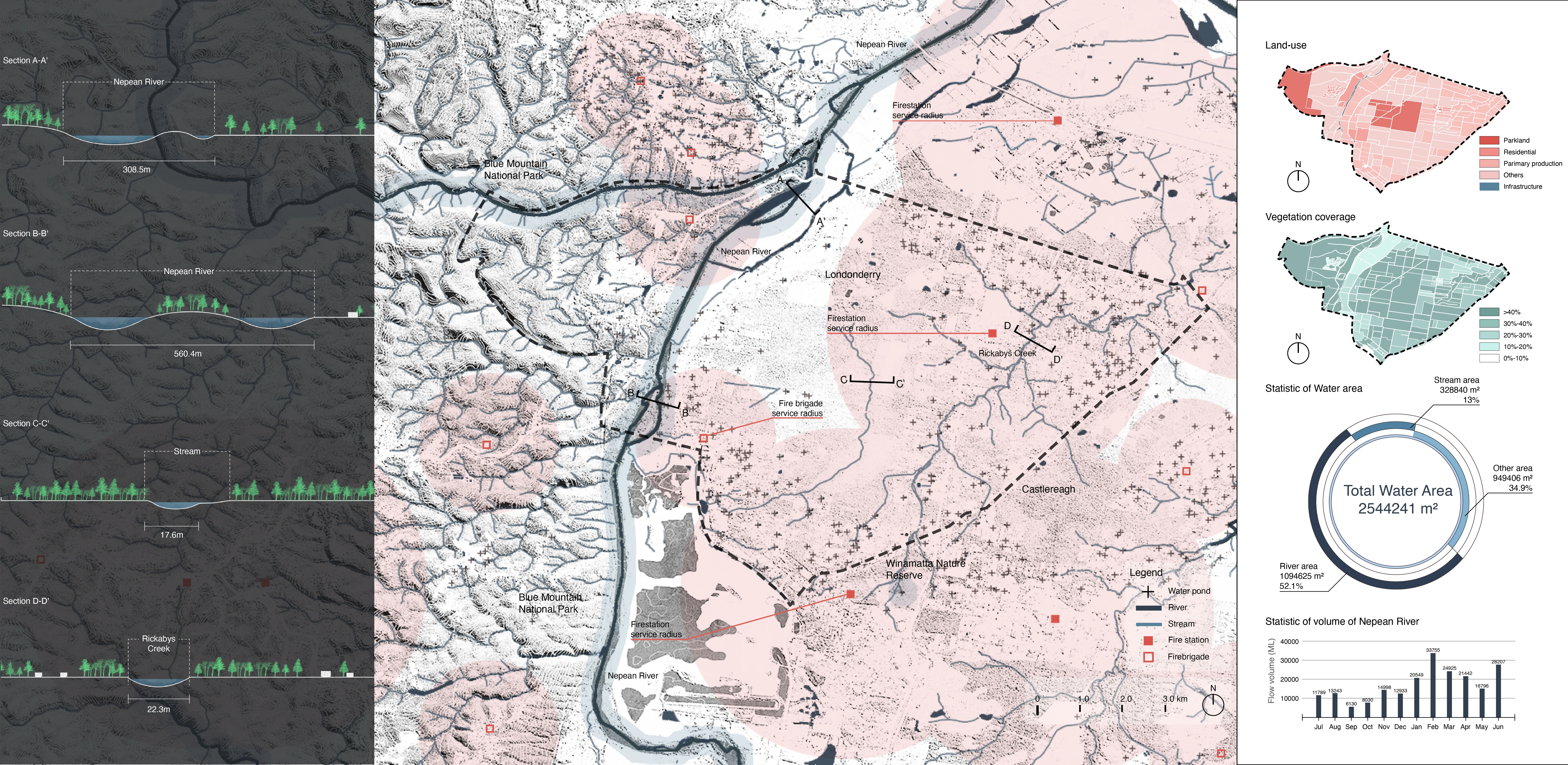
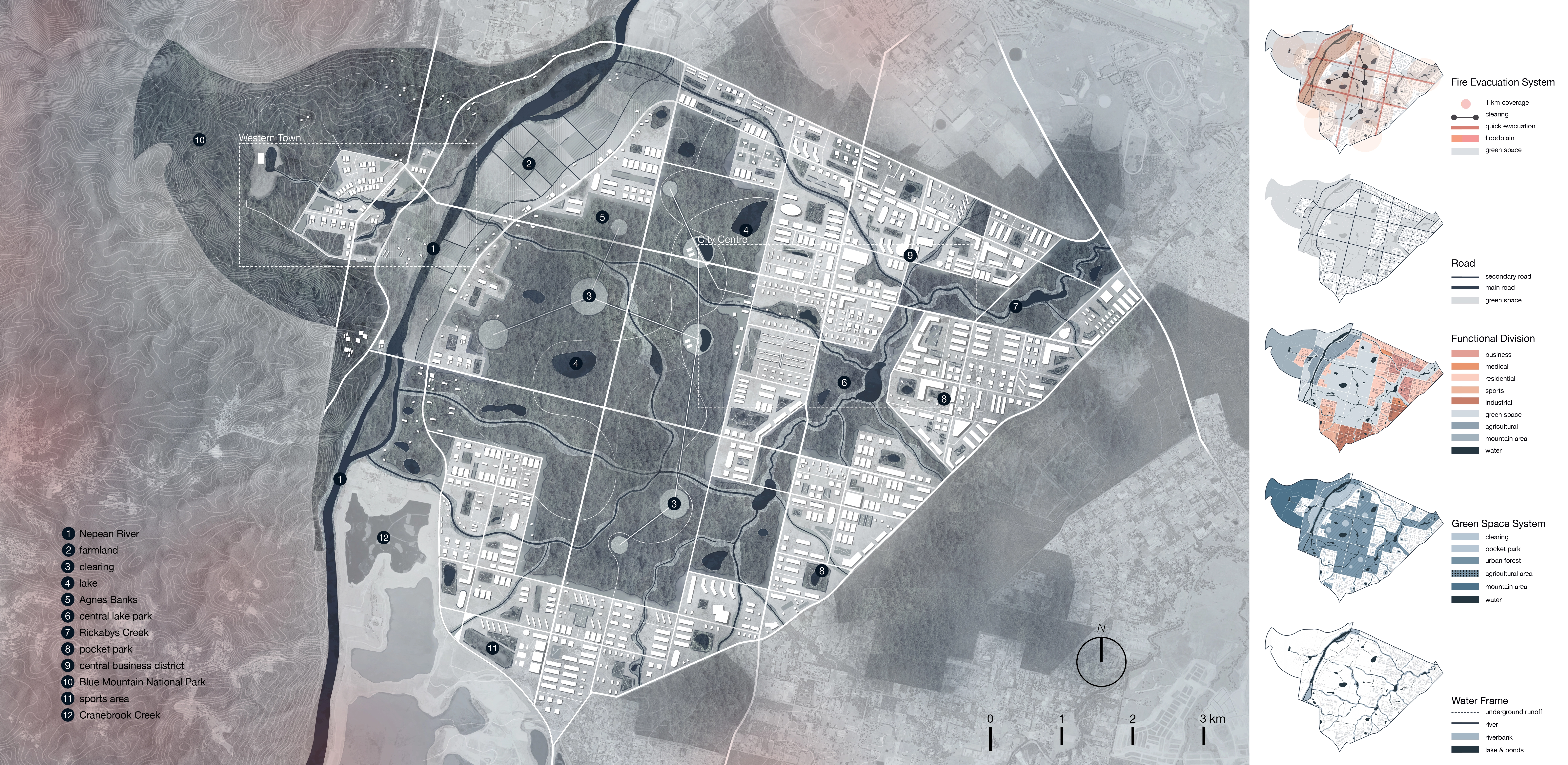
Site Inventory
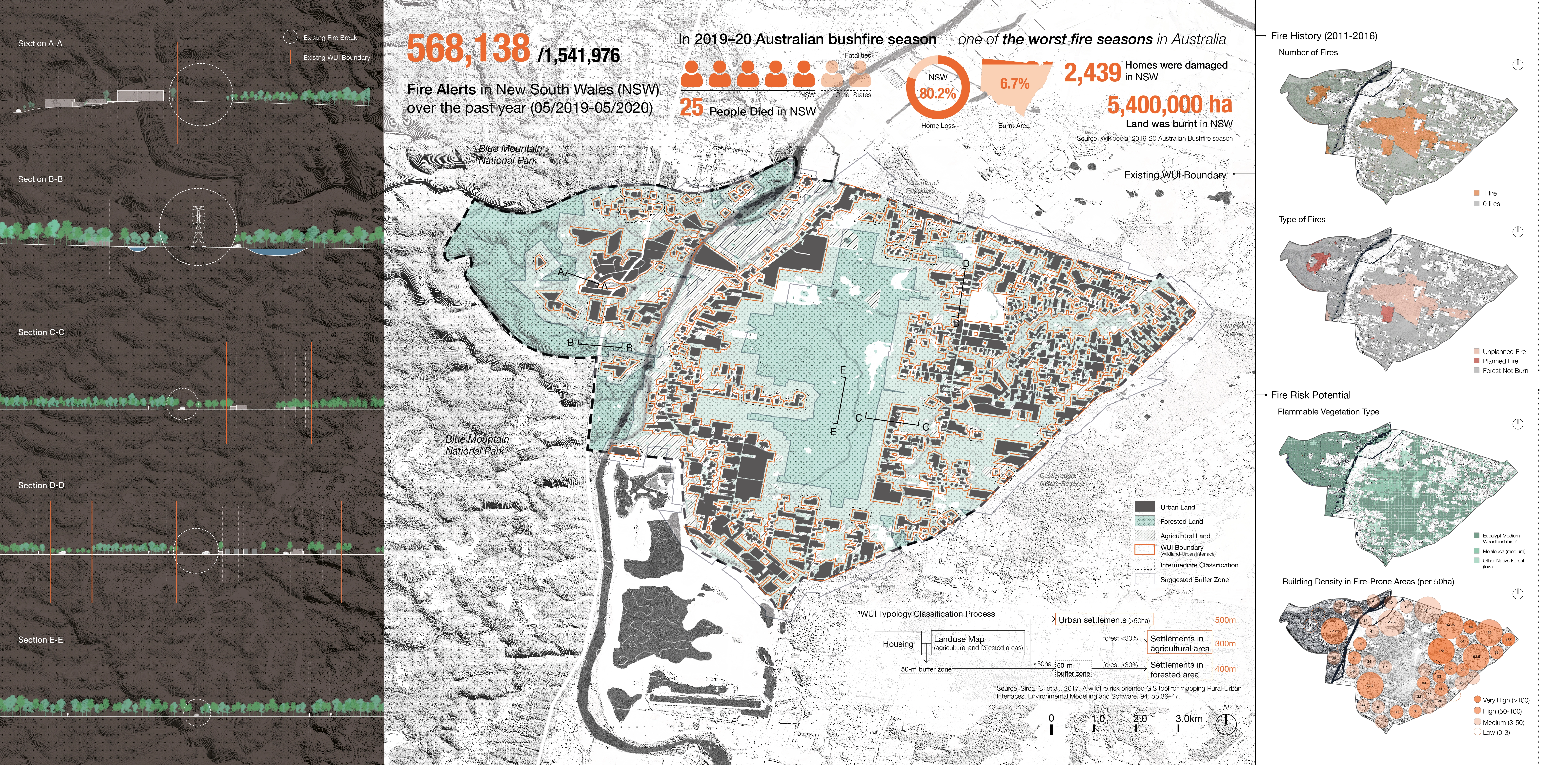
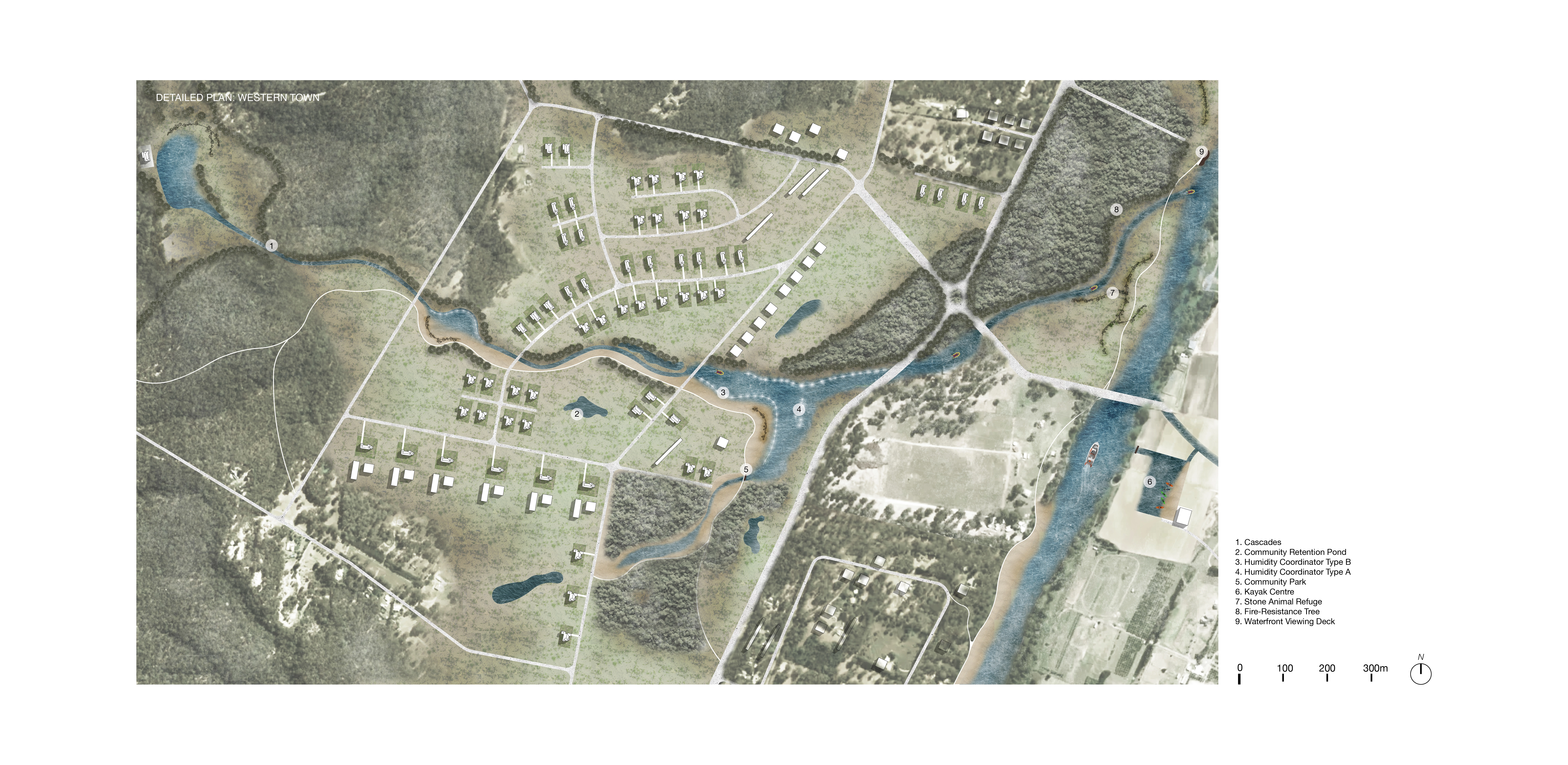
The site is currently a suburban area west to the Greater Sydney. It consists of three small towns- Londonderry, Castlereagh and Agnes on the eastern bank of Nepean River, as well as a small village called Yarramundi on the western side. The western boundary extended into the Blue Mountain National Park where had bred several bushfires in history. However, it is not the only fire threat to the site. The most dangerous component is the central woodland which is enclosed by the three towns mentioned above. It is characterized by its Scribbly Gum Woodland with high flammability in high temperature. According to the historical records, it brought more damages and threats to the site than the Blue Mountain NP. The fringe space of the woodland is occupied by sparse settlements which face extreme threats from bushfires.
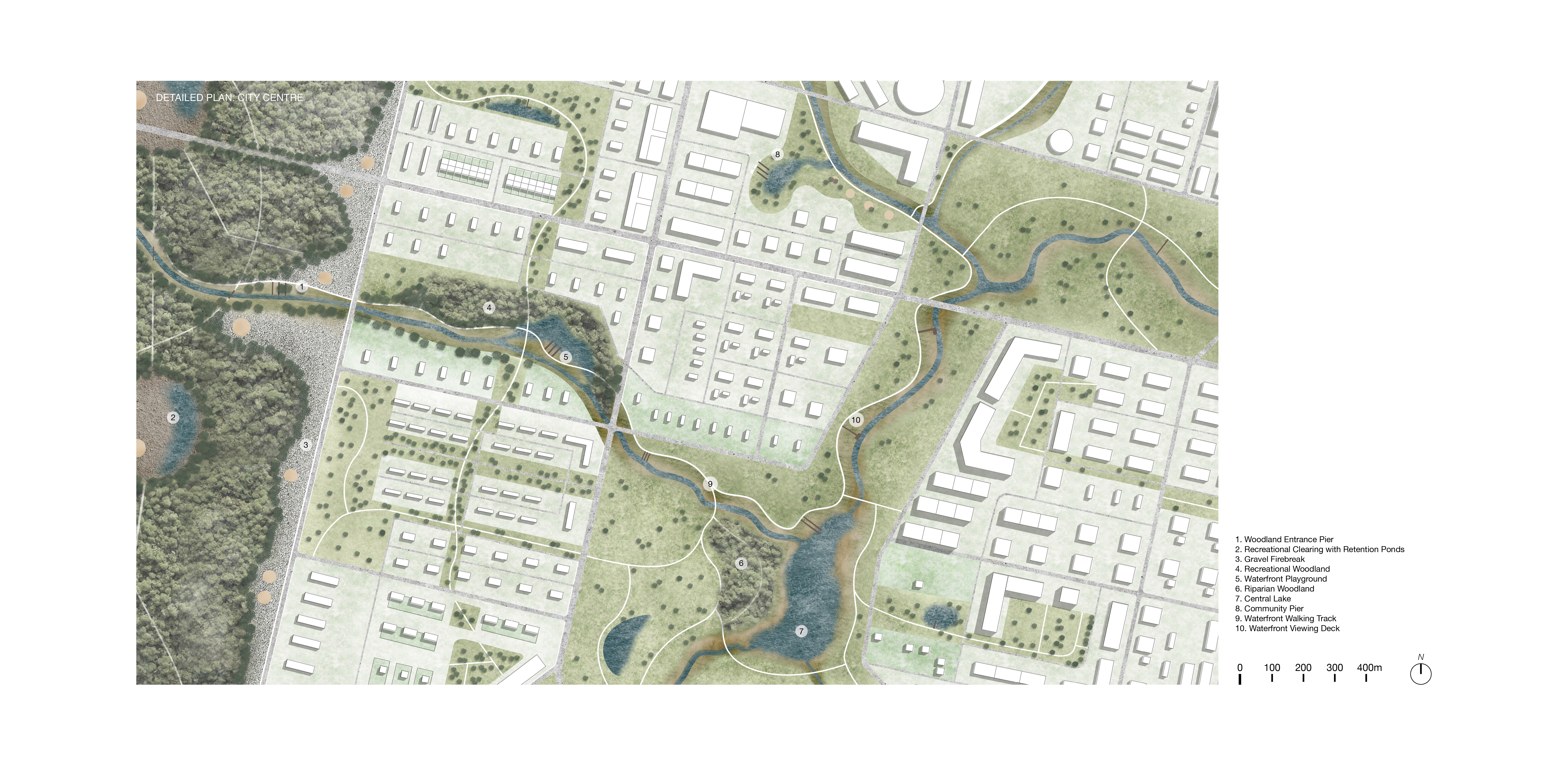
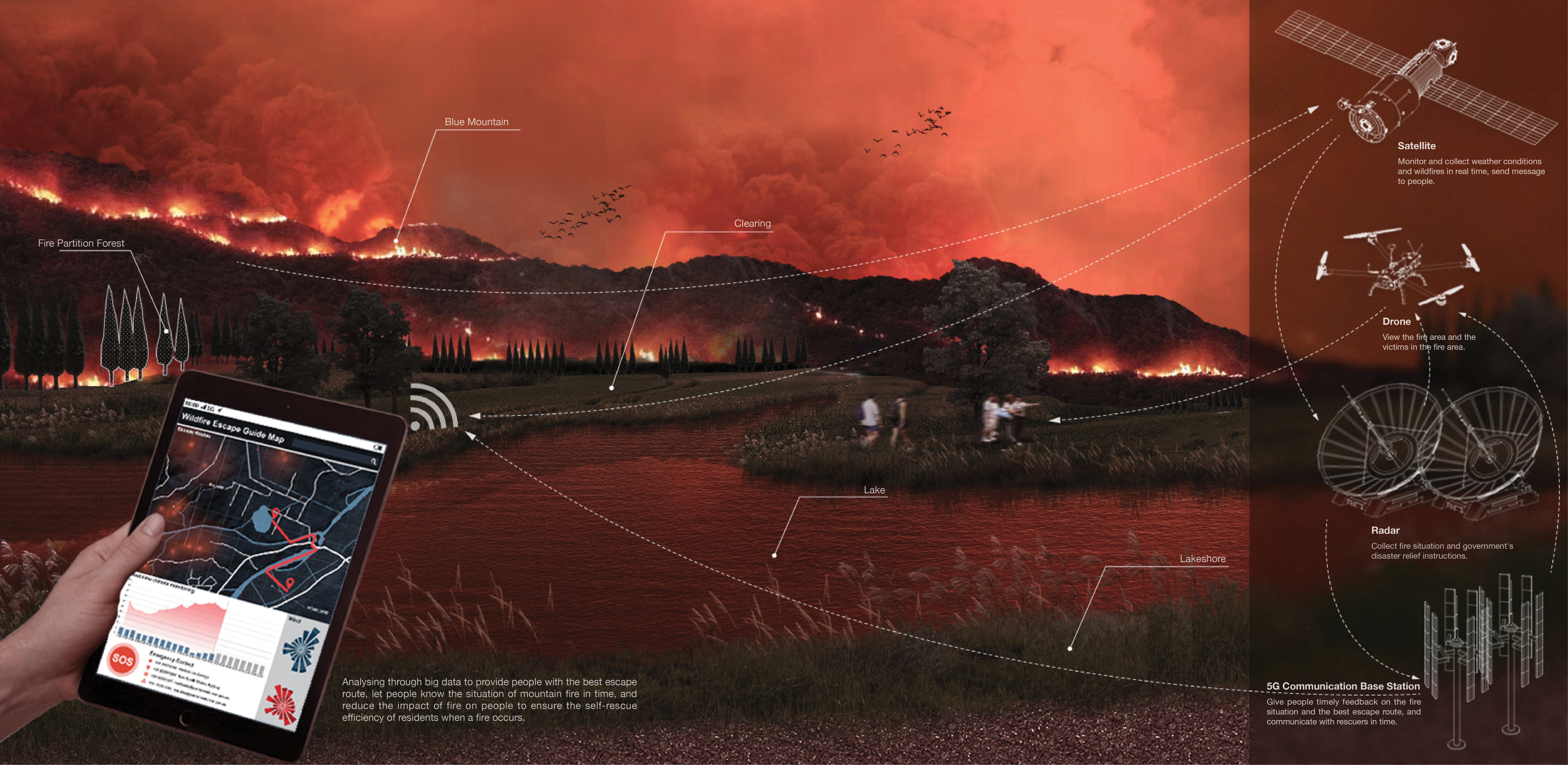
Another eye-catching element is the abundant water source in the site. Two rivers- Nepean River and Rickabys Creek, surround the woodland to west and east. They are almost neglected and faded from the site in the daily life of the residents, though appealing water is an effective weapon in defeating bushfire risks. Thus, utilising the existing water system is a predominant approach in designing a fire-resistance city in WUI areas.
Concept
Based on the site inventory and analysis, a water-led concept is proposed here to give answers to the fire-prone city. The two main rivers and their tributaries will orient the urban design practice in this project. The functions of water in WUI areas are thought again in this design. Normally, water can only function as a tool in suppressing the fire. Thus, in common sense, water certainly has the power to confront with fire, while it still remains in the fighting stage. Nevertheless, water has enough gifts in defeating bushfires through the whole process.
Therefore, the versatility of water will be explored in this project to find more potential of the existing rivers when bushfires force people to stay alert in all situations. The design aims at building a demonstrative model of the new cities in WUI areas with abundant water resource. Giving chances of living with fire to people is to talk about finding a balanced state between normal life and emergent fire. The water here is the bind or the pivot to connect normalcy and emergency.
Strategy
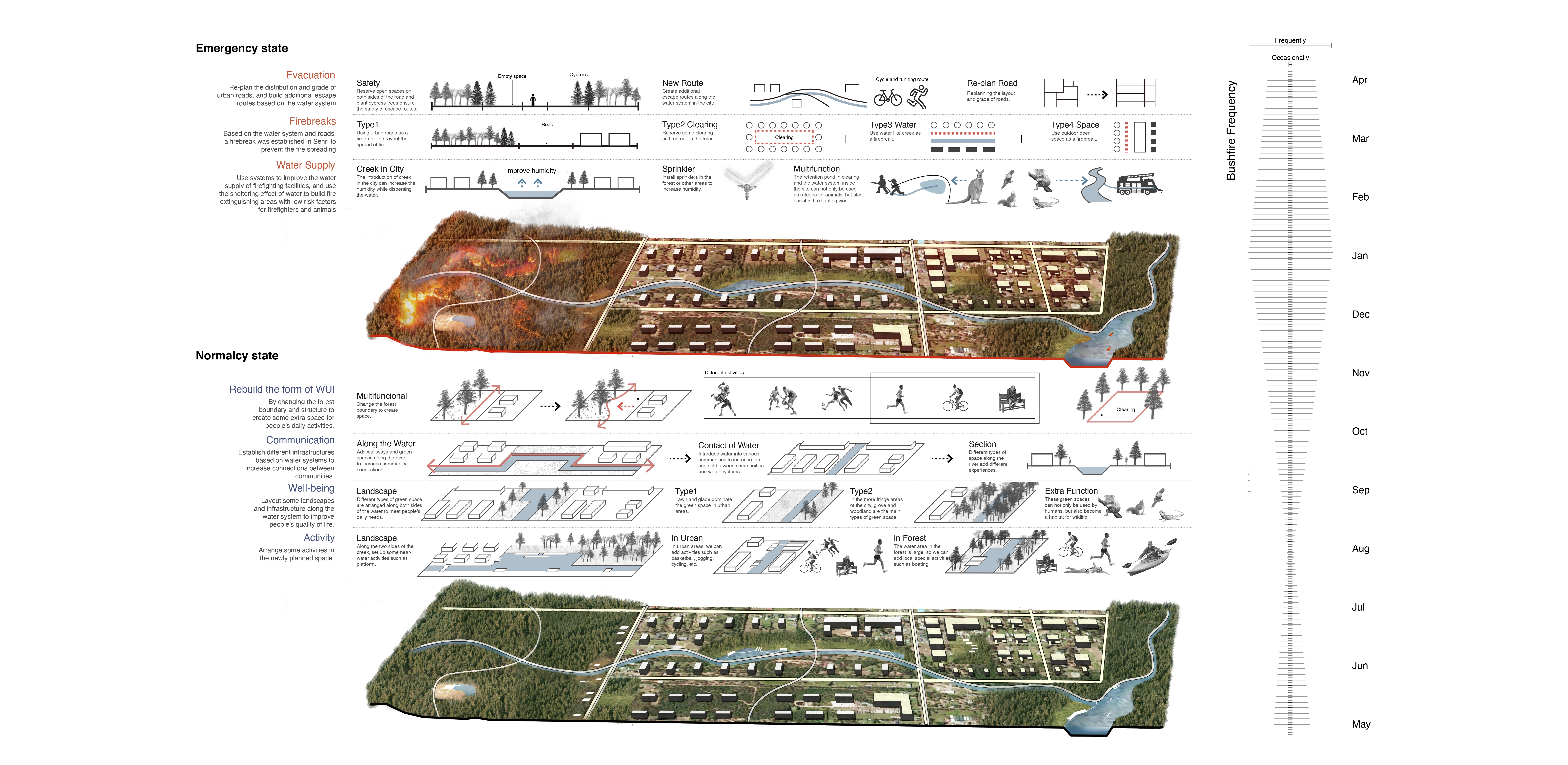
Instead of traditional prevention-led approaches in WUI urban designs, this project experimentally prompts two tenses of the site to explore synthetic and multifunctional solutions in WUI cities.
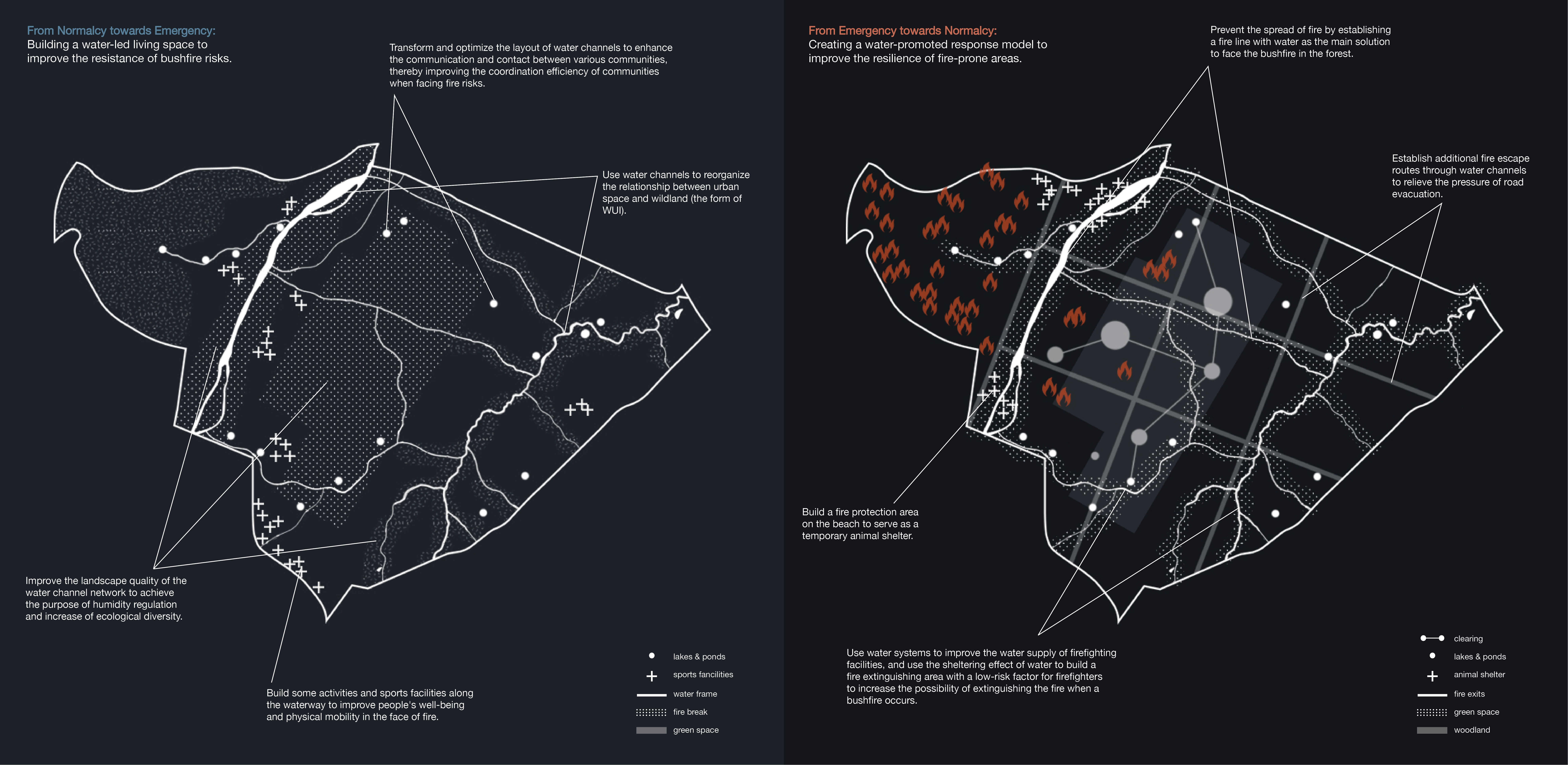
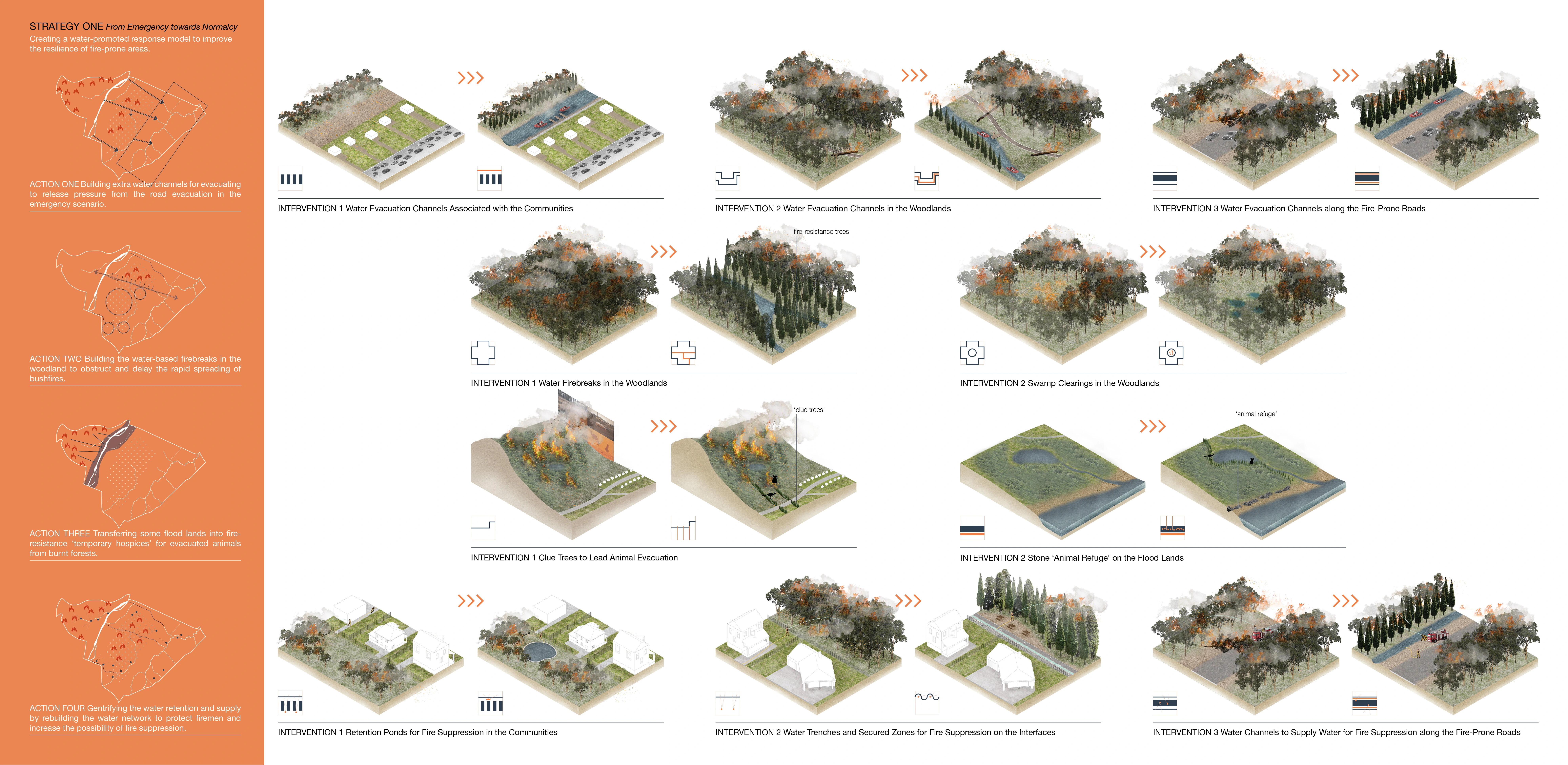
Strategy One: From Emergency to Normalcy
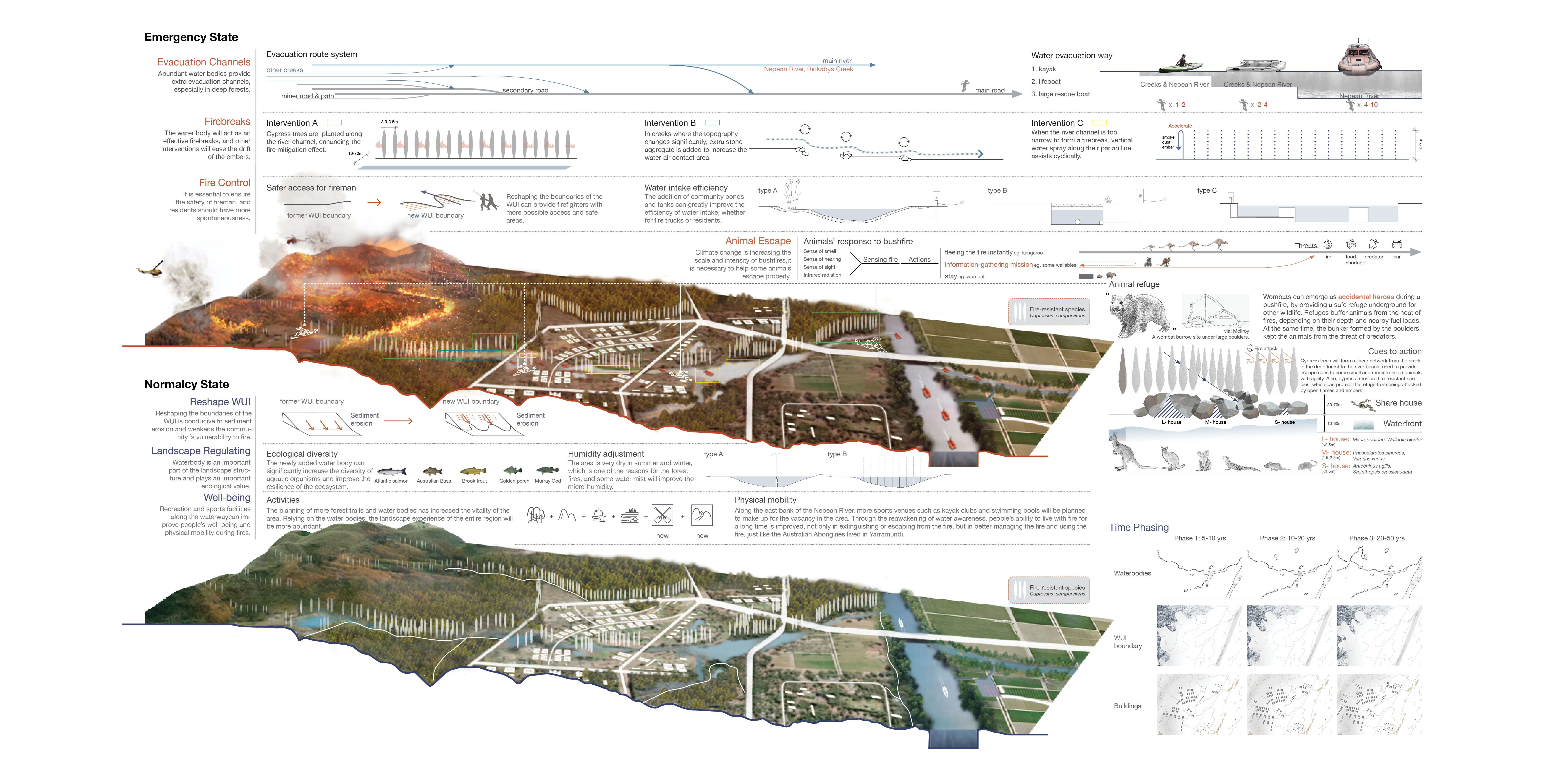
This strategy aims at creating a water-promoted response model to improve the resilience of fire-prone areas. And here are four actions:
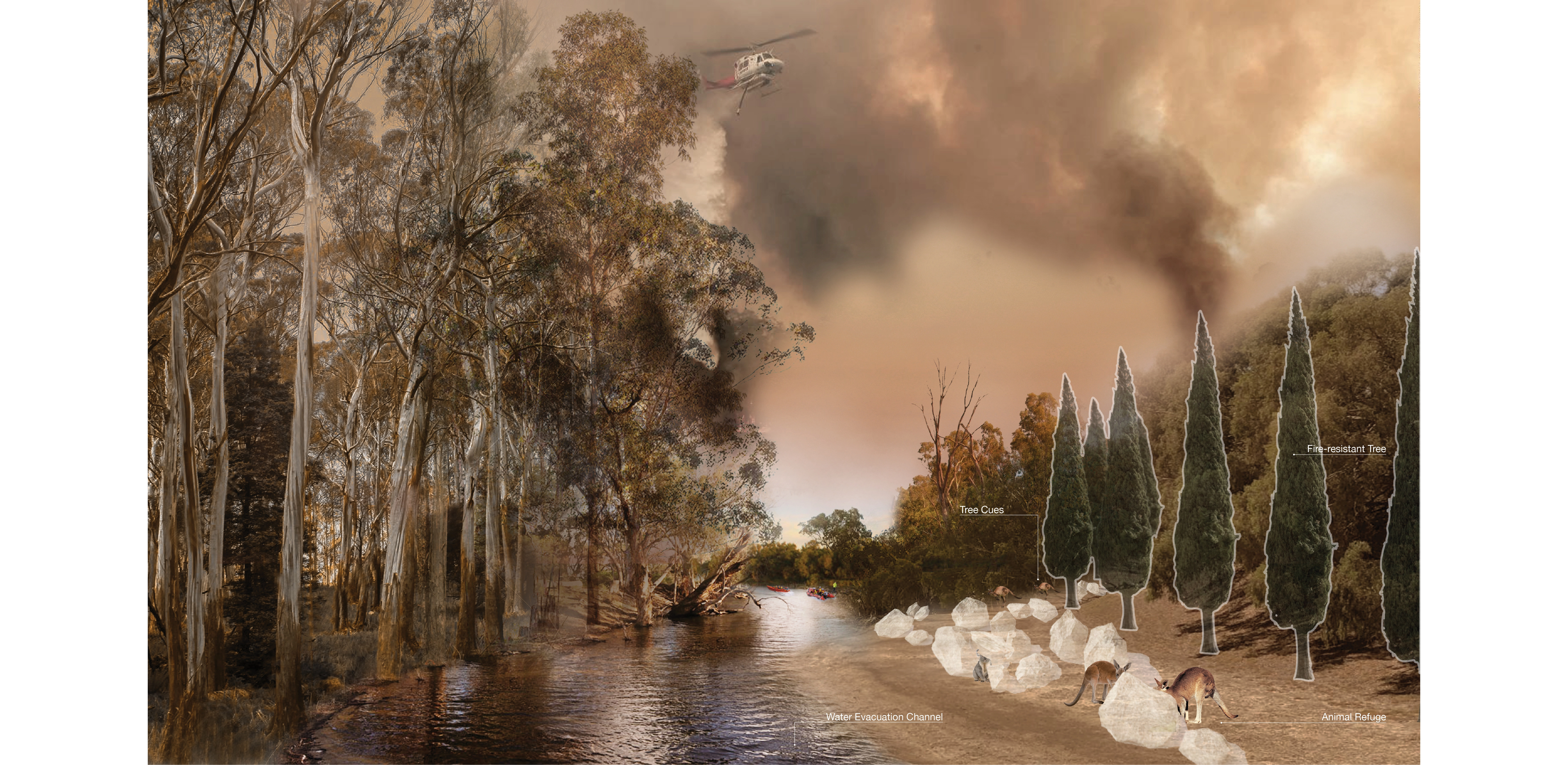
1. Building extra water channels for evacuating to release pressure from the road evacuation in the emergency scenario.
2. Building the water-based firebreaks in the woodland to obstruct and delay the rapid spreading of bushfires.
3. Transferring some flood lands into fire-resistance ‘temporary hospices’ for evacuated animals from burnt forests.
4. Gentrifying water retention and supply by rebuilding the water network to protect firemen and increase the possibility of fire suppression.
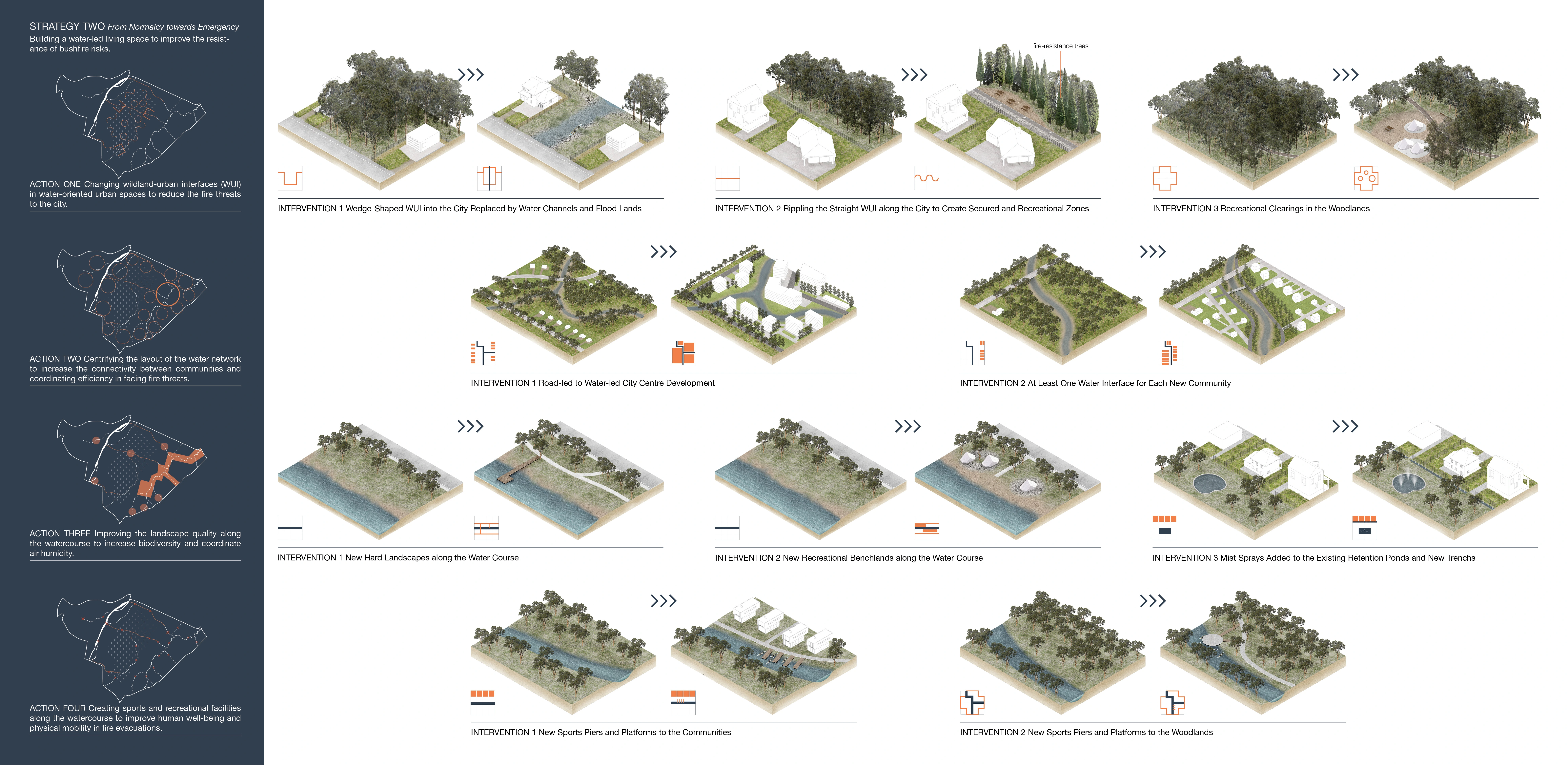
Strategy Two: From Normalcy to Emergency
This strategy aims at building a water-led living space to improve the resistance of bushfire risks. And here are also four actions:
1. Changing wildland-urban interfaces (WUI) in water-oriented urban spaces to reduce the fire threats to the city.
2. Gentrifying the layout of the water network to increase the connectivity between communities and coordinating efficiency in facing fire threats.
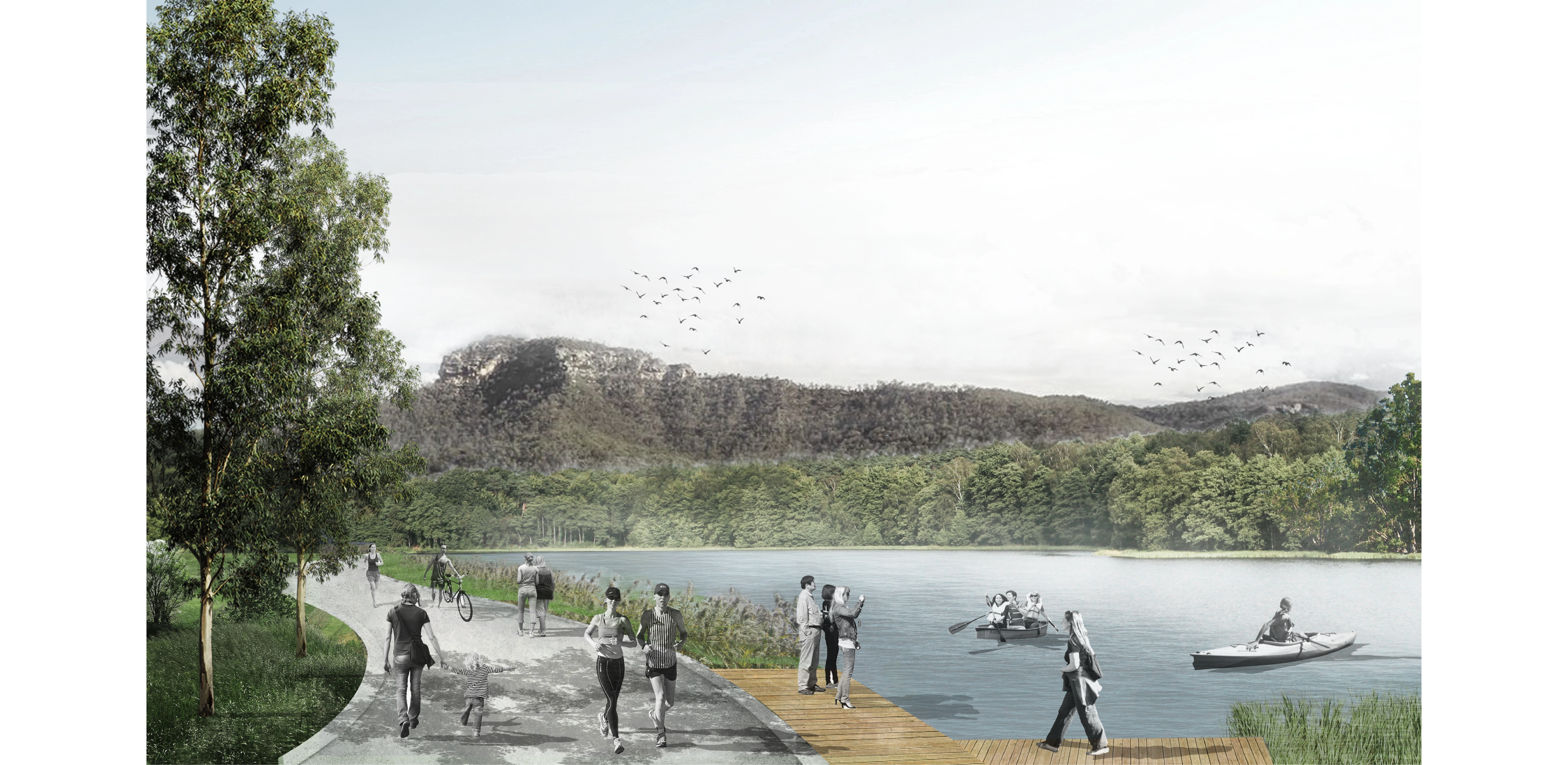
3. Improving the landscape quality along the watercourse to increase biodiversity and coordinate air humidity.
4. Creating sports and recreational facilities along the watercourse to improve human well-being and physical mobility in fire evacuations. -
- mediterranean cypress
Advertisement
Related Awards
Honor Award, Urban Design
Urban Balcony Embracing Rewilded Nature
In a densely populated urban setting, this project unveils a rewilded natural area, revitalizing a former concrete waterway through innovative stormwater management. The design introduces a linear activity zone extending over four residential blocks, tailored for diverse social interactions. It underscores the vital role of landscape architecture in enriching the social and ecological aspects of urban living.