.webp?language=en-US)
Peat/Land: Strategies for Restoration, Design, and Planning of North Carolina Peatlands
Madalyn Baldwin, Student ASLA
Peat, which is plant matter that deteriorates over millennia, is usually seen as an impediment to agriculture—if it is seen at all. To elevate peat’s low profile, this project proposes a boardwalk and interpretive exhibits for a conservation site in Fair Bluff, North Carolina, and the potential for monetization through ecotourism and carbon offset programs. Expanding the conservation area to incorporate Fair Bluff’s flood-prone downtown would, over several phases, relocate vulnerable residents while restoring low-lying areas to a more natural peatland condition that would also absorb future floodwaters. By relocating its downtown and ceding that land back to nature, the town of Fair Bluff ensures its own survival.
Awards Jury
-
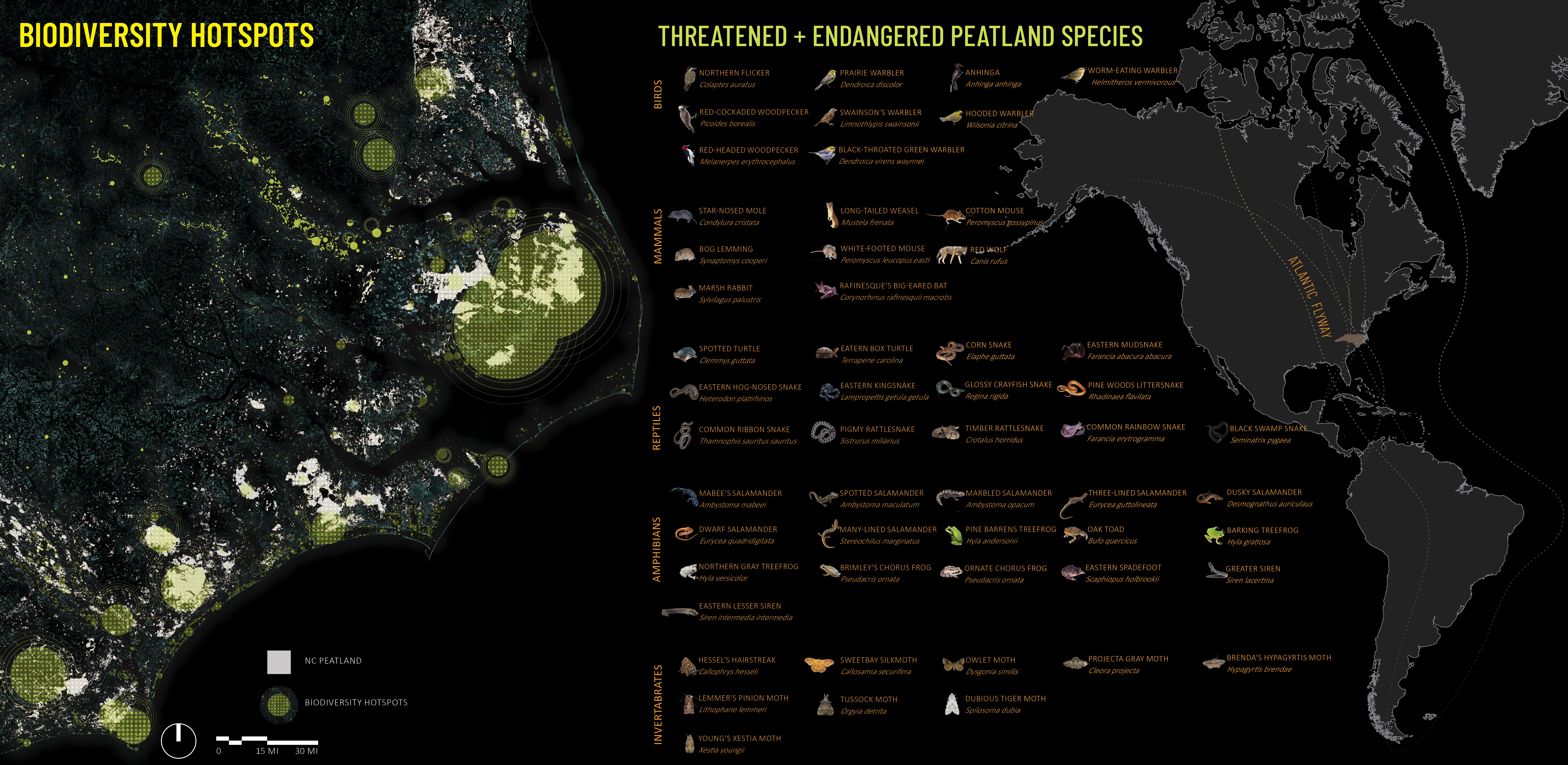
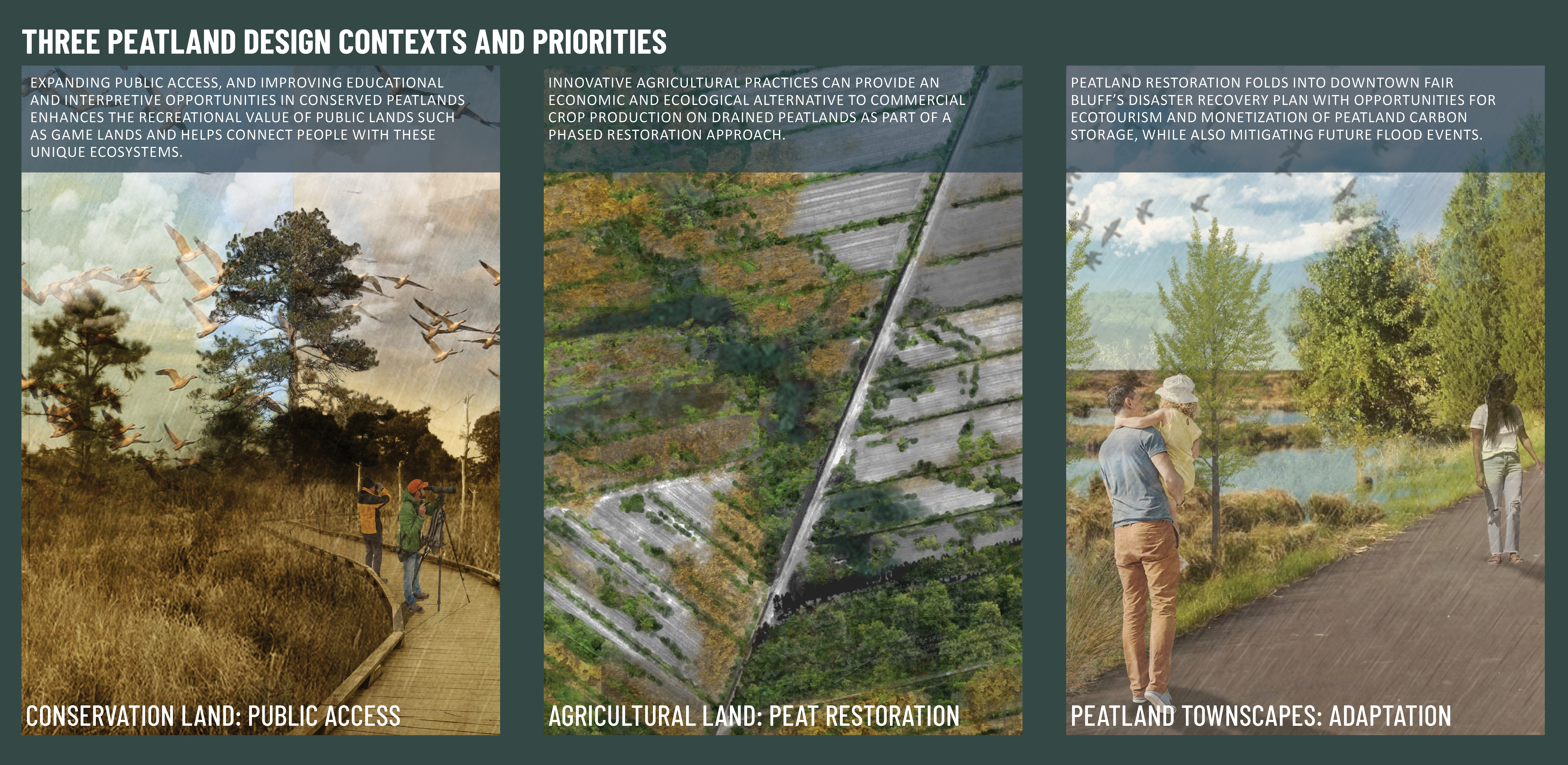
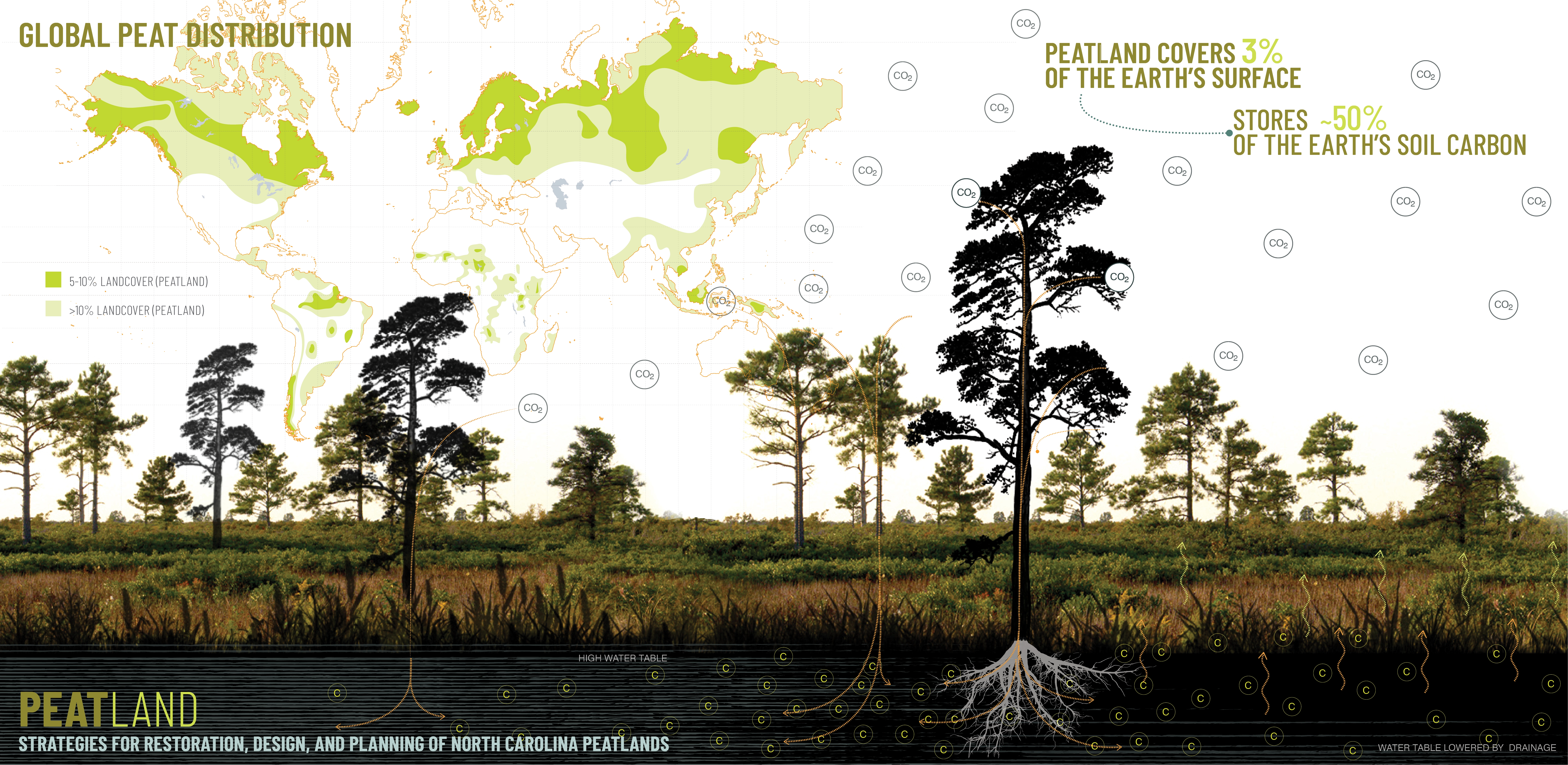
This project explored the unique ecological, historical, and cultural role of peatland in North Carolina, and examined restoration and design strategies for these sensitive landscapes. Peatland is a unique type of wetland that produces peat through the partial decomposition of plants and other organic matter. Globally, peatland covers less than 3% of the earth’s surface, but stores close to 50% of the world’s soil carbon. Peatland conservation and restoration aligns with global priorities for climate adaptation, hazard mitigation, biodiversity conservation, and rural economic development, and landscape architects working in peatland contexts are positioned to lead these regenerative design efforts. This project identified three peatland contexts in NC for the implementation of restoration and design strategies: i) public access to conserved peatlands; ii) restoration of peatland drained for agriculture; iii) resilience and adaptation of rural towns built in and around peatlands.
-
Peatland only remains on about 3% of the earth’s surface, but stores close to 50% of the world’s soil carbon, equivalent to two times more than what is stored in all of the earth’s forests combined. This project explores how the conservation of intact peatlands and the restoration of drained and degraded peatlands can serve as an impactful tactic for addressing climate change while simultaneously aligning with the priorities and imperatives of biodiversity conservation, hazard mitigation, and rural economic development. Regenerative planning and design is critical to framing these issues and opportunities, and landscape architects must drive these conversations and deploy innovative and high-performing strategies for peatland conservation and restoration.
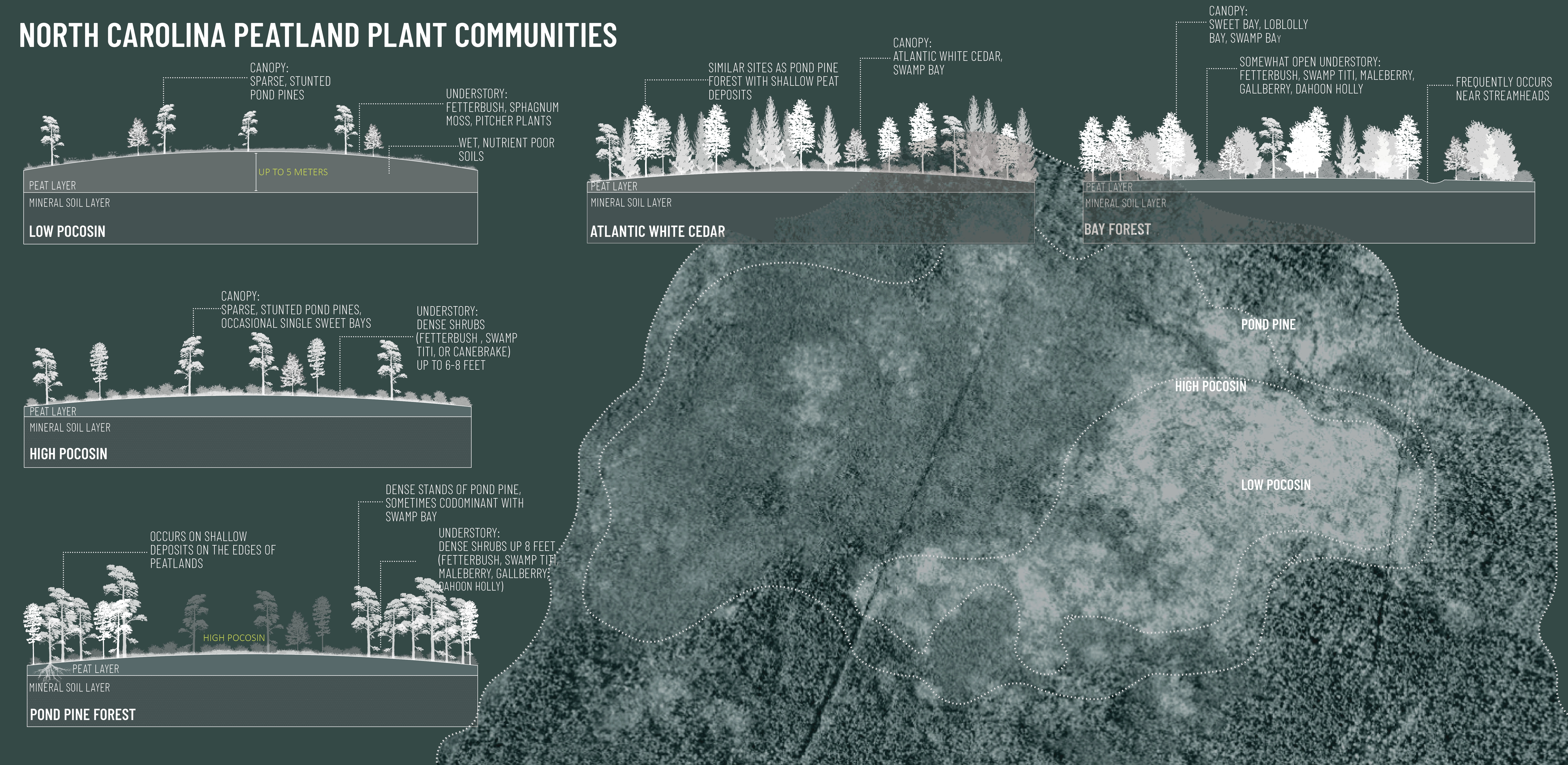
Peatlands are specific types of wetlands that produce peat from the partial decomposition of plants and other organic material. Due to their ability to sequester and store atmospheric carbon and support an incredible range of diverse plant and animal species, peatlands occupy a critical ecological niche. However, they are one of the most endangered ecosystems globally due to commercial extraction and drainage to support agriculture and other land uses. This project focuses on the conservation and restoration of temperate peatlands in North Carolina’s Coastal Plain. This project researched and analyzed natural and cultural histories of peatland to develop innovative, multidisciplinary restoration strategies that guide land-planning processes for landscape architects working in and around these sensitive ecosystems.
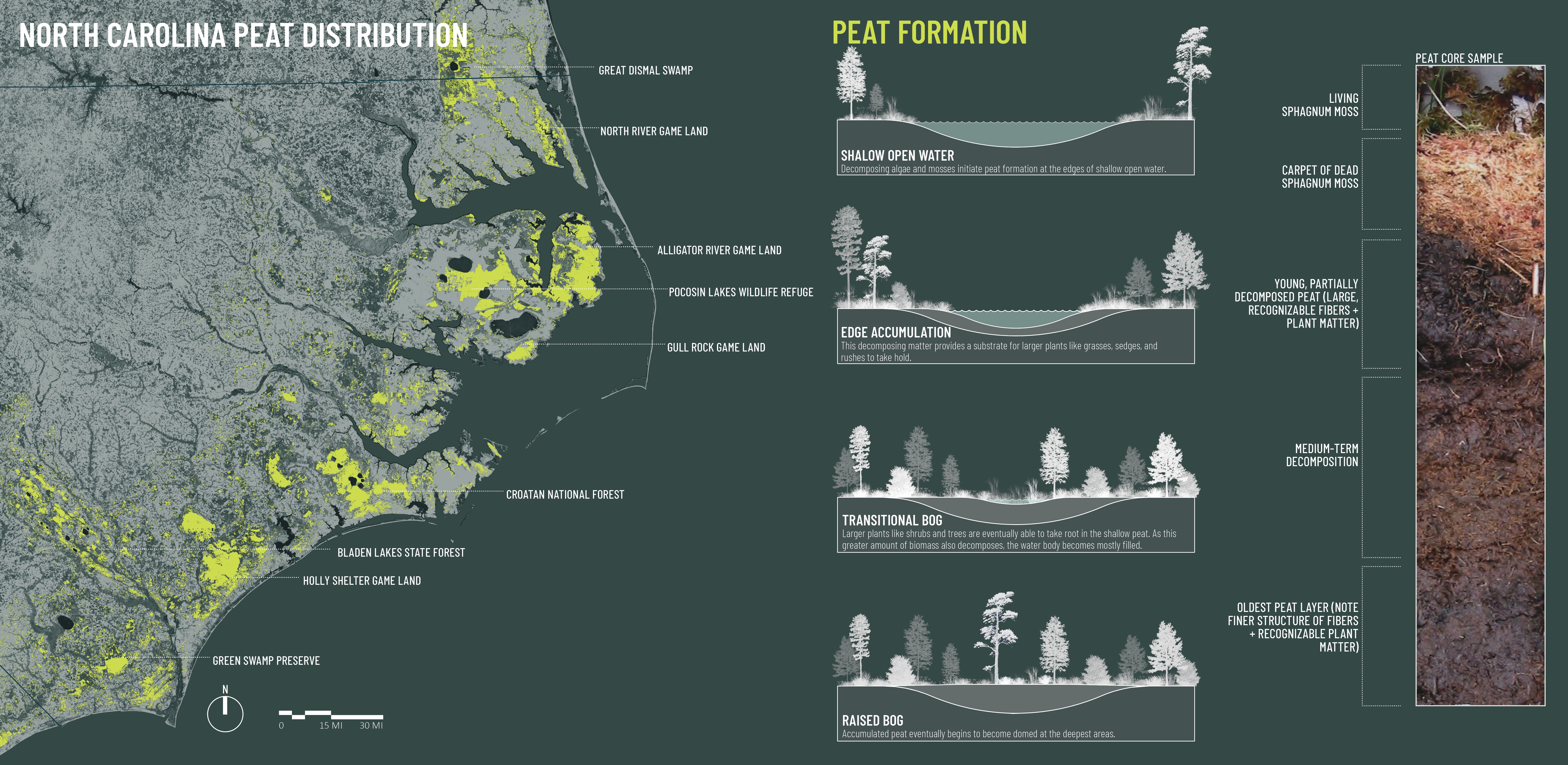
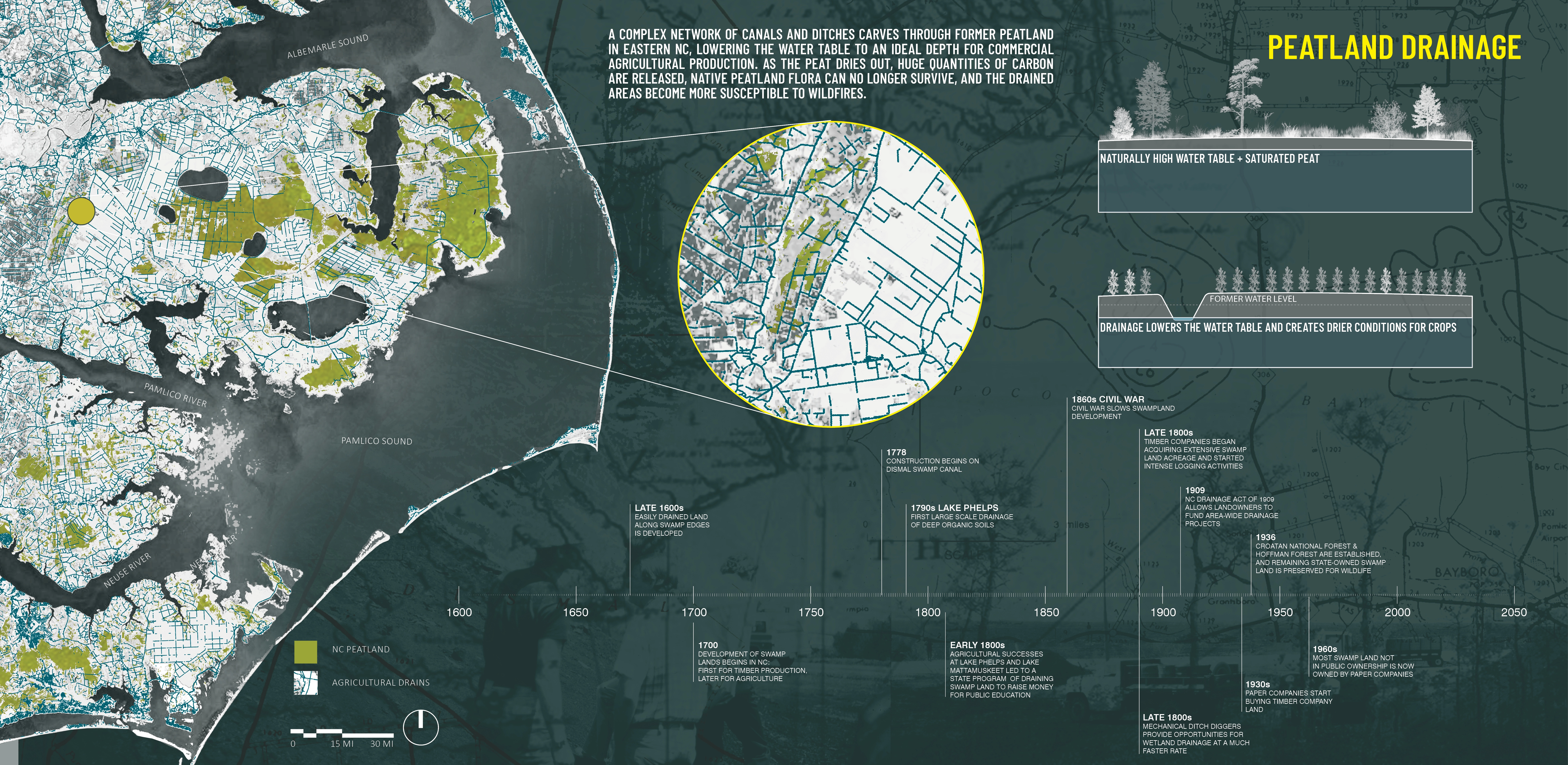
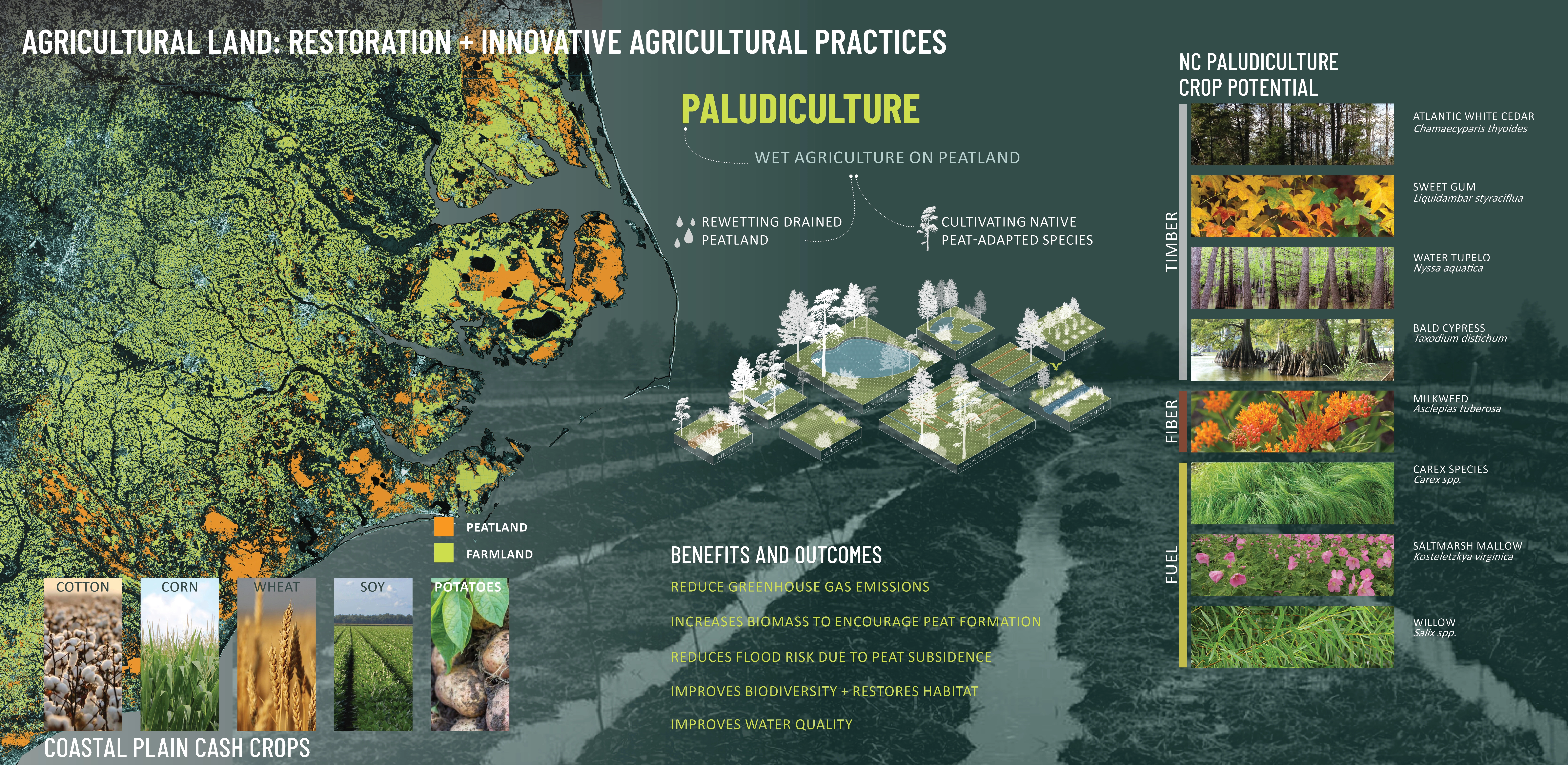
Peatland once covered many millions of acres of North Carolina’s Coastal Plain. In some places, deposits reached a depth of five meters. Accumulating at a rate of about one millimeter per year under ideal conditions, this means that peat has been developing in North Carolina wetlands for at least 5,000 years. But peat is often drained or extracted for commercial opportunities. Across the United Kingdom and Northern Europe, peatlands have been drained and mined to burn peat for energy production. In Canada peat is extracted, then dried and shipped worldwide as the popular horticultural soil conditioner, peat moss. And in the United States, where peatland typically occurs along the mid-Atlantic coastal plain and near the Great Lakes, most peatland is systematically drained and converted to farmland. In North Carolina alone, almost 70% of the state’s peatland has been drained during the last 50 years for conversion to agricultural uses, with only about 700,000 acres left intact.
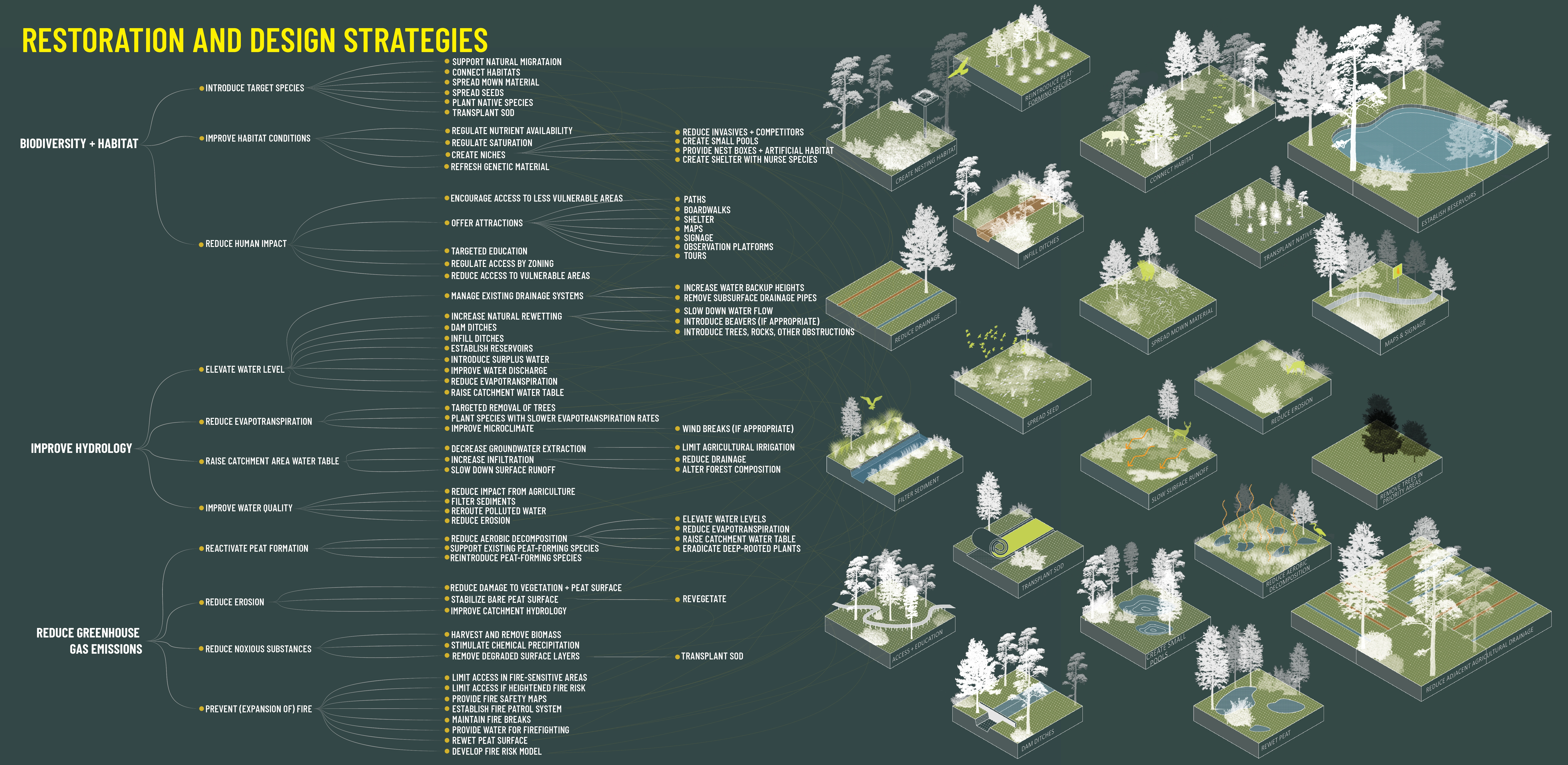
Informed through rigorous research and analysis, this project developed land planning and design frameworks for sensitive peatland contexts through extensive geospatial analysis, literature review, historical, and archival research. Peatland restoration is typically approached through the lens of ecology, engineering, agriculture, and natural resource management. Through review of recent publications across these disciplines, myriad overlapping peatland restoration strategies were identified for further exploration. The most common strategies typically aligned with at least one of three restoration goals: i) improving biodiversity and habitat value; ii) improving or restoring hydrology; and iii) reducing greenhouse gas emissions and/or increasing carbon storage capabilities. Landscape architects’ roles continue to expand beyond site design and increasingly address critical ecological and social issues on global scales, uniquely positioning the profession to address peatland restoration in practice. While peatland currently only cover’s 3% of the earth’s surface, it was once much more expansive. Landscape architects working in the Southeastern United States, around the Great Lakes, across Canada, Northern Europe, India, or the eastern coast of China are likely to encounter sites containing drained, degraded, or former peat areas. An initial phase of this project involved synthesizing and translating some of the previously identified restoration strategies and interpreting them as design interventions. The result was a visual toolkit of diagrammatic representations of these strategies, used to communicate design intent and restoration goals for the three contexts and project types.
Peatland conservation, restoration, and design strategies were explored and implemented for three peatland contexts and priorities:
Conservation Land: Promoting public access and education
Agricultural Land: Innovative production practices for phased peatland restoration
Peatland Townscapes: Climate adaptation and resilience in rural peatland communities
Conservation Land:
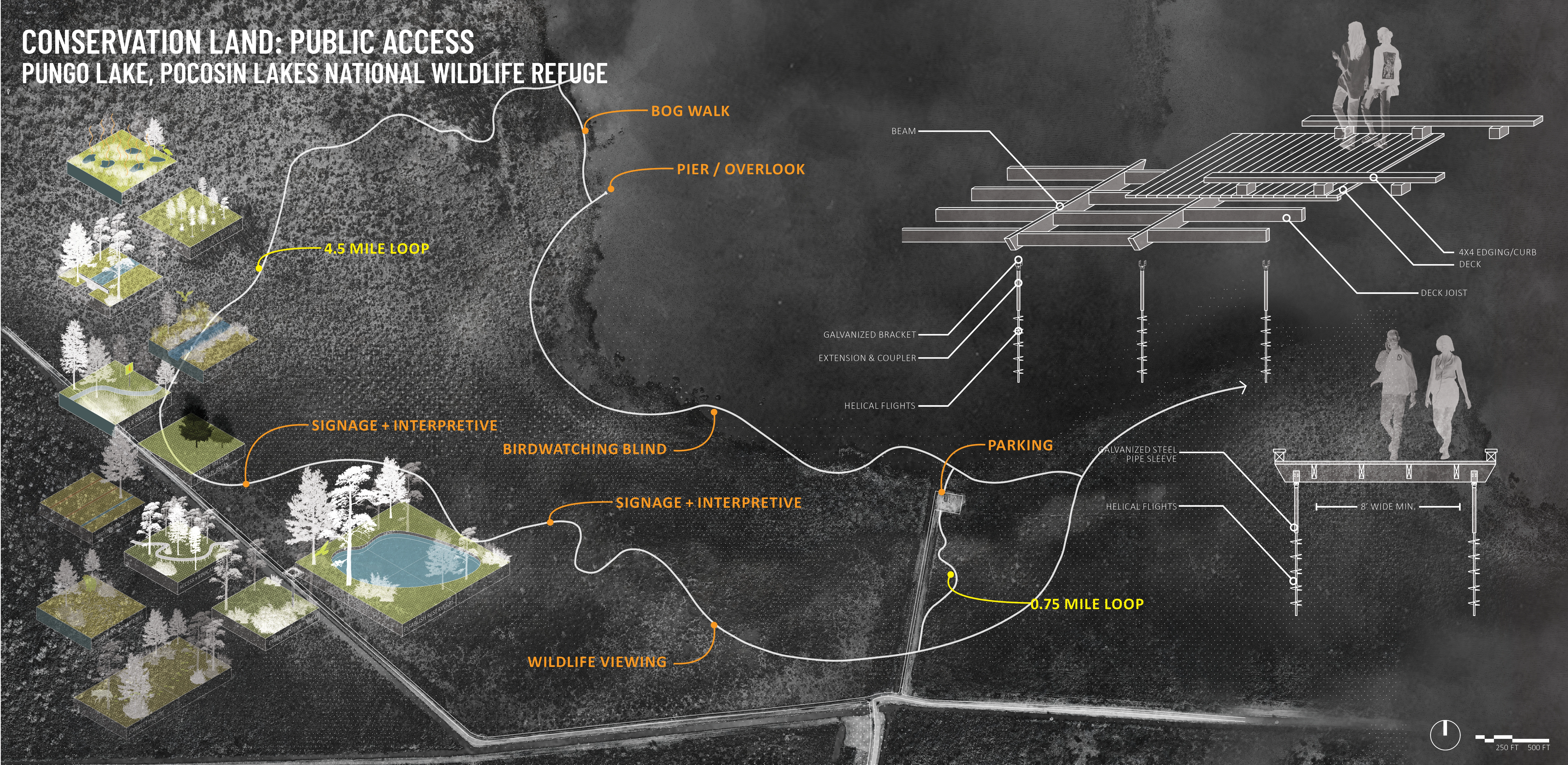
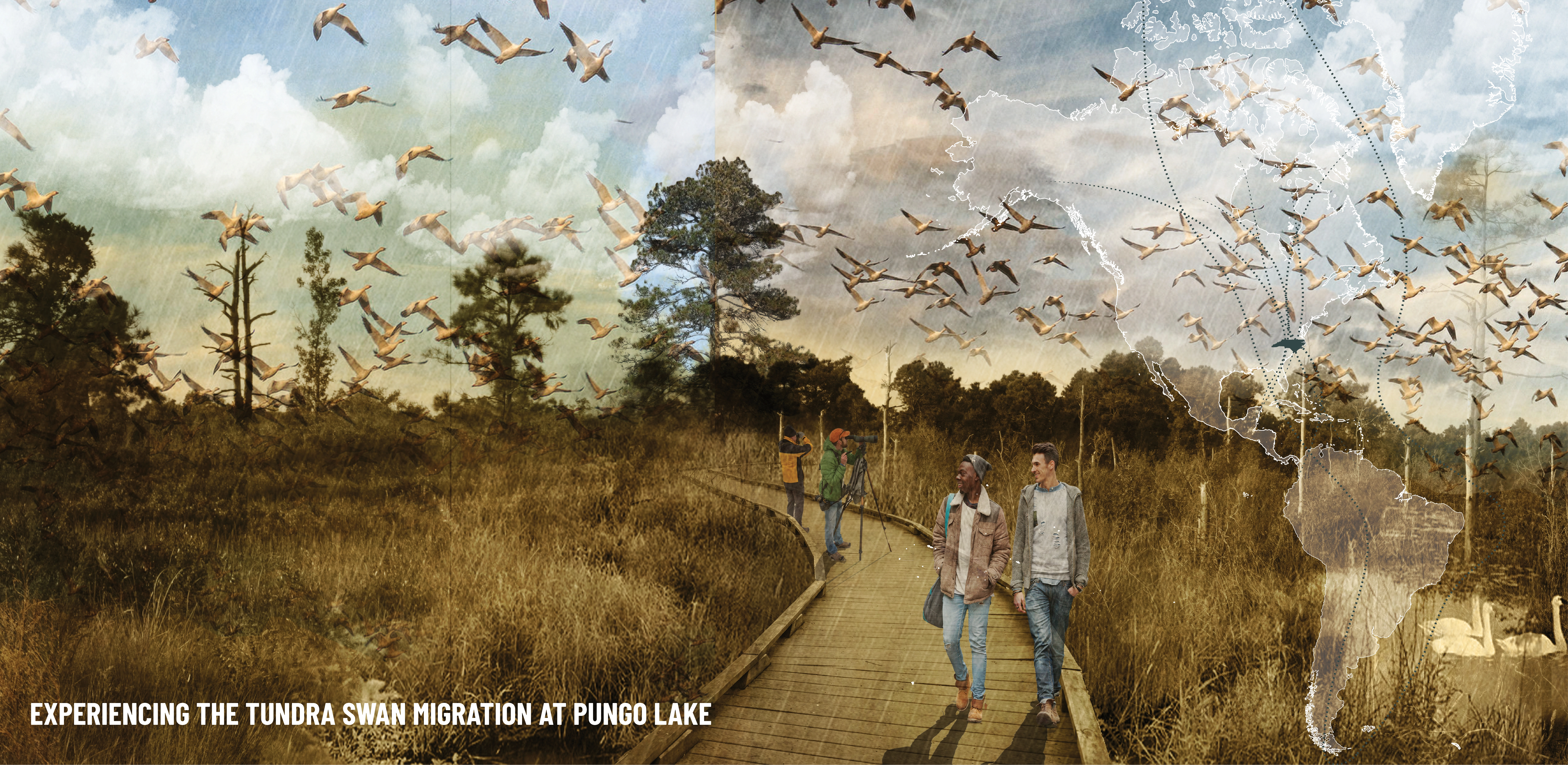
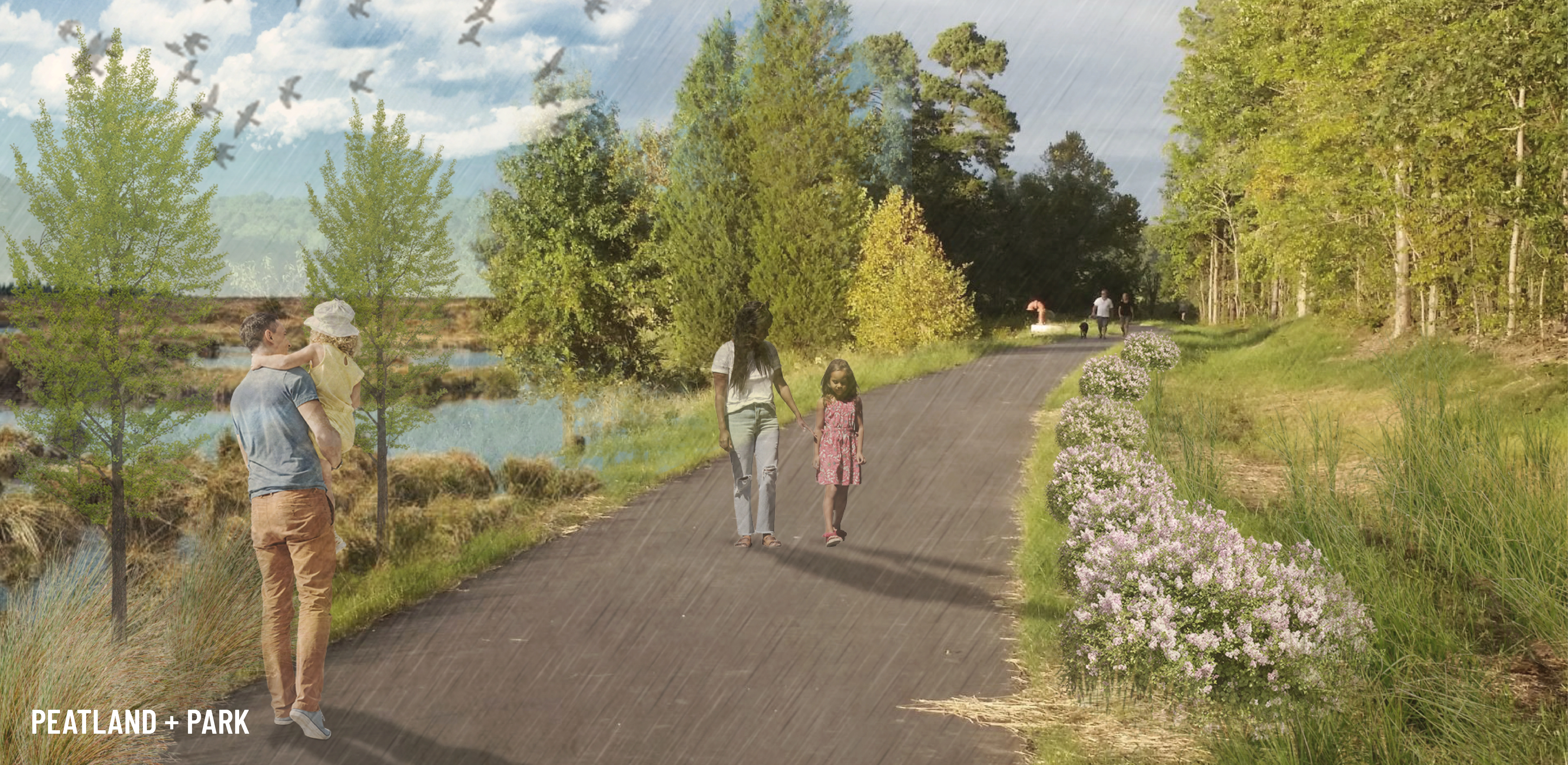
Much of North Carolina’s remaining intact peatland has already been protected and exists today as gameland managed by the North Carolina Wildlife Resources Commission. It is open to the public, but lacks amenities or recreational and educational opportunities. Encouraging public access and recreation affords opportunities to educate the public about the importance of these vulnerable ecosystems. These large, conserved land holdings are also ideal demonstration sites for innovative restoration and management strategies. This project proposes a 4.5 mile trail and boardwalk loop as well as a shorter 0.75 mile loop at Pungo Lake in Pocosin Lakes National Wildlife Refuge. Hand-driven helical piers allow boardwalk segments to be sensitively constructed without heavy machinery or damage to peat deposits and vegetation. Routing the boardwalk through the gradient of different plant communities and microtopographic conditions showcases the subtle and dramatic differences in peatland landscapes and affords numerous opportunities for educational signage and interpretive exhibits about peatland ecology, restoration, cultural history, carbon impact, and more.
Agricultural Land:
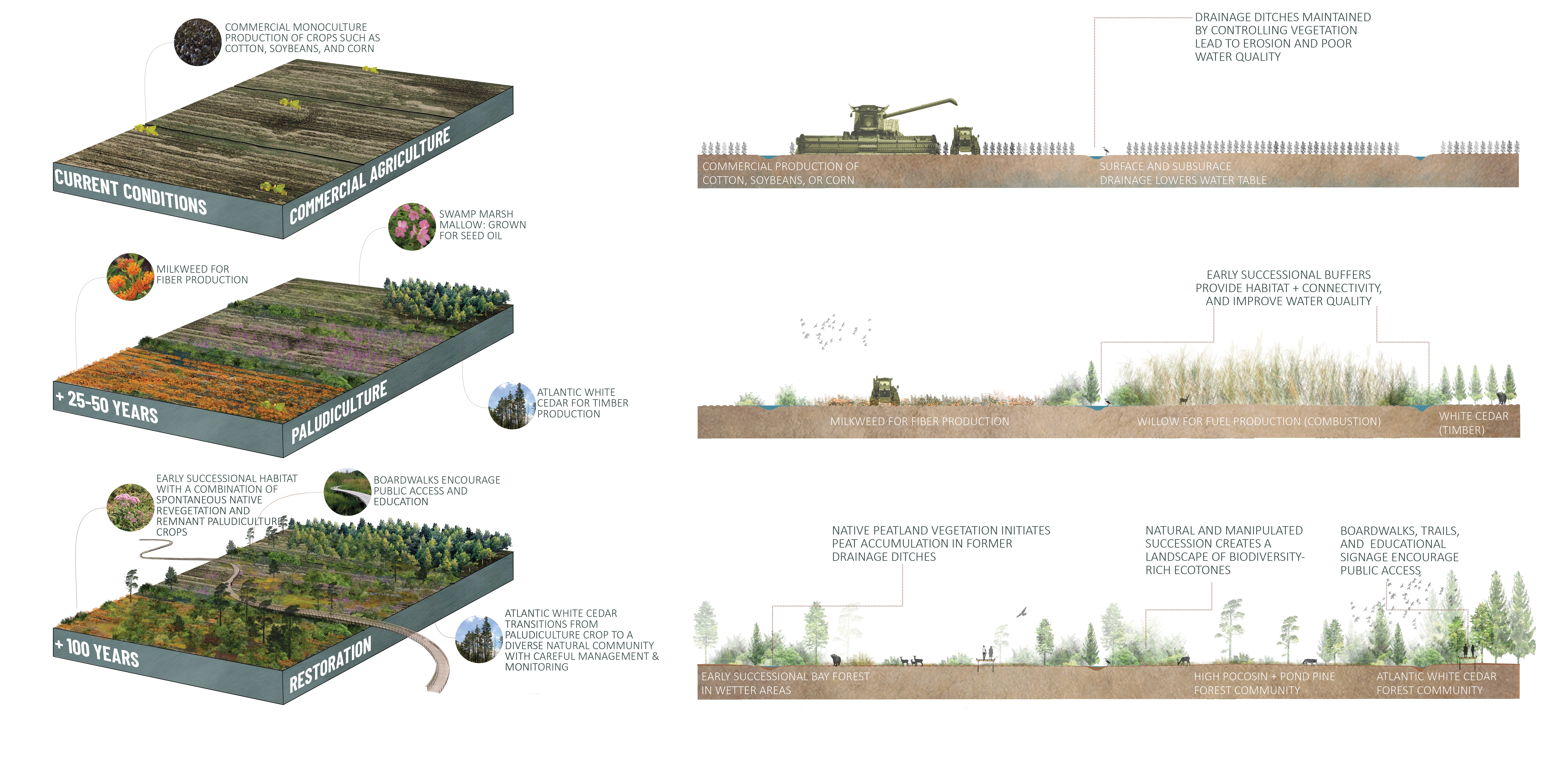
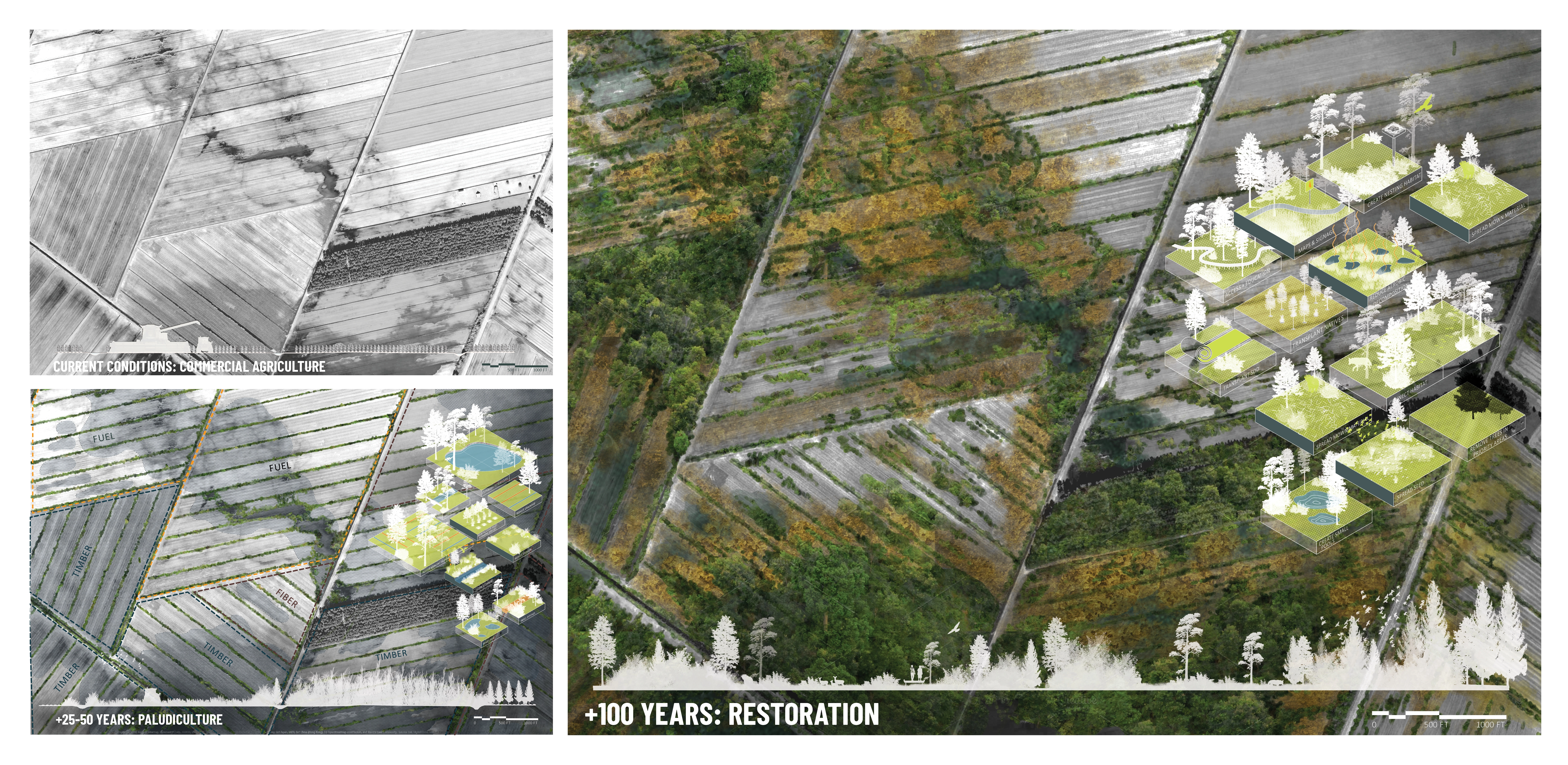
In the United States, most peatland has been drained for agriculture. By lowering the water table through digging ditches and canals and installing subsurface drains, the rich soil is able to support intensive crop production. However, peatland drainage has dire ecological consequences: as peat dries, it rapidly releases carbon back into the atmosphere; drained peatland is particularly susceptible to long-burning wildfires; peat subsidence can result in catastrophic flooding in adjacent rural communities; water quality is impacted from sediment and nutrient runoff, and coastal areas become more susceptible to saltwater intrusion. Large-scale restoration of agricultural peatland can have one of the strongest impacts on global carbon emissions and local hydrological regimes, but it’s conflict with the current economics of large-scale agriculture. One promising and innovative alternative is a production method called paludiculture, the practice of wet agriculture on peatland. The basic premise of paludiculture is rewetting drained peatland through infrastructural modifications to existing drainage networks, coupled with a shift from current crop production to the cultivation of native, peat-adapted species for profit. Paludiculture presents a unique opportunity to shift from productive to regenerative landscapes without drastic disruption to rural economies and ways of life. The monetization of carbon sequestration and storage through emerging carbon markets, and the imperative for communities of all sizes to address issues of climate resilience can also create economic opportunities for rural peatland communities that have historically relied on agriculture. This project envisions a phased approach to agricultural peatland restoration where paludiculture practices offer ongoing income from the land while implementing restoration strategies and ultimately transitioning to a full restoration scenario.
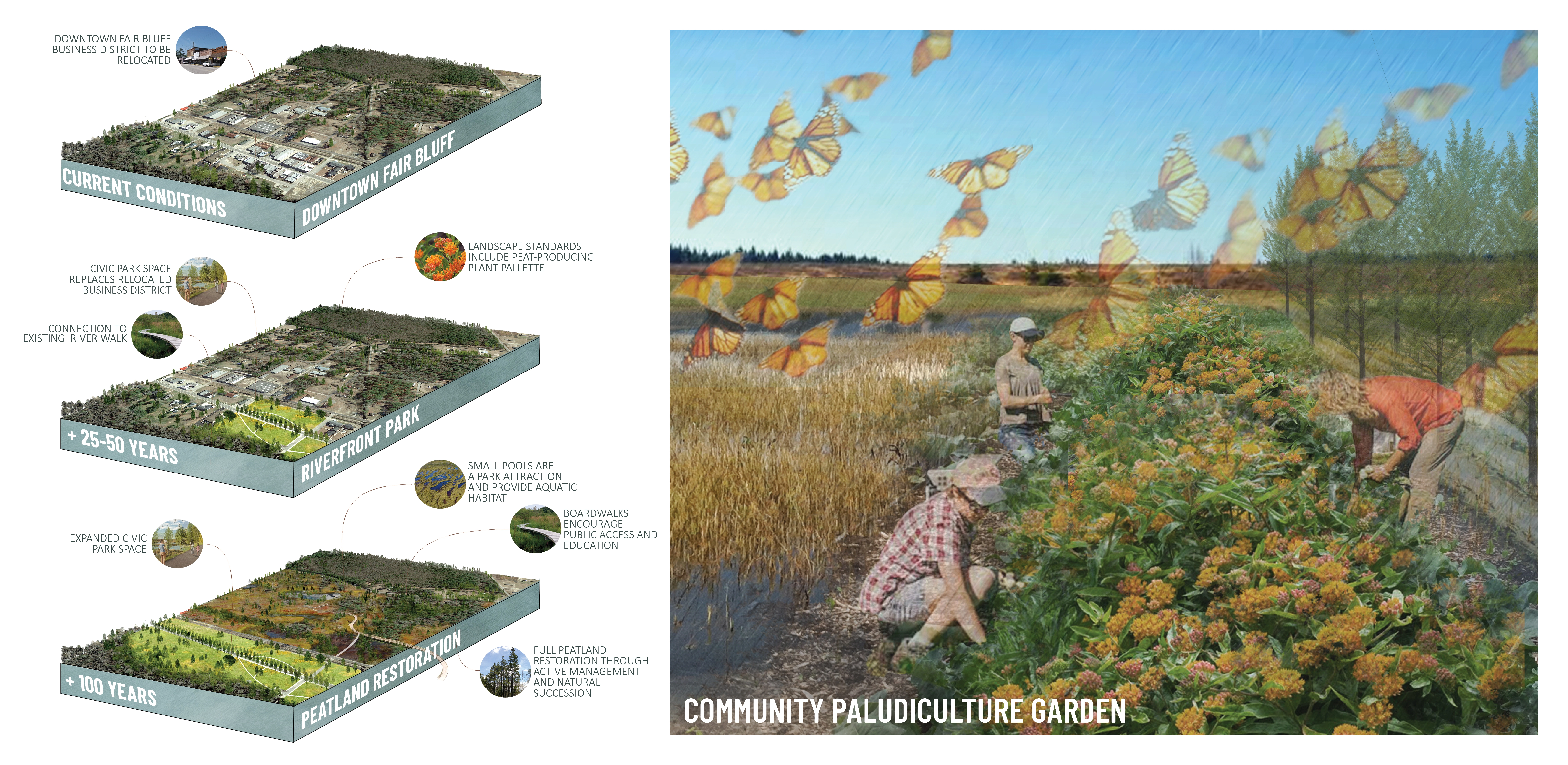
Peatland Townscapes:
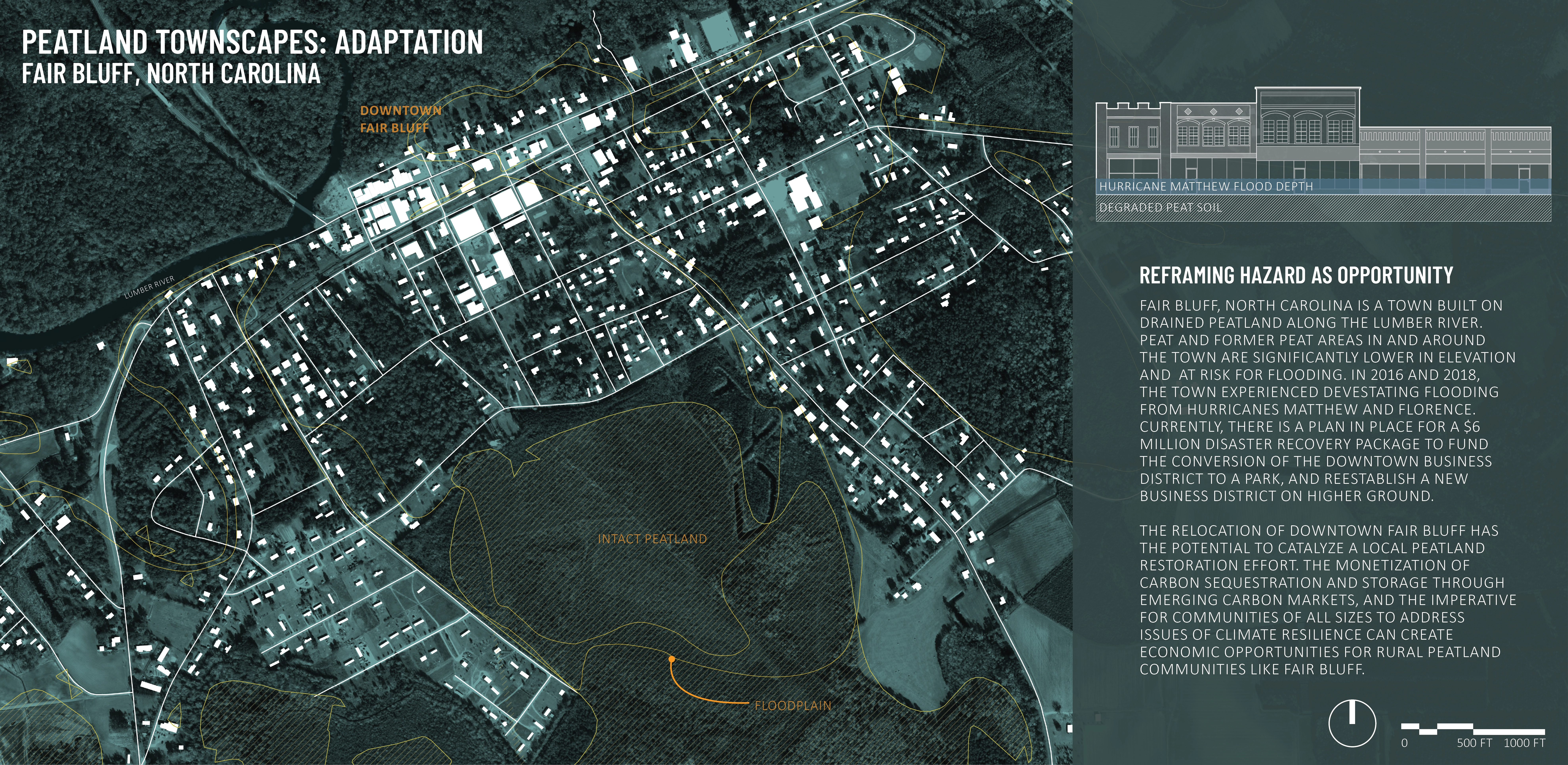
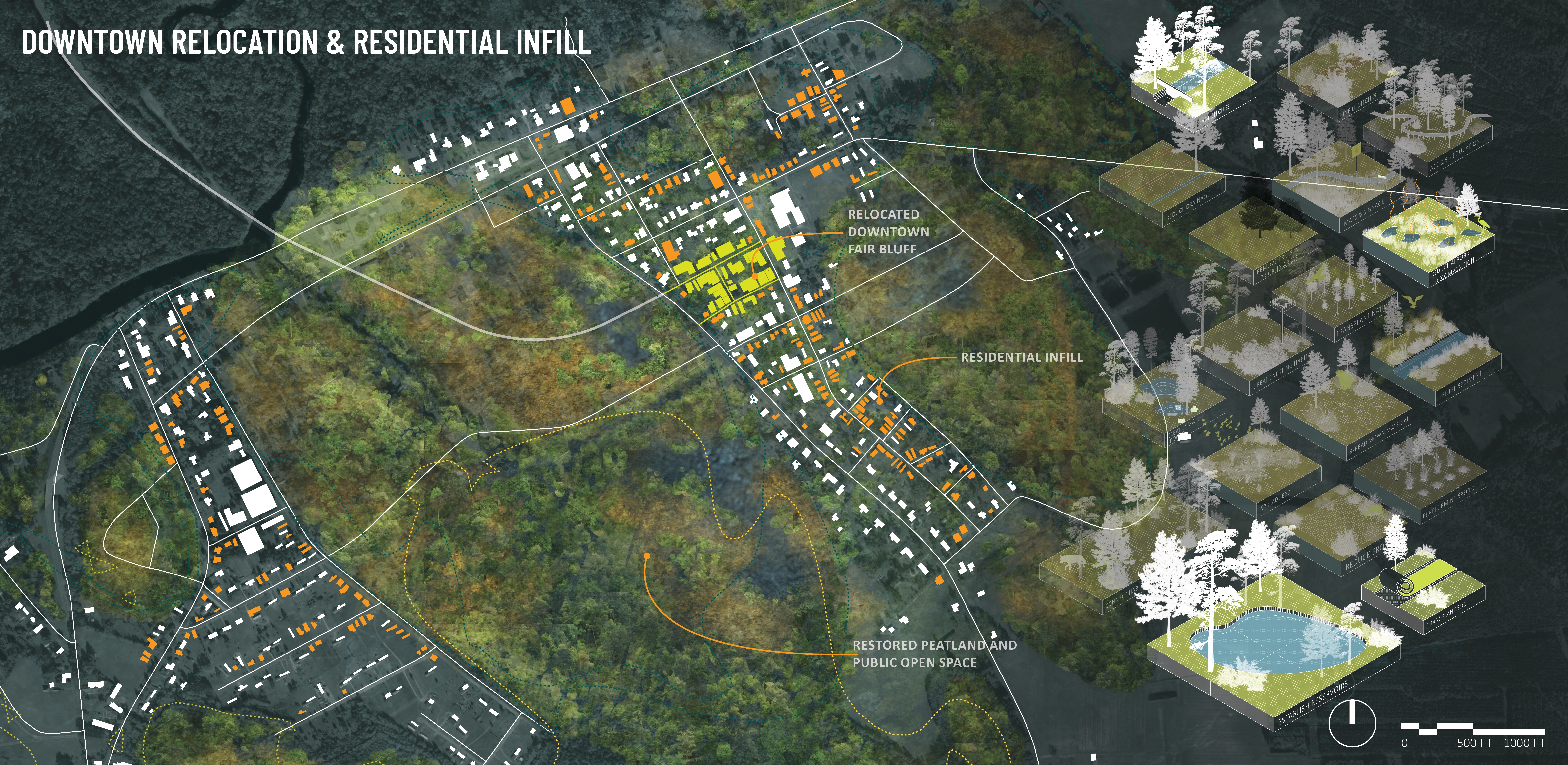
Fair Bluff, North Carolina is a small, historic town built on drained peatland along the Lumber River. Fair Bluff has always been susceptible to flooding due to the hydric soil conditions, adjacency to the river, local topography, and the system of ditches that drain the peat: the boundary of the mapped floodplain coincides almost precisely with the boundary of intact and degraded peat. The town experienced devastating flooding due to Hurricane Matthew in 2016 and Hurricane Florence in 2018. At the end of 2019, town officials announced that a disaster recovery package would help to fund the relocation of Fair Bluff’s downtown business district to higher ground and develop a park in its place. This project explored several alternate locations for the downtown relocation and envisioned a phased approach for residential infill around the new business district coupled with peat restoration as homes and businesses relocated. The resulting plan included a new dense downtown core overlooking a restored peatland nature park. -
- Atlantic White Cedar
- Sweet Gum
- Water Tupelo
- Bald Cypress
- Milkweed
- Sedge
- Saltmarsh Mallow
- Black Willow
Advertisement
Related Awards
Honor Award, Analysis & Planning
A Cultural Approach: The Fort Peck Tribes Hazard Mitigation Plan
In collaboration with the Fort Peck Assiniboine and Sioux Tribes, EPA, and FEMA, the Fort Peck Tribes Hazard Mitigation Plan (HMP) adopts a culturally responsive approach to hazard mitigation planning that features connection to place.