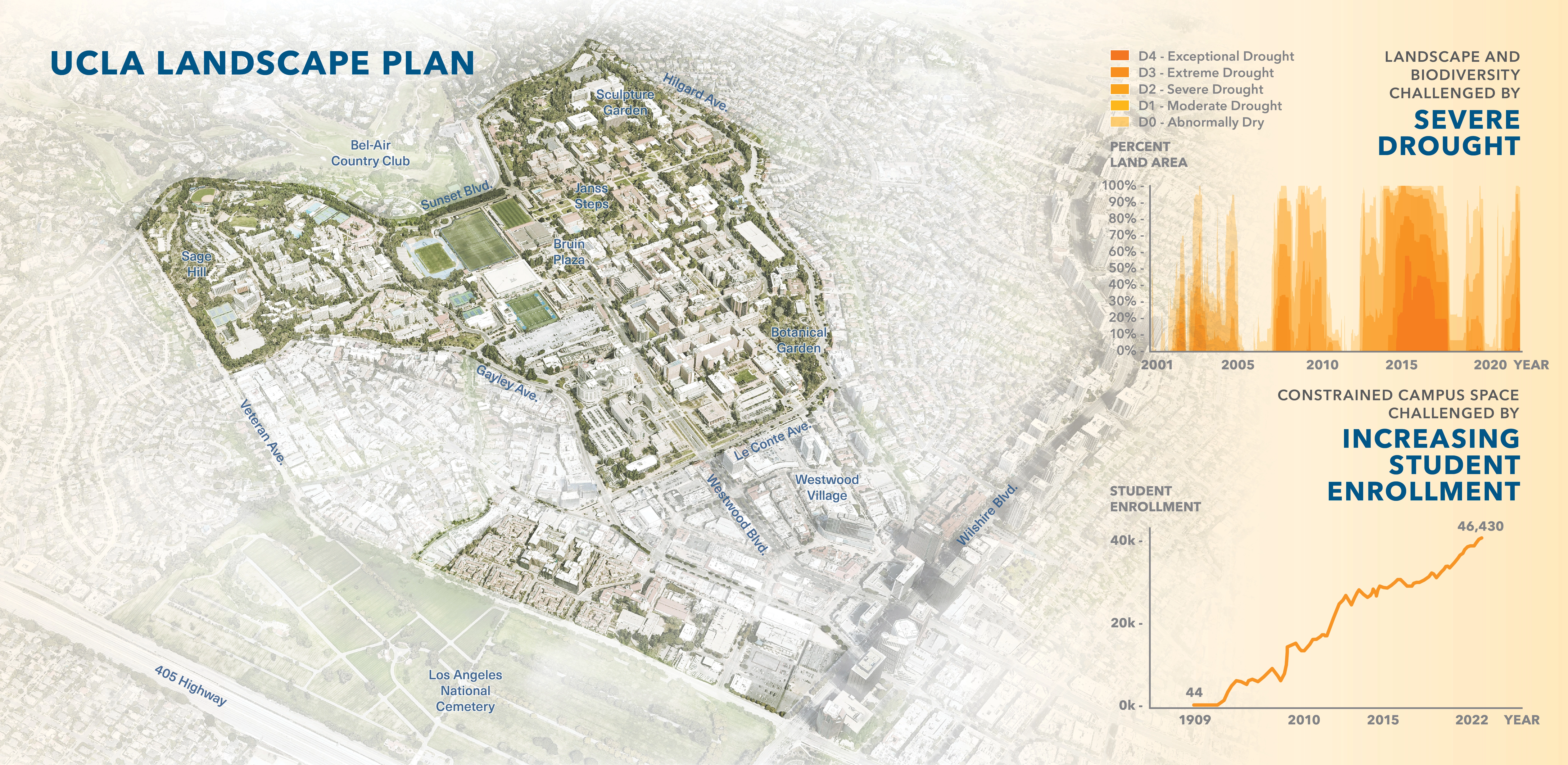
.webp?language=en-US)
The Landscape of An Agreement: The Role of Regional and Geopolitical Landscape, Agriculture and Religion in a Future Peace Agreement Between Palestine and Israel
Few lands remain as contested as the West Bank between Israel and Palestine, but fights over ownership often neglect realities of the land itself. Investigating a series of overlays—distribution, ecology, heritage, and agriculture, to name a few—this study posits a future peace agreement, and suggests a human retreat and natural re- wilding as perhaps the key to attaining such an outcome. Looking more globally, the ability to de-settle land will hold lessons for flood-prone cities that face the prospect of retreat.
Awards Jury
-
The applied research was commissioned by the ngo "Peace Now", and is continually presented to key politicians, diplomats, press members, and think-tanks. It examines the open spaces planning aspects of the Palestinian-Israeli conflict in the West Bank - territorial landscape, agriculture, nature reserves, religious and heritage landscapes - and suggests their solutions for a future peace agreement, in : 1. the equitable, sustainable growth of Palestine. 2. as part of Israeli settlement and spatial religious heritage. 3. the possibilities for land swaps between Palestine and Israel.
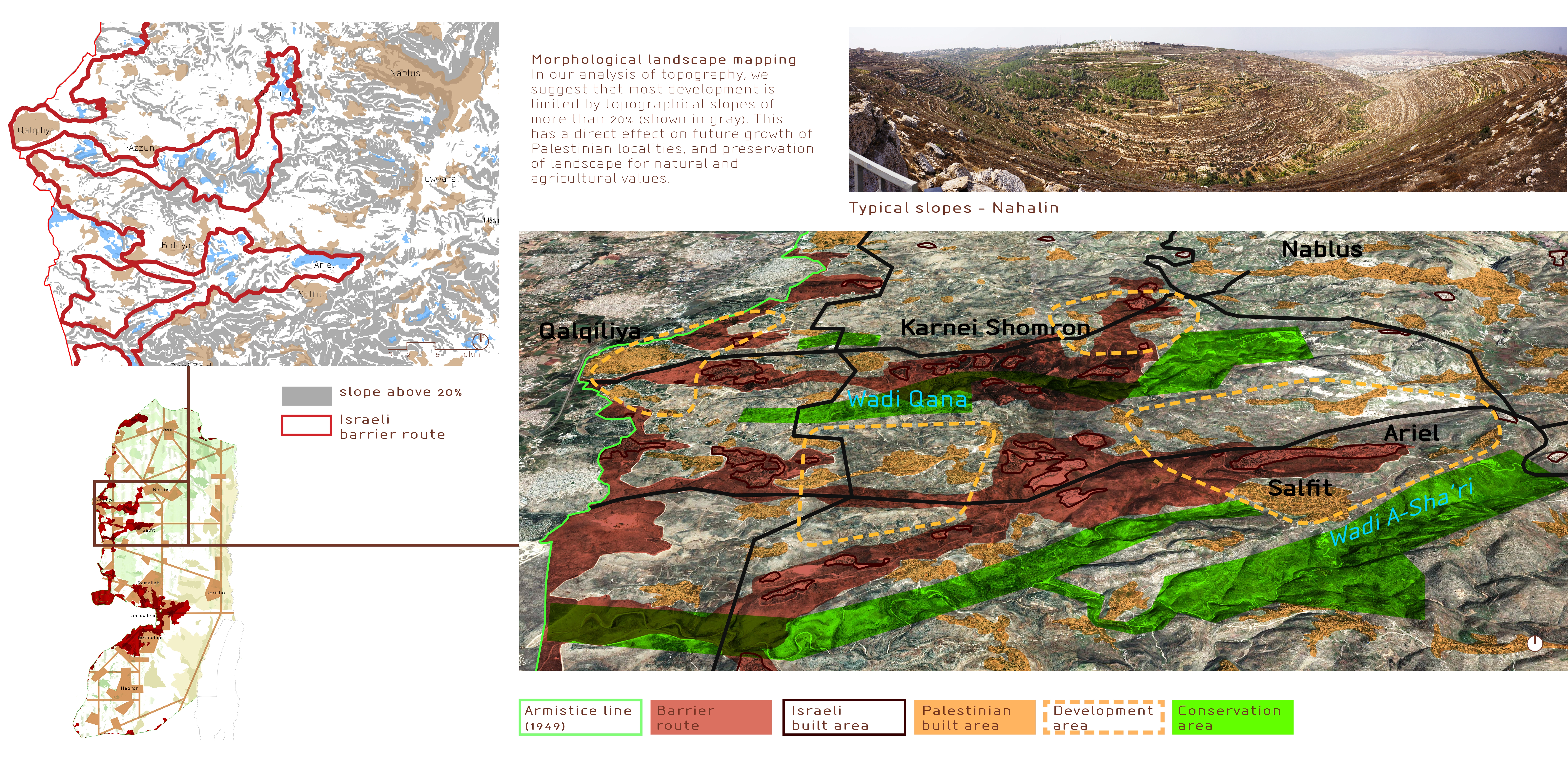
The research delineates a methodology of regional landscape, which is integral to complex urban-rural areas such as the West Bank, and is relevant to their planning in general - a critical issue today. The work broadens the scope and responsibility for landscape architects. Landscape is central to the act of settlement. Now, the complete, expansive settlement of the earth is a major cause for conditions of political injustice, economic inequality, and environmental crisis. Therefore "leaving the landscape" should be planned just as much as building it. -
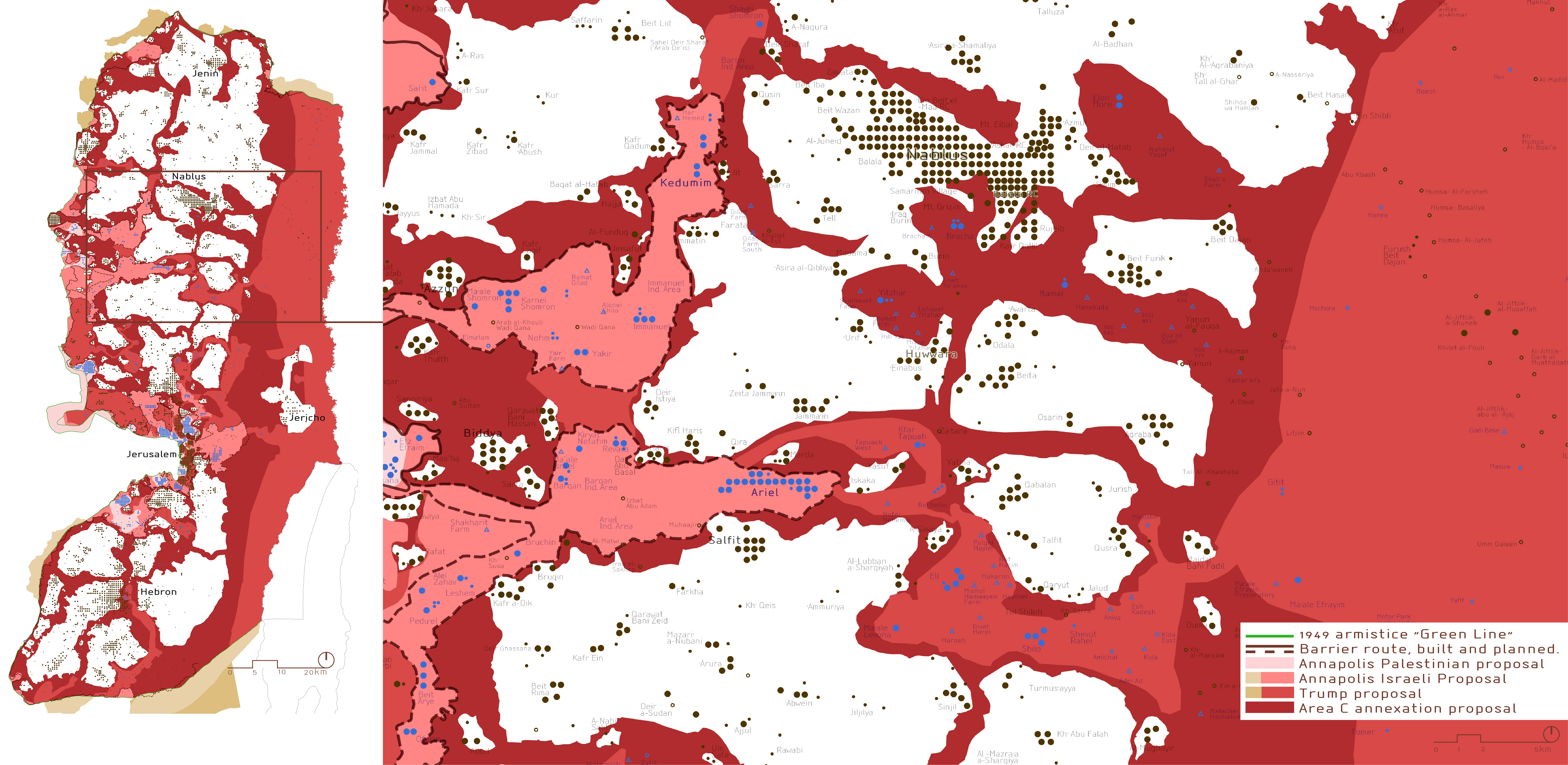
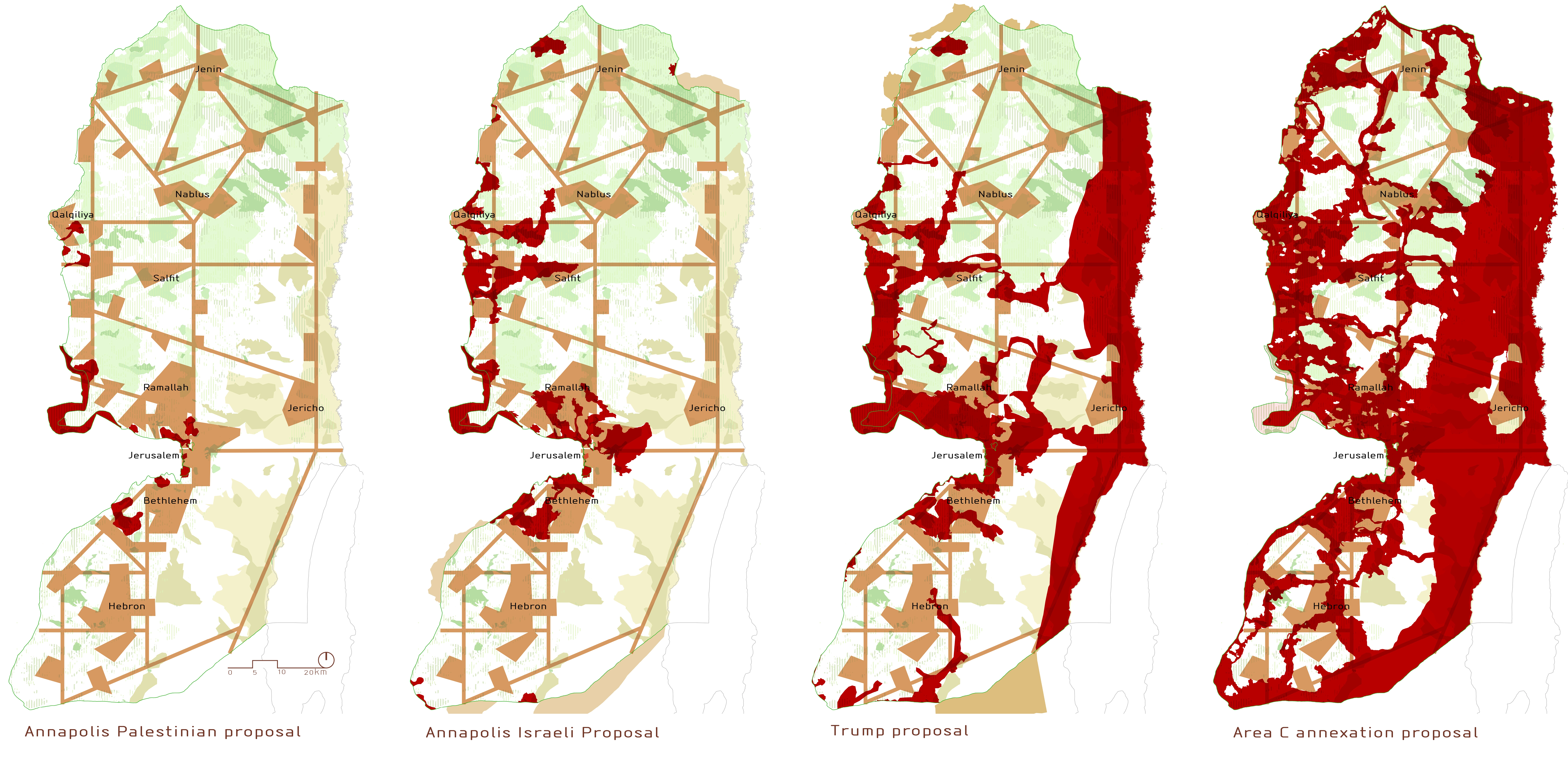
Landscape is at the heart of our current global challenges - mainly political and economic inequalities, inextricably coupled with the environmental crisis. Landscape architects must address these issues with clear, universal political-economic principles. "Landscape of an Agreement" presents such an approach, as part of a larger research work on the planning aspects of the Palestinian-Israeli conflict in the West Bank. With every year since its commencement in 2015, the on-going project becomes more and more relevant - and now with the White House recent peace plan, Mr. Netanyahu proposal for annexation of the Jordan Valley; and on the liberal side, talks of a one-state solution. We believe that a just peace is only possible with an agreed division of the land.
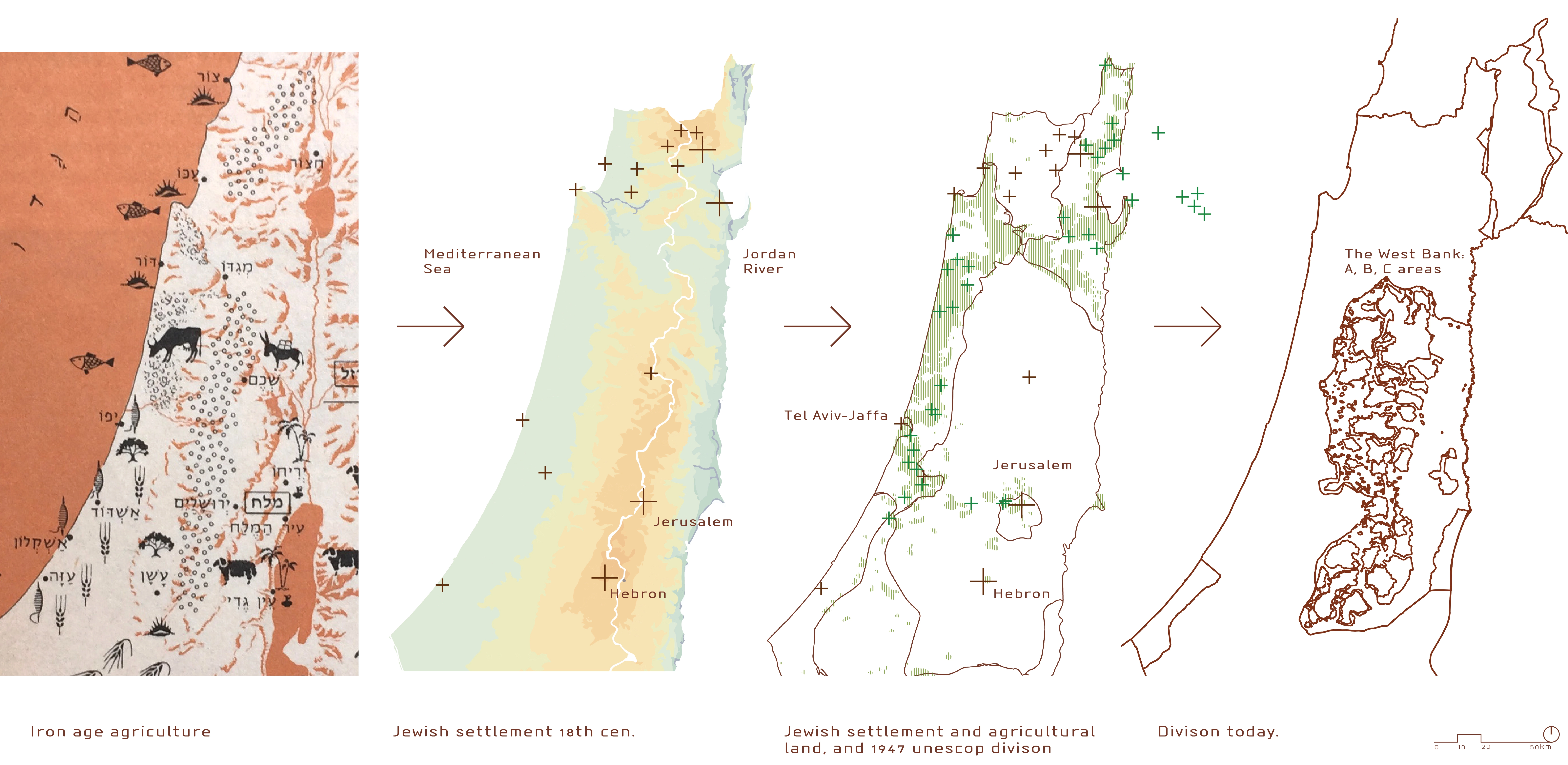
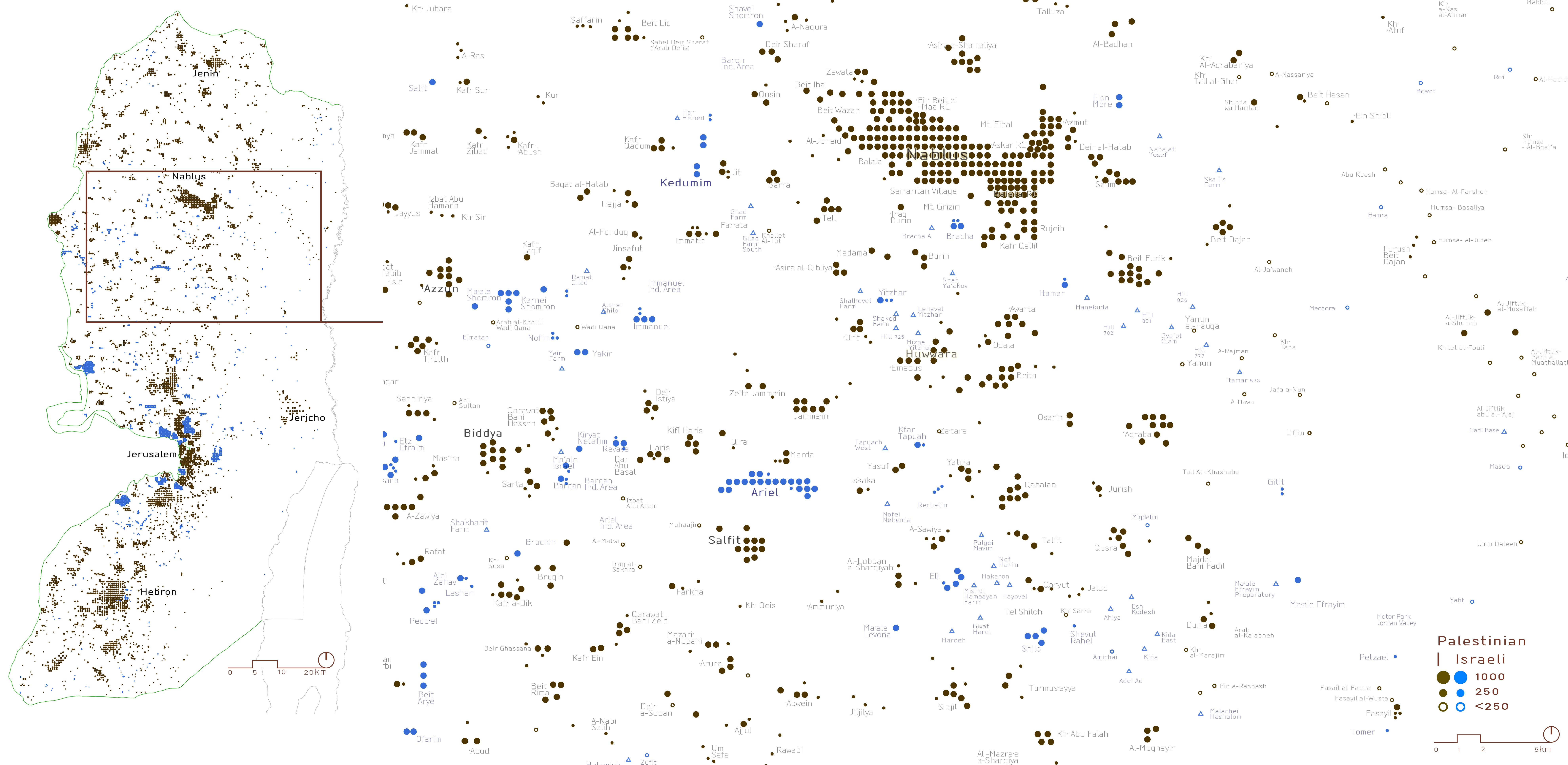
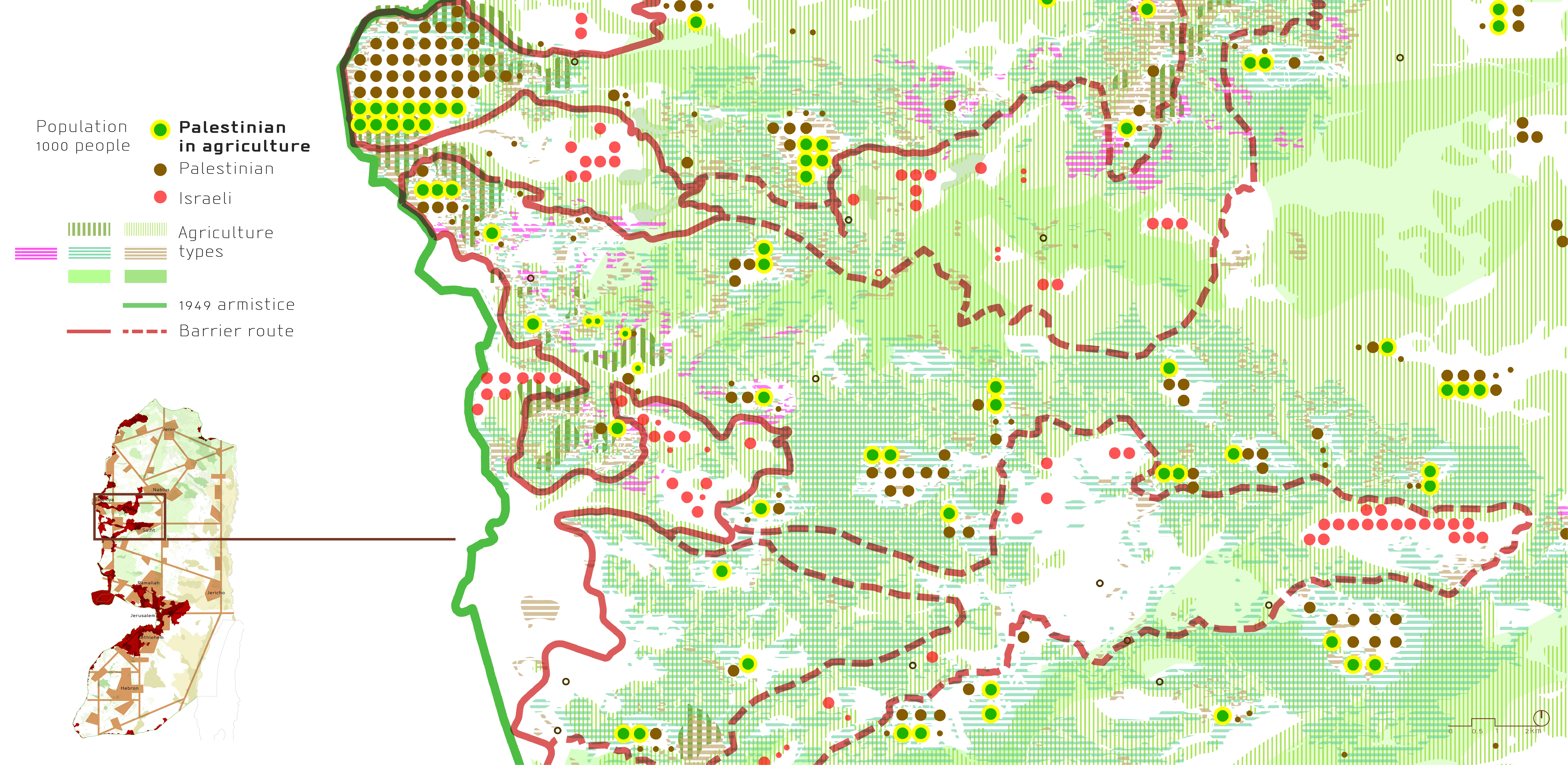
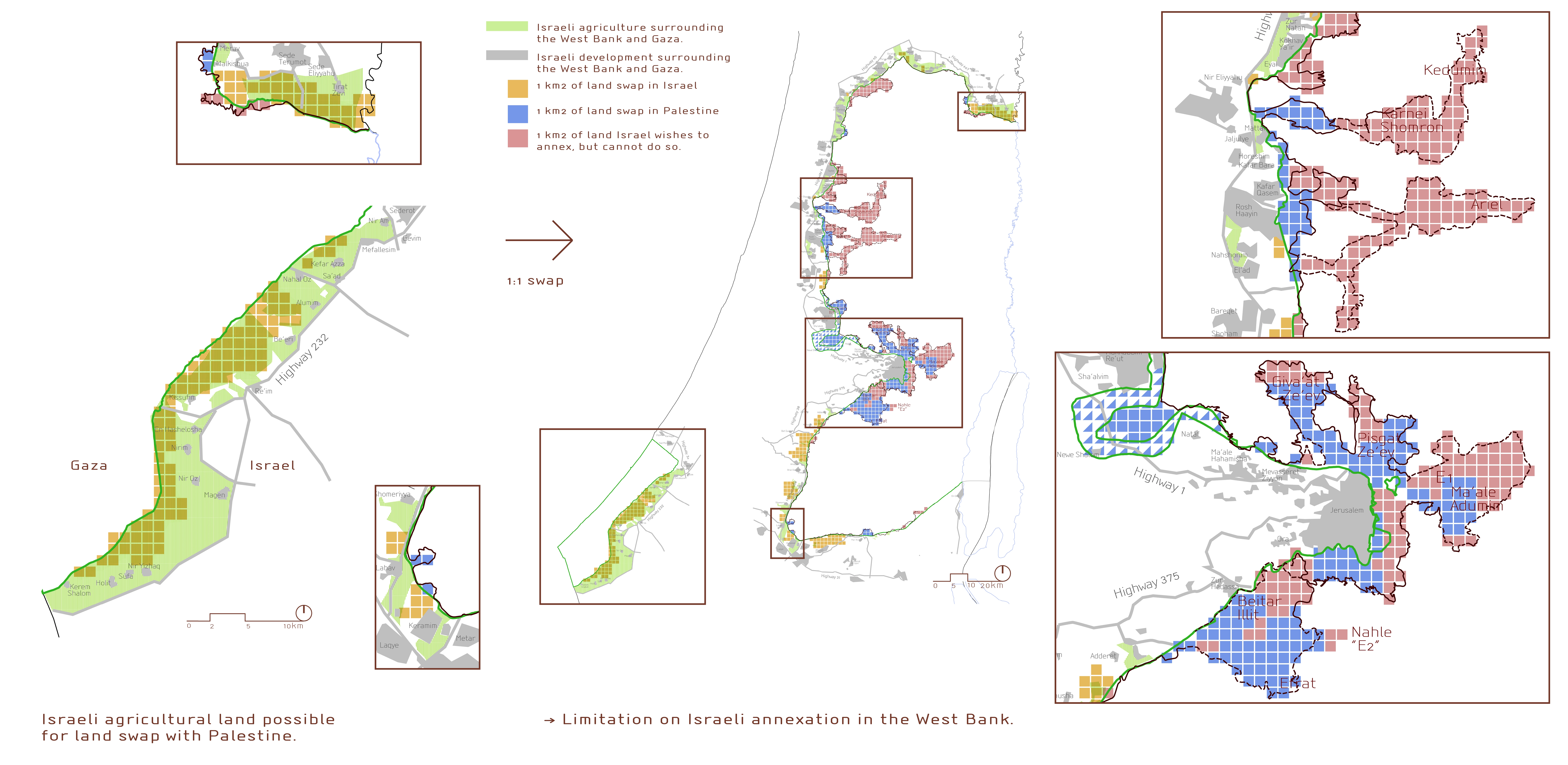
The conflict over the West Bank is a conflict for the mountain, between the Jordan valley and the coastal plain. It is a conflict for myth and land – landscape. The research is based on an historical study, analysing the movement and settlement of populations between the landscapes of the mountain and the plain, and the territorial expansion based distinctly on agricultural open spaces - "The line of the furrow will determine the line of the border". We are also constantly mapping the present distribution and densities of the two populations, and study how they are affected by historical and current border proposals.
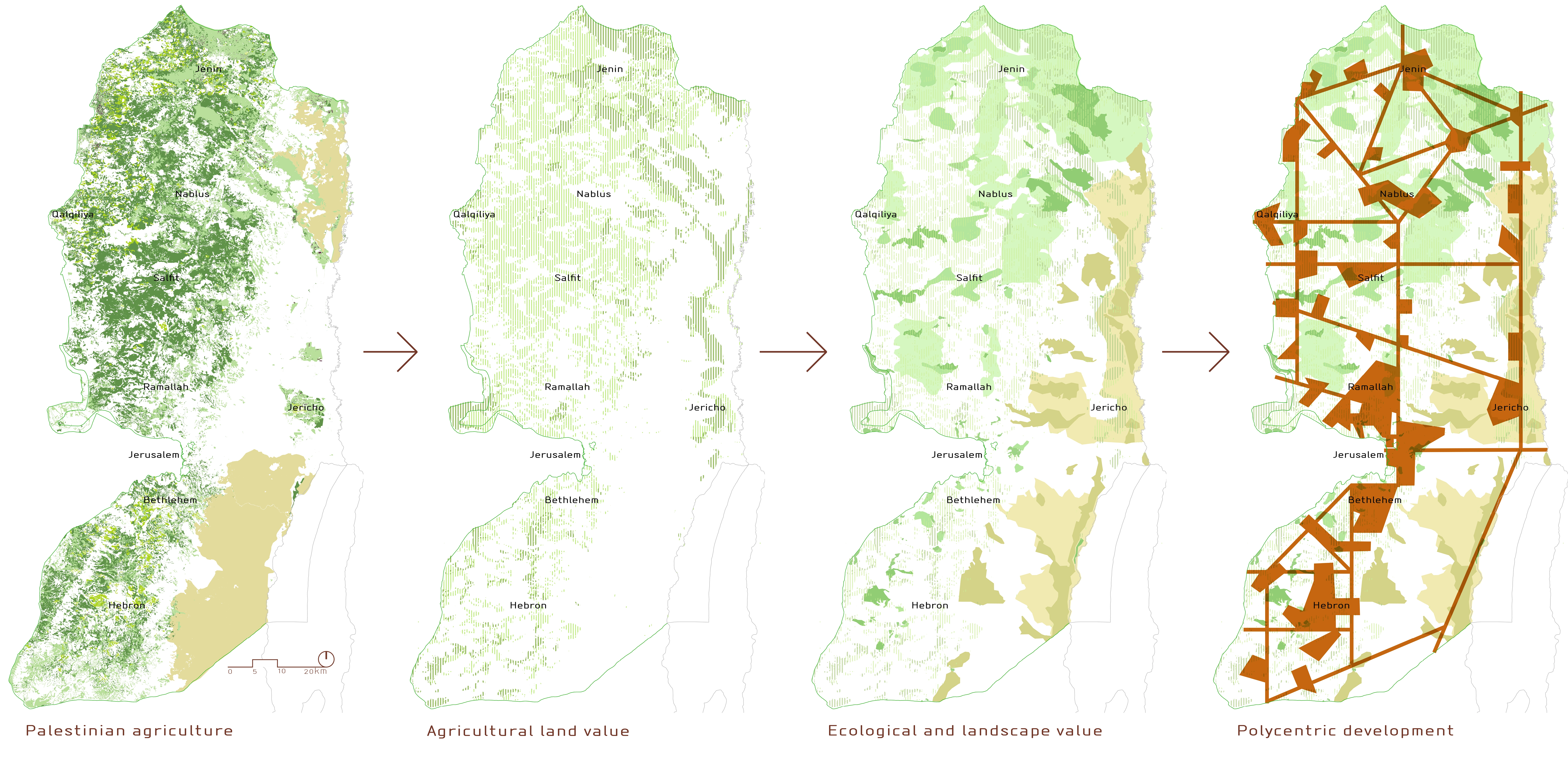
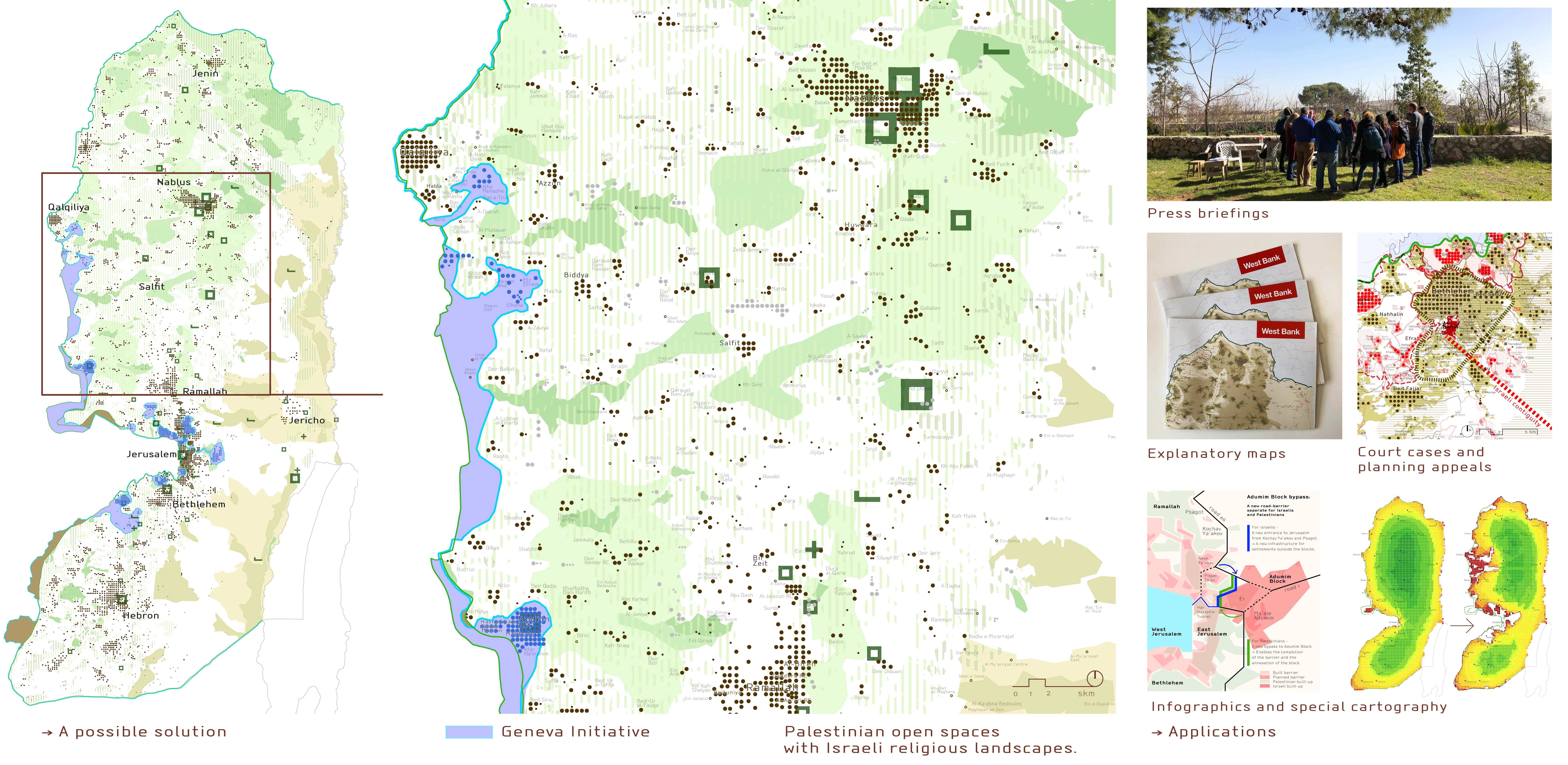
A clear sovereign, sustainable, open space is a requisite and an expression of the Palestinians' right to national self-determination. We study the relationships between Palestinian regional landscape and equitable development on a national level, and on a local level of "rural urbanism" and "integrative urbanism" comprising towns, suburbs, villages, open spaces and infrastructure.
The characteristics of the landscape ultimately determine the characteristics of the society - continuity and proximity, size and width, distribution and variety, components of heritage, agriculture, ecology – all affect social and economic relations, access to education, employment and other spatial opportunities, which in turn affect culture, community, and so on. The regional landscape is an integral part of the sovereign, broad, continuous territories required for a long-term growth of a viable Palestinian state. Any border proposals should take this into consideration.
From settlements without landscape to settlement by landscape
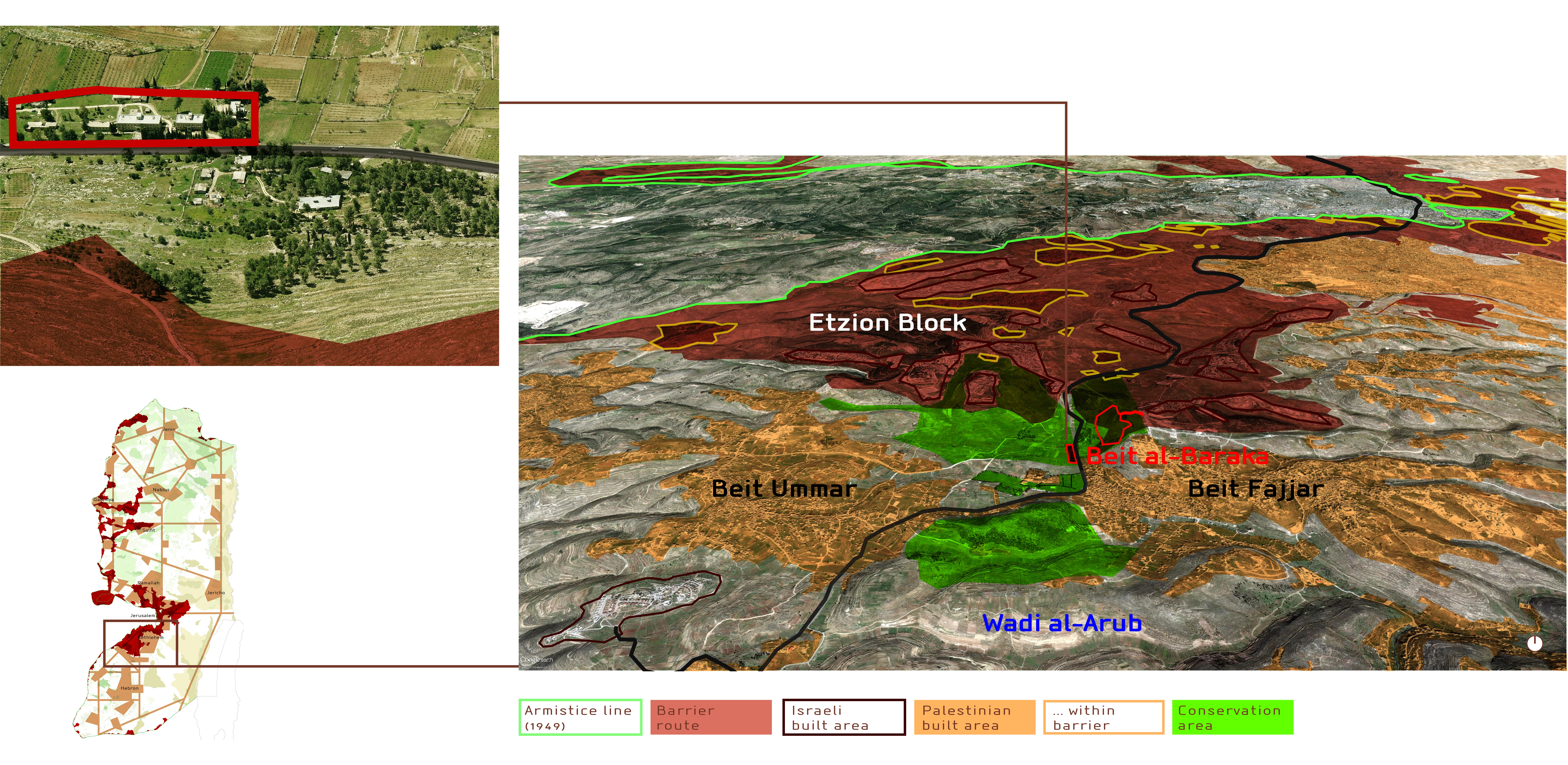
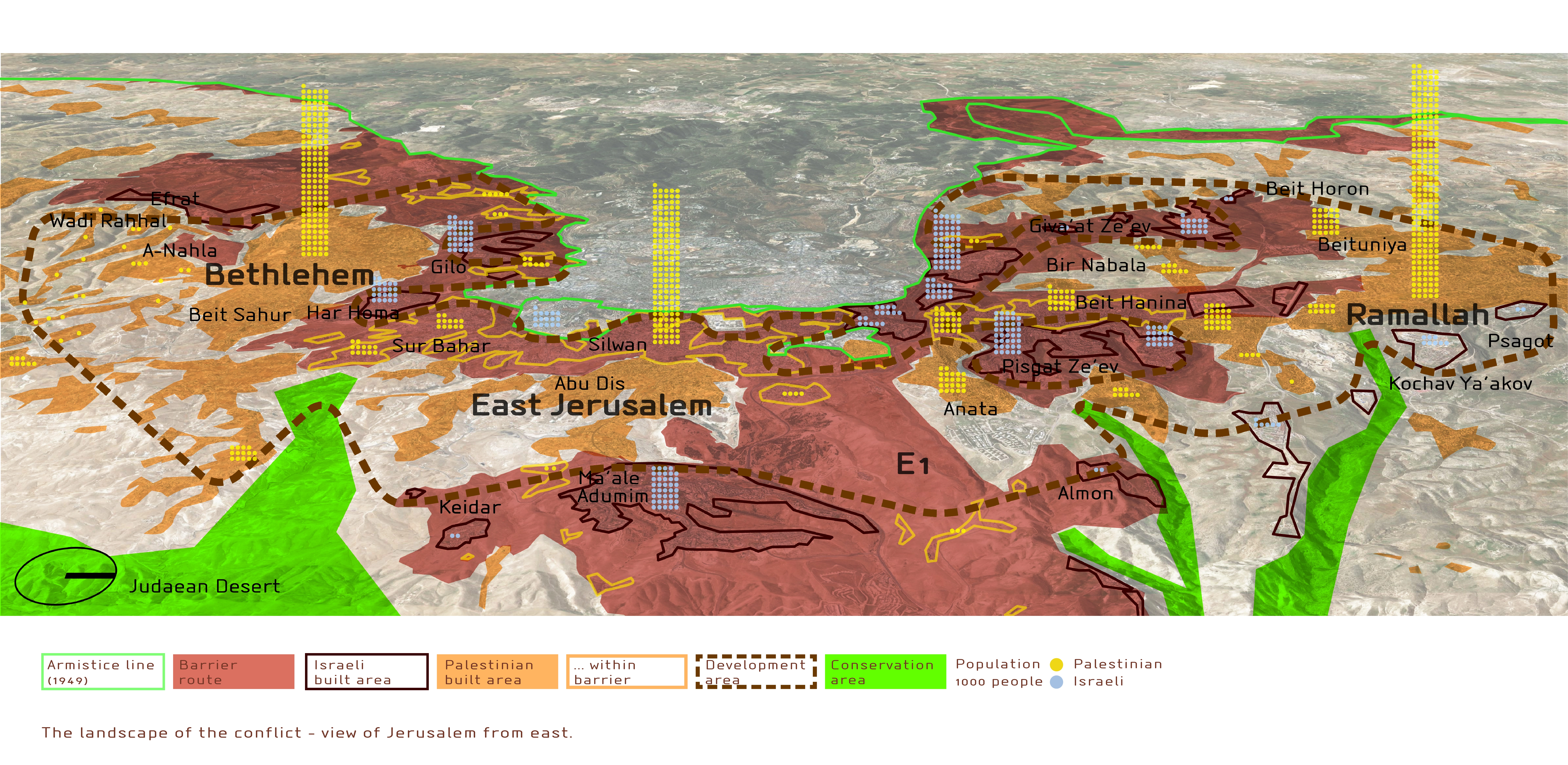
Historically, the borders proposed by Israel leave annexed Jewish settlements isolated from their surroundings. Living in sleeping-suburbs, residents would be enclosed within a wall, and unable to simply take a walk out in the surrounding landscape. The settlements could therefore exist anywhere within the original borders of Israel.
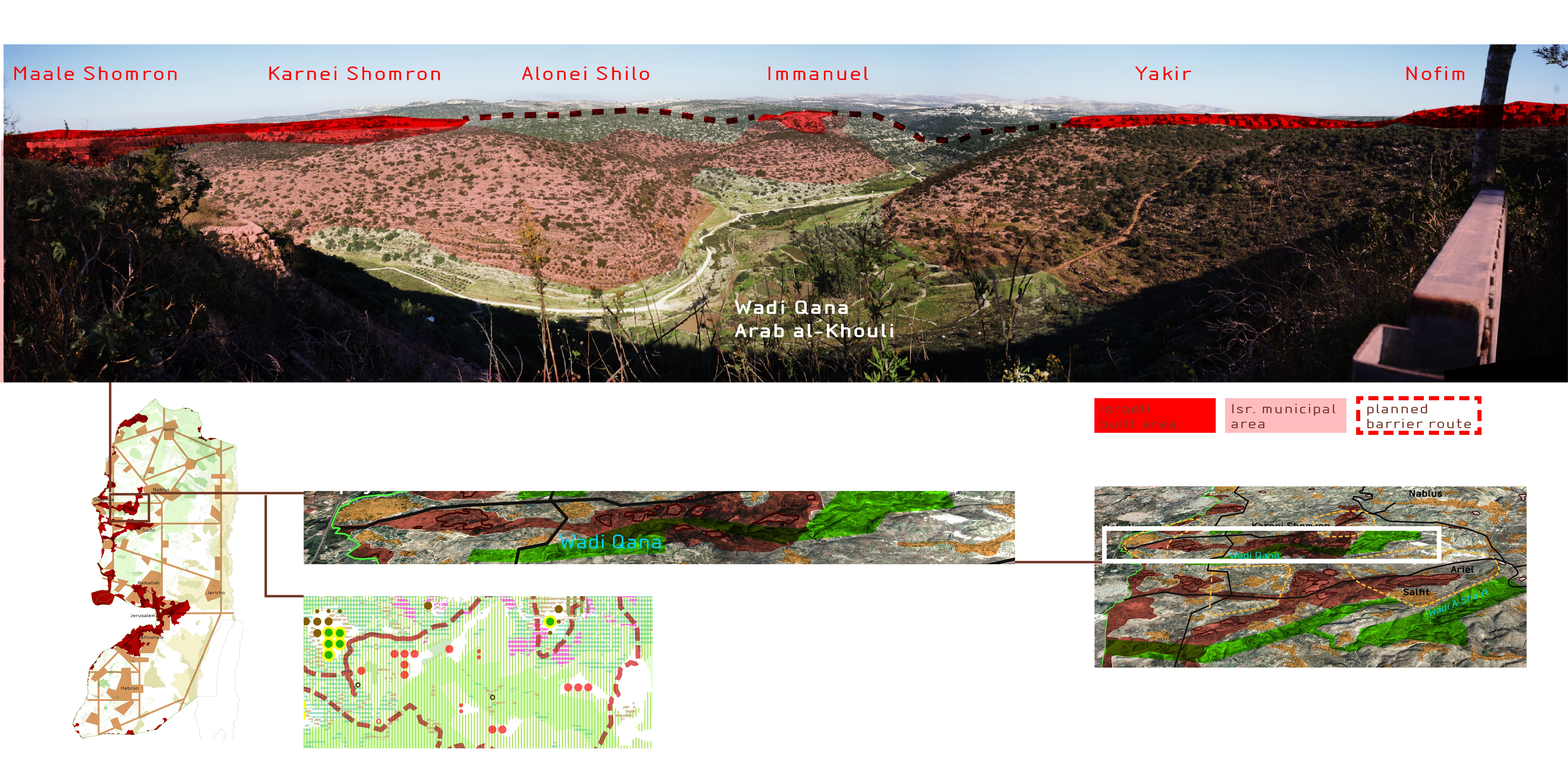
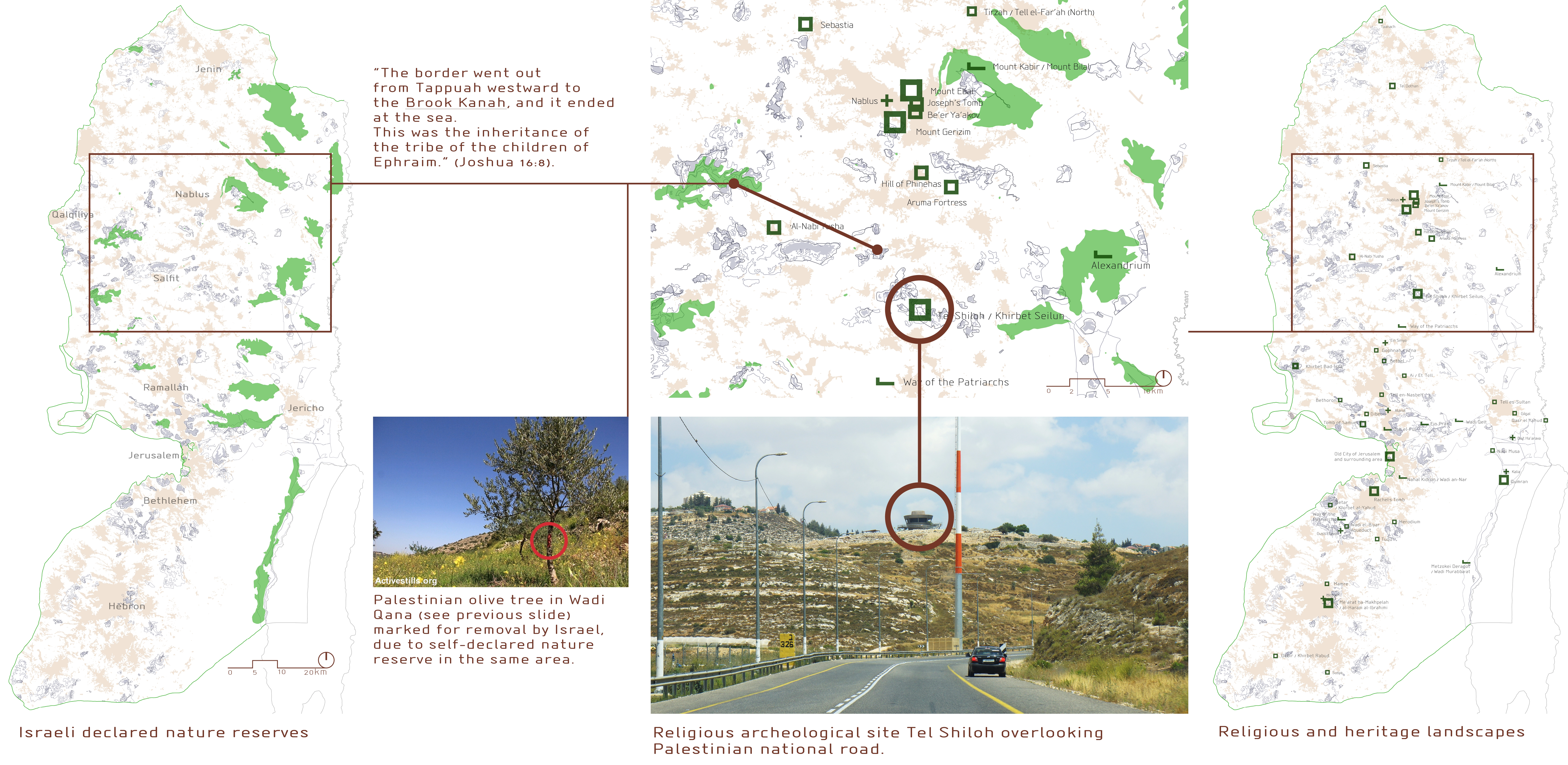
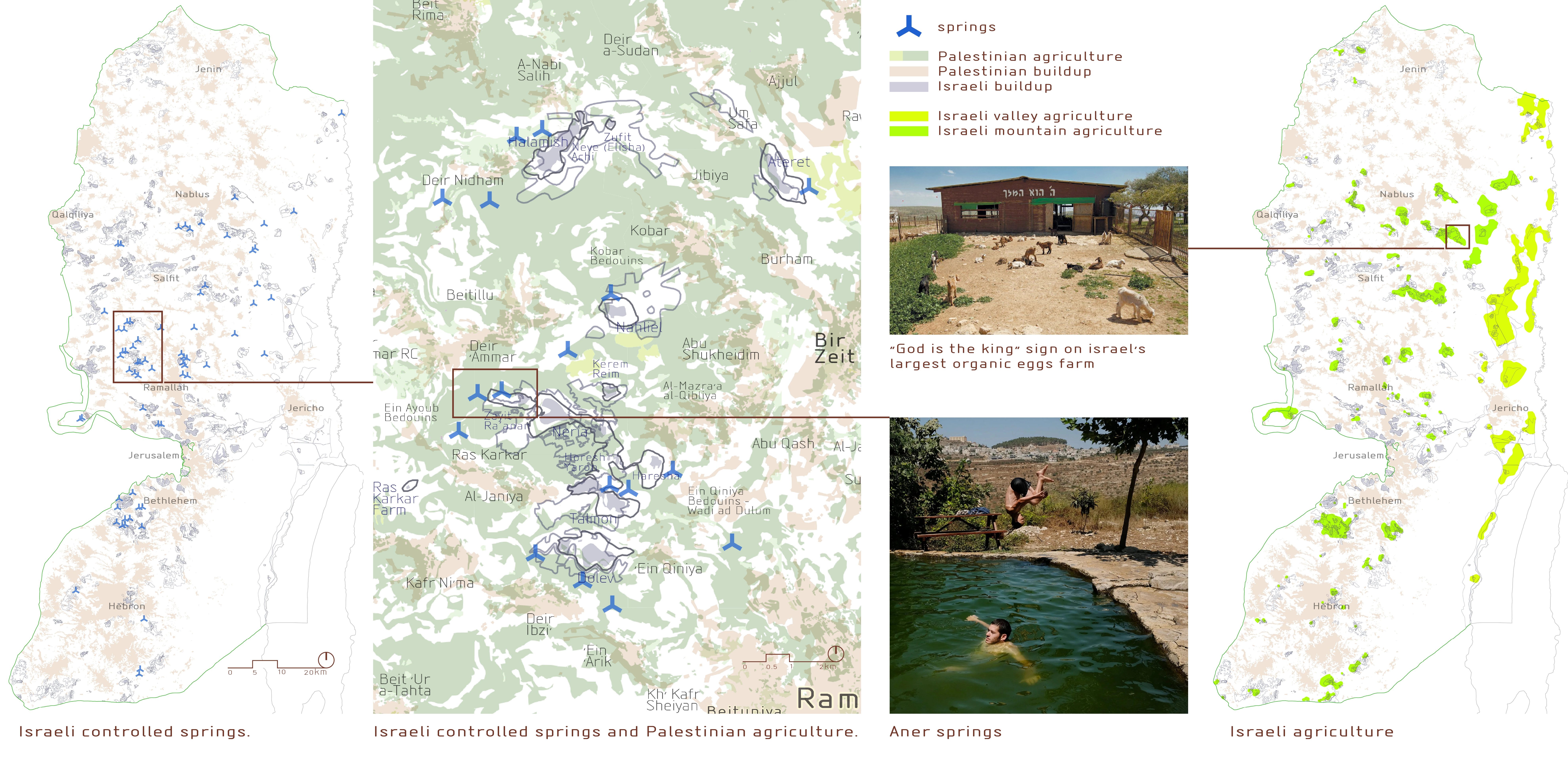
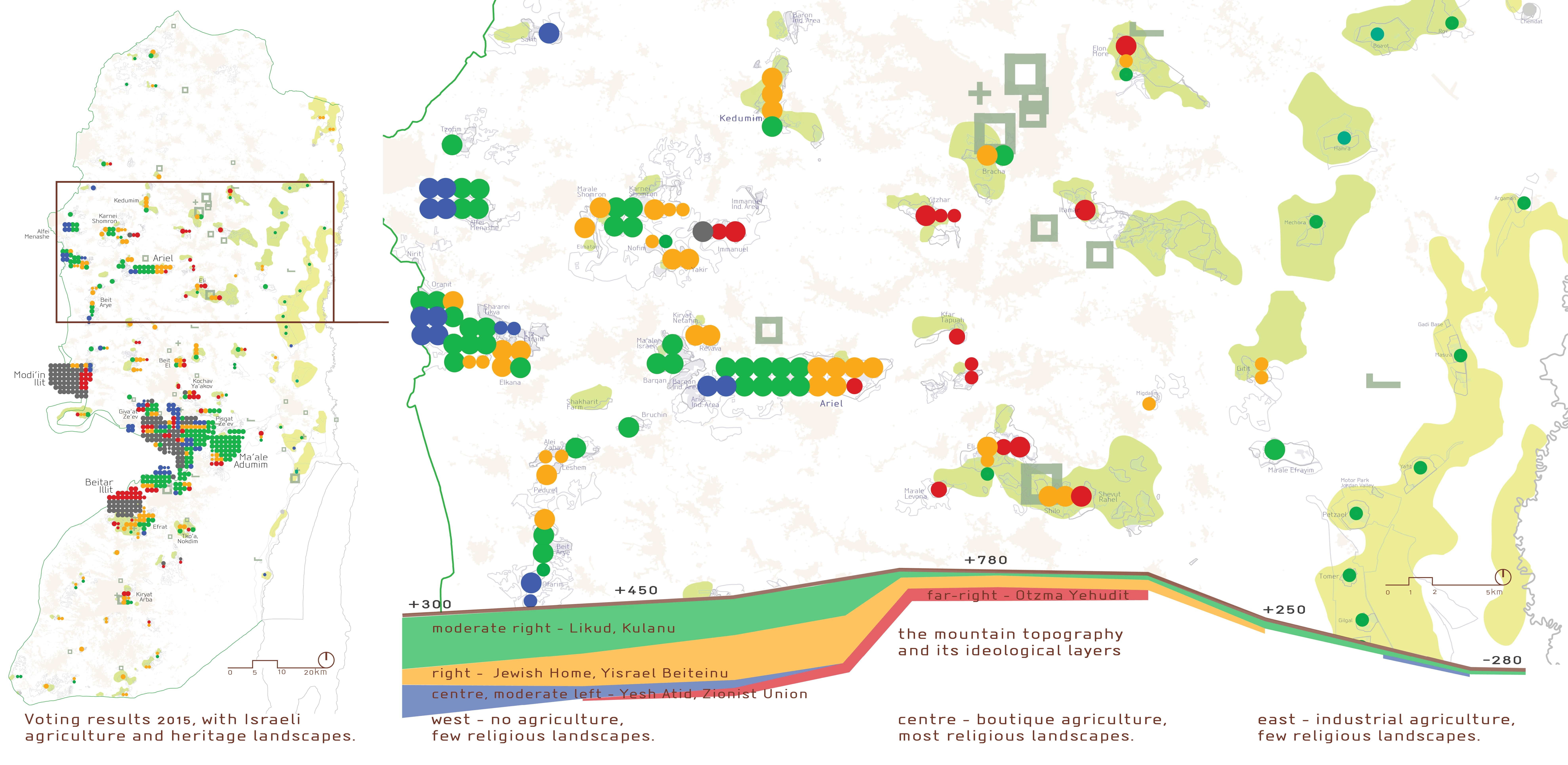
In contrast, with an aim to consolidate wide geopolitical continuities, keeping Palestinian localities, rather than Israeli, as the "islands", Israel implements a settlement by landscape. It emphasises religious, spiritual, heritage values. The Israeli 20th century Zionist agriculture of the plain was that of the Green Revolution - large-scale, industrial agricultural landscape in which Israel was always at the forefront. This is also true also to the secular, ideologically moderate, intensive farms in the Jordan valley. However, the recent agriculture of the mountain settlements emphasises "terroir", traditional, religious characteristics. For example – Gva’ot Olam – one of the most extremist outposts in the West Bank – is also the largest organic egg farm in Israel. It sells most of its produce to left-leaning liberals in Tel Aviv. This is not a coincidence. The liberal “back to the soil” is intertwined with the same attitude in the far right.
Most of Israel's religious and heritage landscape is located along the mountain ridge, away from the territories for annexation. We suggest that instead of annexing settlements with almost no heritage value, Israel should propose arrangements that preserve access to sites and landscapes that the Jewish people have an actual affinity with - similar to arrangements other religions have with Israel within its 1949 borders.
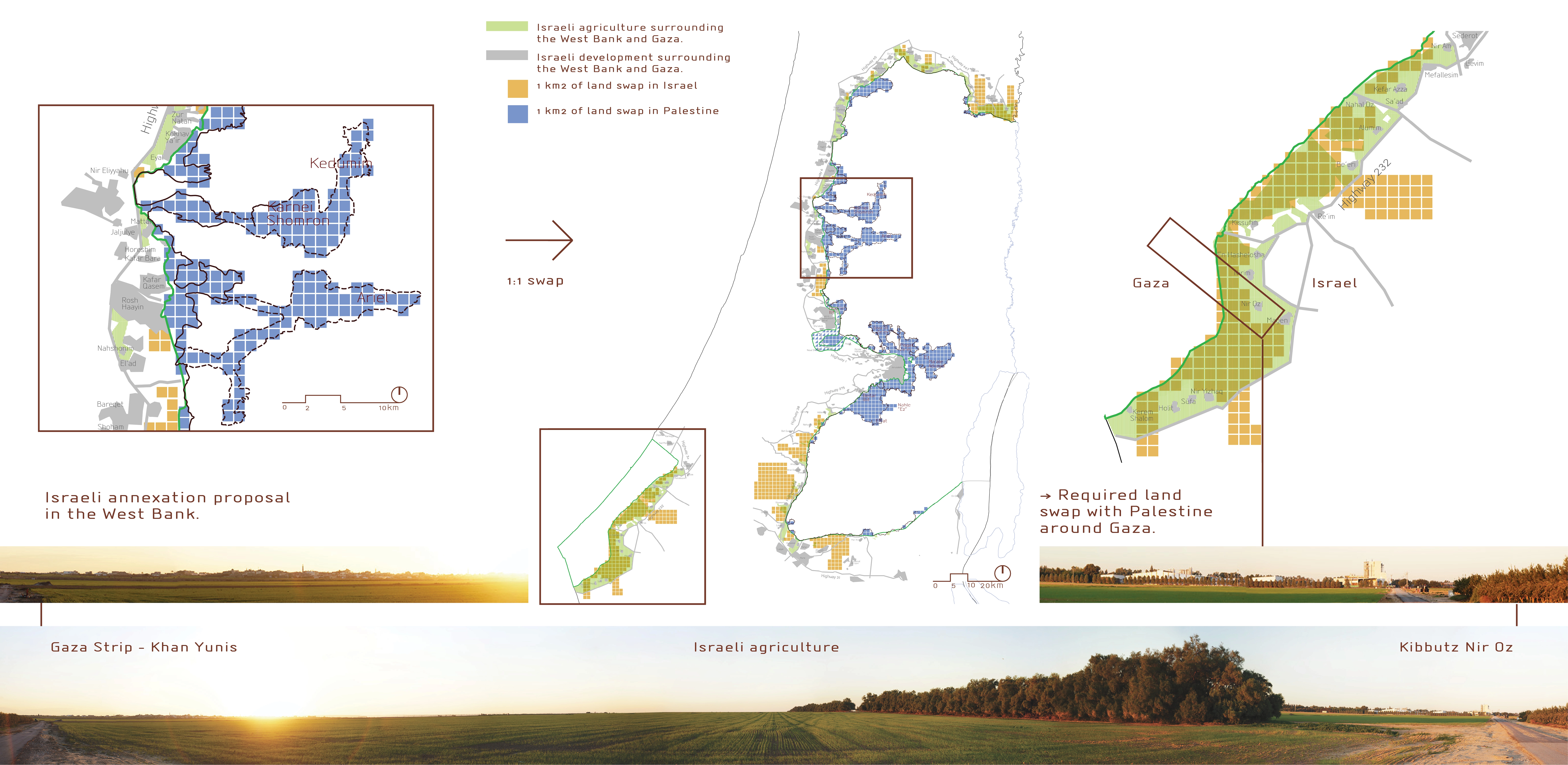
This analysis is complemented by effects of landscape on the possibilities for "land swaps" between Palestine and Israel. The three studies then converge to form territorial scenarios for a possible agreement. We thus see how a research and planning of landscape directly affects geopolitical possibilities, and the character of communities, such as the number of settler population Israel will need to evacuate.
Data, methodology, presentation and implementation in practice
The research combines unique inter-disciplinary data, some of it made publicly accessible for the first time, especially at this level of detail. In addition, important layers of data have been assembled specifically for this project. For example, all Palestinian localities were re-mapped. It involved a tailor-made re-definition of aggregation and delineation functions of buildup areas, due the integrative rural-urban characteristics of the region. The gradual change of density from city-centre to small farms and Bedouin camps, required decisions on the delineation of edges and continuities of buildup polygons. This is extremely controversial because each side of the conflict wishes to show as much spatial continuity as possible. The research and data collection combined hi-res aerials analysis together with regular field trips, as the area constantly changes. Many developments are "under the radar" of public planning permits and publications. More than once our own data collection "discovered" new developments not previously known to government offices or ngos.
Cartographical presentation techniques were designed specifically for the project, to clearly and intuitively illuminate complex relationships between several layers of data. The work combines cartography, infographics and use of ground and aerial photography - inspired by the works of Heinrich Berann.
The research is constantly used in practice. Data, maps, and textual analysis and conclusions are "packaged" and presented in various forms based on different implementations -
- Reports and presentations for experts and general audience, local and international.
- Press briefings and field trips.
- Expert opinion for court cases.
- Press releases regarding specific cases.
- Explanatory maps.
The research is continually presented to and discussed by policy makers, diplomats, press members, ngos and think-tanks. Cartographical data produced for the research is also used by other organisations for various maps.
While there is still a long way ahead, we believe that "Landscape for an Agreement" provides a meaningful contribution towards a future peace agreement between Palestine and Israel.
The analysis and planning methodologies developed in this research are also applied by our studio in landscape planning projects such as a town for Bedouin communities based on public participation, formulating new spatial opportunities for a rural region on the edge of the desert, and renovating Israel's largest polluted industrial site in Haifa Bay.
"Landscape of an Agreement" also provides data and lessons for related disciplines. For example, the planning of integrative rural-urban regions, and cartography techniques - such as population distribution, and delineation of buildup continuities. It most importantly places geopolitical landscape architecture at the negotiation table of policy makers and analysts.
Beyond its direct applications, "Landscape of an Agreement" is a case study for planning towards "leaving the landscape". The settlement of the mountain had a drastic effect on Israeli culture and society. The ideologies of Zionism - universal, international, secular, humanistic, socialist, abstract - once settled in the mountain became local, nationalistic, religious, individual, capitalist, concrete. When the horizon is settled, there is no longer a view outward, towards another culture - a "barbarism of reflection", as described by Giambattista Vico. Everywhere the view has turned inward – art, politics, landscape architecture. Israel should de-settle the mountain and re-settle the plain, to lift its view from the soil back to an horizon.
The act of landscape de-settlement is critically relevant for global warming - such as leaving territories for re-wilding; and for economic pre-distribution of spatial means of productions through land equality, geopolitical resolutions and more. It requires a new episteme for landscape architecture, of change and revolution. -
Matanya Sack, shelter_expanse, Project Leader
Uri Reicher, shelter_expanse, Project Leader
Gagu Eshet, shelter_expanse
Yeela Gundar, shelter_expanse
Lior Lachman, shelter_expanse
Tamar Salinger, shelter_expanse
Dor Schreier, shelter_expanse
Shlomit Wartenburg, shelter_expanse
Michal Wolner, shelter_expanse
Adi Toren, shelter_expanse
Advertisement
Related Awards
Honor Award, Analysis & Planning
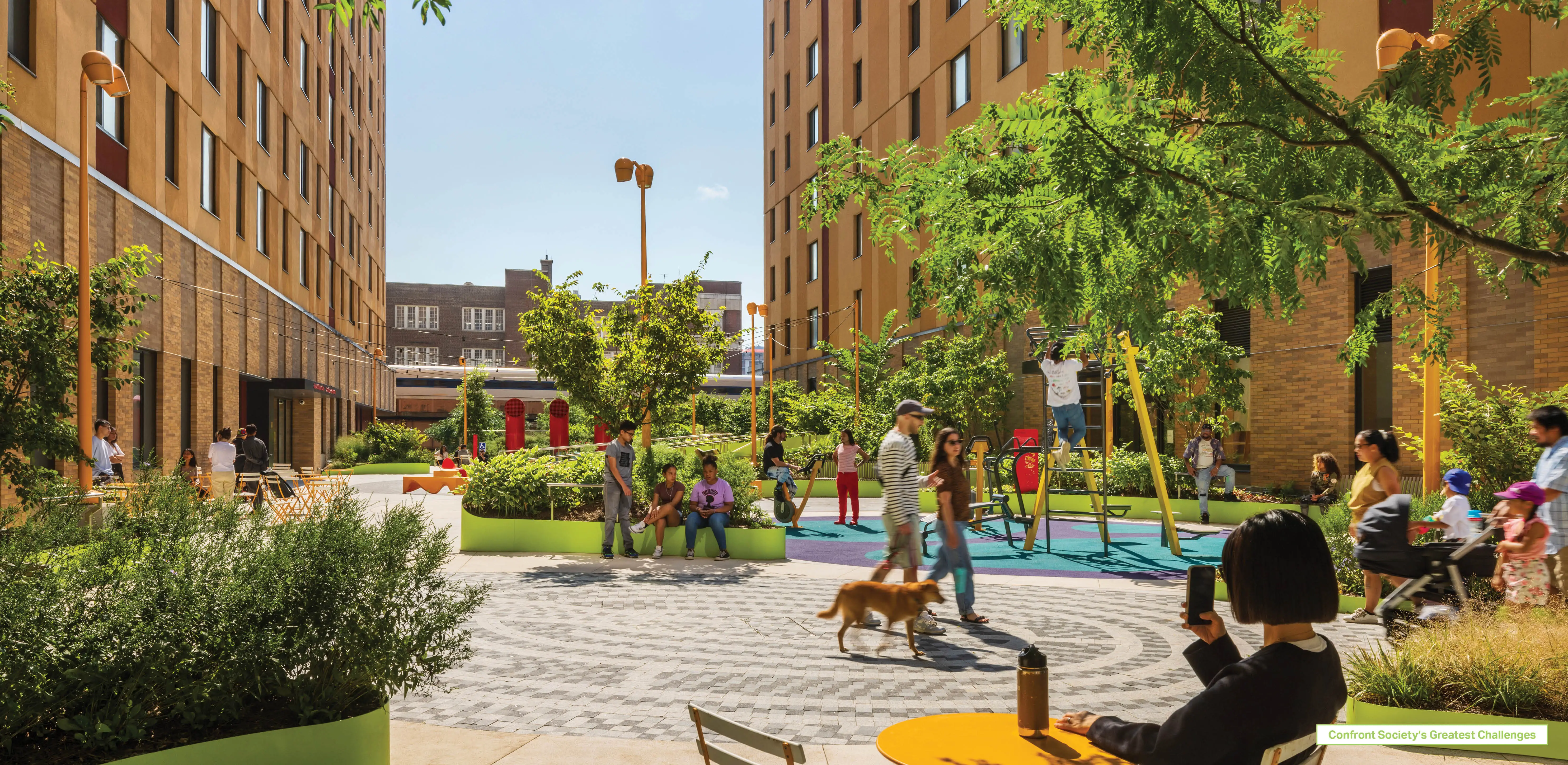
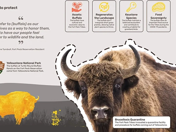
A Cultural Approach: The Fort Peck Tribes Hazard Mitigation Plan
In collaboration with the Fort Peck Assiniboine and Sioux Tribes, EPA, and FEMA, the Fort Peck Tribes Hazard Mitigation Plan (HMP) adopts a culturally responsive approach to hazard mitigation planning that features connection to place.