Willamette Falls Riverwalk
HONOR AWARD
Analysis and Planning
Oregon City, OR, USA | Snøhetta, Mayer/Reed, and DIALOG | Project Partners: Oregon Metro, City of Oregon City; Clackamas County; State of Oregon; PGE Falls Legacy, LLC
Here we see the combining of public access, habitat, historic and cultural interpretation, and economic development in a project that’s very tangible in terms of its potential to being implemented.
- 2018 Awards Jury
PROJECT CREDITS
- Snøhetta, Lead Landscape Architect and Architect
- Mayer/Reed, Landscape Architect
- DIALOG, Urban Designer
Additional Project Credits
- Michelle Delk, Snøhetta, ASLA, Partner, Role: Landscape Architect
- Matthew McMahon, Snøhetta, ASLA, Role: Project Manager
- Carol Mayer-Reed, Mayer/Reed, FASLA, Principal, Role: Local Landscape Architect
- Alan Boniface, DIALOG, AIBC, AAA, MRAIC, AIA, Principal, Architect Role: Architect
- Jessica Pickul, JLA Public Involvement, Program Manager Role: Public Engagement Consultant
- Craig Totten, KPFF, PE, SE Principal, Structural Engineer Role: Structural Engineering
- Paul Dedyo, KPFF, PE, LEED AP, Civil EngineerRole: Civil Engineering
- Andy Jansky, Flowing Solutions, P.E., M.S. Principal Role: Water Restoration Consultant
- Kevin Chewuk, DKS Associates, Transportation Planner Role: Transportation Planning
- Alan Bean, PE, GE, NW Geotech, Senior Project Geotechnical Engineer Role: Geotechnical Engineering
- Trish Drew, DCW Cost Management, Managing Director Role: Cost Estimator
- Alex Gilbertson, Metro, Project Manager, Senior Parks Planner Role: Client
- Brian Moore, Metro, Project Manager Role: Client
- John Southgate, Clackamas County, Economic Development Project Manager Role: Client
- Laura Terway, City of Oregon City, Community Development Director Role: Client
- MG Devereux, Deputy Director, Oregon State Parks Role: Client
- Mini Sharma-Ogle, Portland General Electric, Archaeologist/Willamette Falls FERC License Manager Role: Partners Group
- George Heidgerken, Falls Legacy LLC, Manager Role: Owner
PROJECT STATEMENT
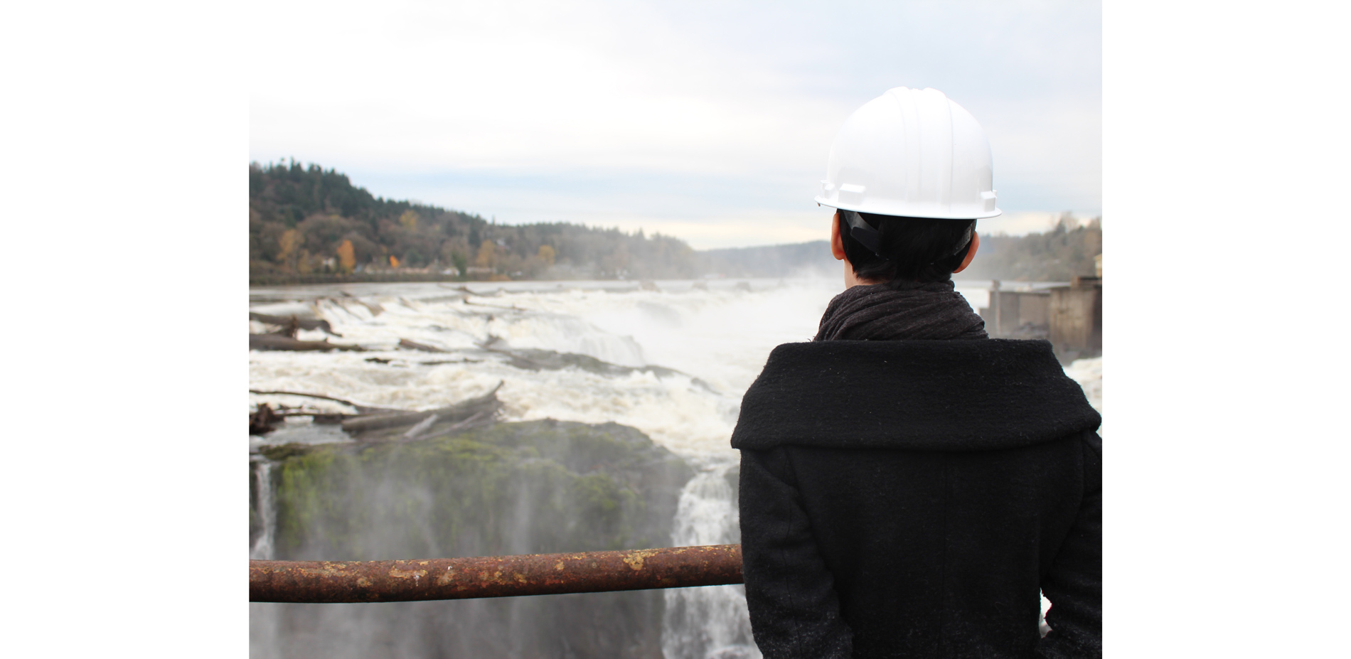
Willamette Falls is the second largest waterfall by volume in the country. For over a century, the breathtaking site has been cut off from public access by industrial infrastructure built along the water's edge. Upon closure of the Blue Heron Paper mill in 2012, city and state agencies came together as the Willamette Falls Legacy Project to secure public access to the Falls. A new riverwalk and its sequence of public spaces will allow visitors to rediscover the full height of the Falls and its rugged shoreline, uncovering swaths of the 22-acre site's basalt topography and reconnecting Oregon City to its spectacular waterfront. Grounded in four core values, the analysis, planning, and resulting design of the project targets Public Access, Healthy Habitat, Economic Redevelopment, and Historic and Cultural Interpretation. The riverwalk will serve as a portal to the Northwest's history, reviving its aggregated layers of natural, ecological, cultural, and geological history. The reimagining of Willamette Falls in its fullest depth in nature, culture, and time, opens a new chapter in the life of the site.
PROJECT NARRATIVE
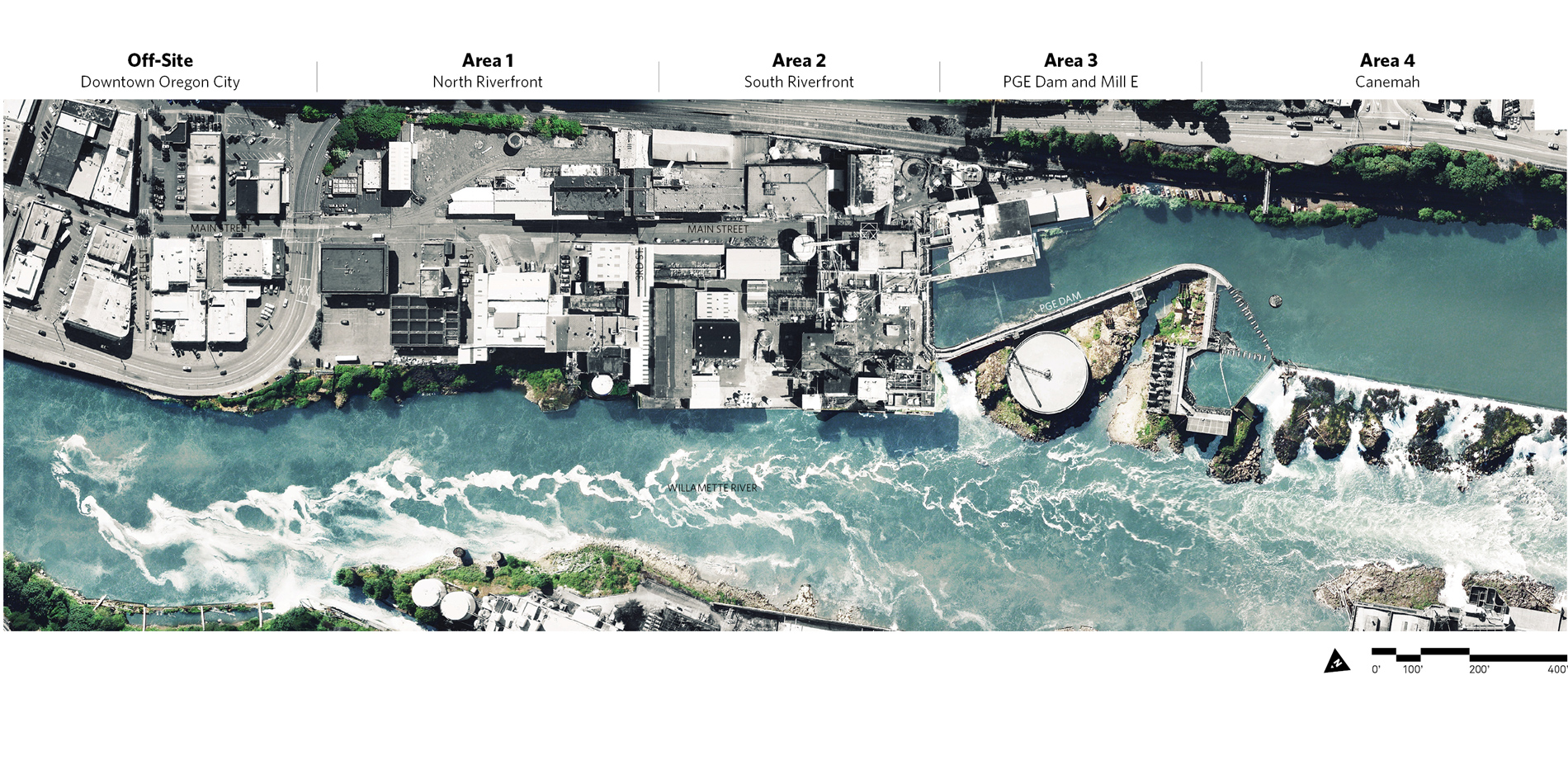
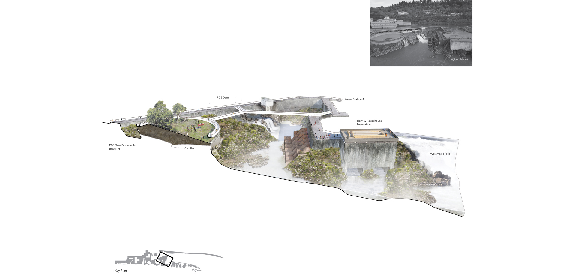
The Willamette Falls Legacy Project site in Oregon City contains more than 50 industrial buildings, various degraded natural habitat areas, and is partially within the Willamette River floodplain. At the southern end of the project site, and on Willamette Falls itself, is a dam owned and operated by Portland General Electric (PGE). The site presents many opportunities and challenges. Opportunities for the riverwalk include strong ties to Native American tribes and culture, a site rich with the history of the Oregon Territory, the industrial west and power generation, and a fully operational dam walkway that can draw visitors close to the Falls to feel the mist and hear the roar of the water. Challenges for site development include hazardous building materials, flooding risks, state and federal protection of fish and wildlife species and dam operations.
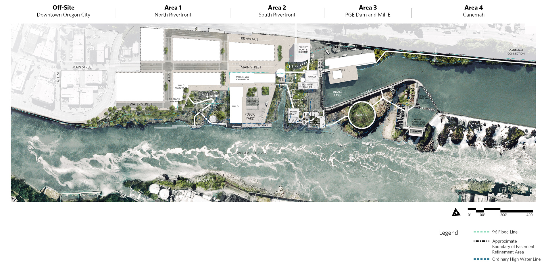
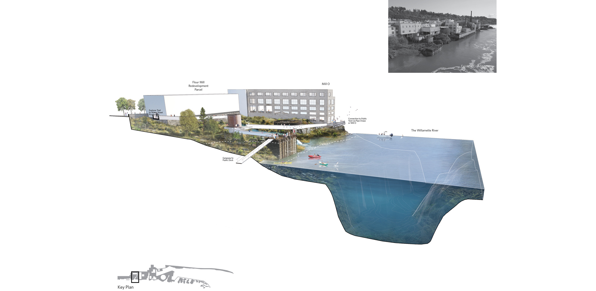
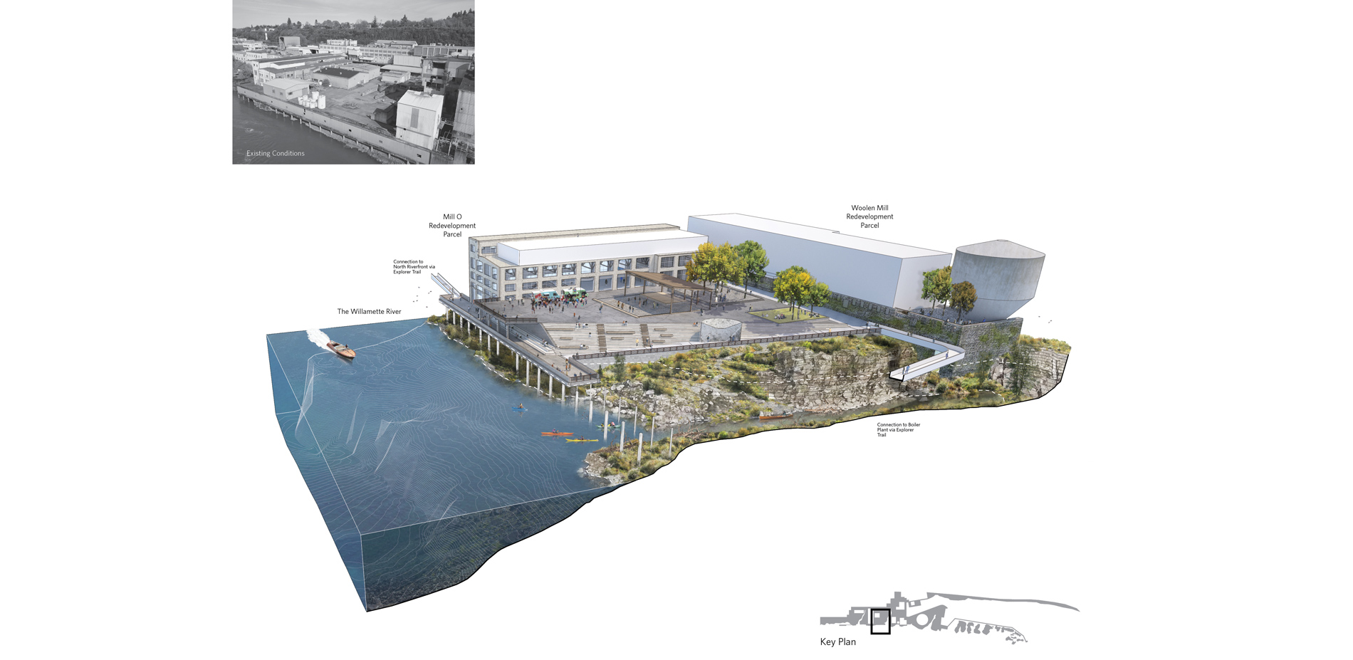
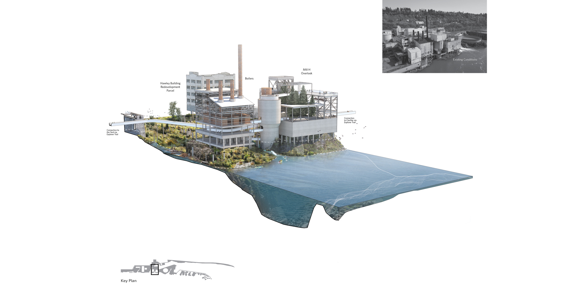
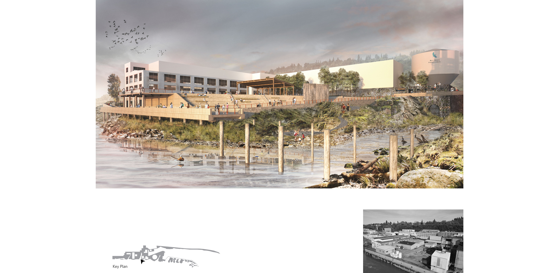
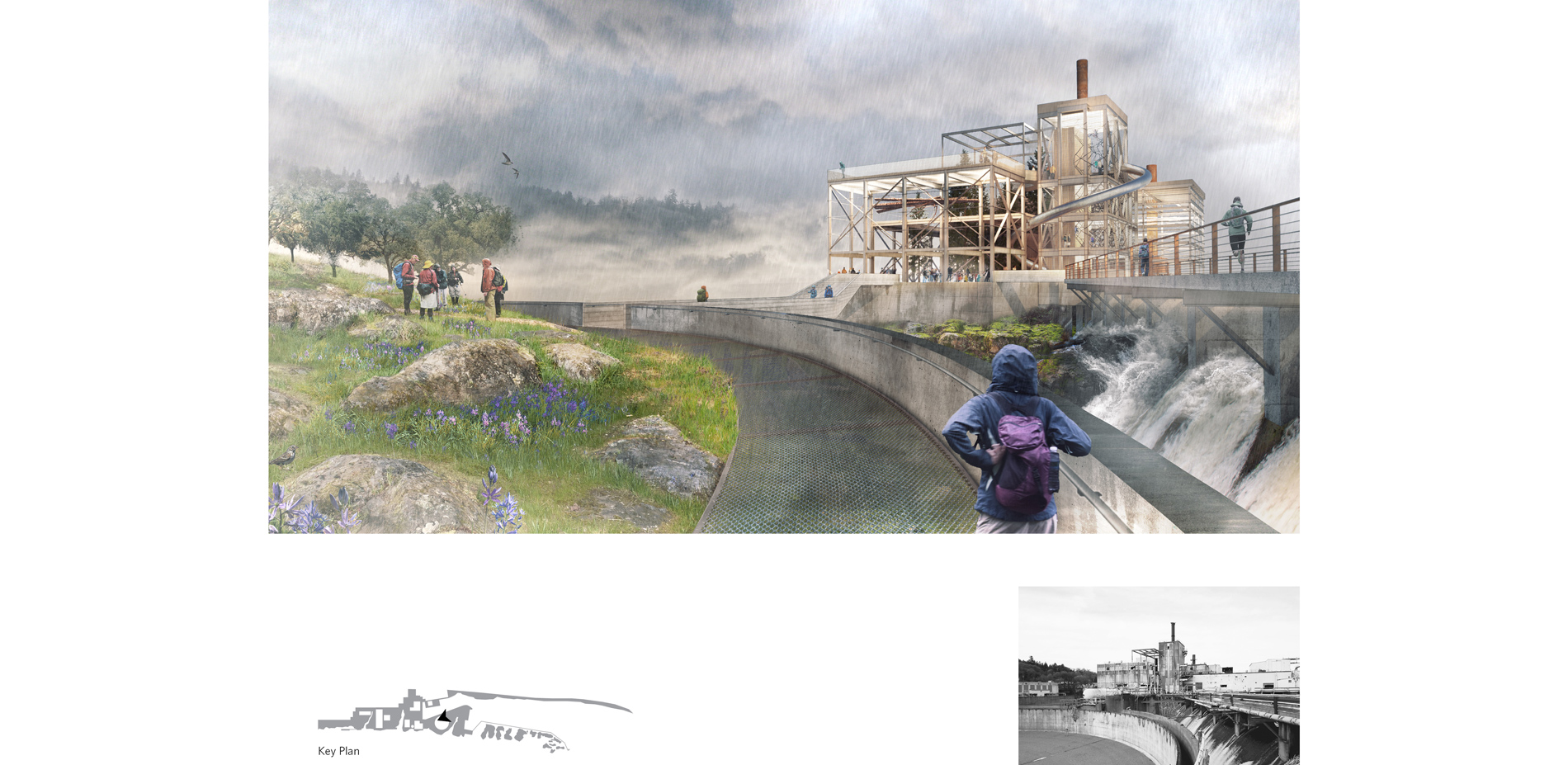
Beginning at the entrance to Oregon City's historic downtown and ending at the crest of the Falls themselves, the proposed Willamette Falls riverwalk is conceived as a sequence of islands, an archipelago carved from ancient basalt and industrial steel, concrete, and wood alike. The new design treats the whole site as a single landscape, with a network of promenades and lofted pathways that lace through the physical strata of the site. Since its earliest phases, when the Partners Group–comprised of Oregon City, Clackamas County, Metro and the State of Oregon–first came together in 2012 to bring back access to the Falls, the project has been guided by four core values. As grounding pillars that laid the foundation for the design, these four core values have been used as a framework for all decisions in the analysis and planning of the project, and will continue to guide future decisions as the project is implemented:
Public Access, Healthy Habitat, Historic and Cultural Interpretation, and Economic Redevelopment.
Public Access
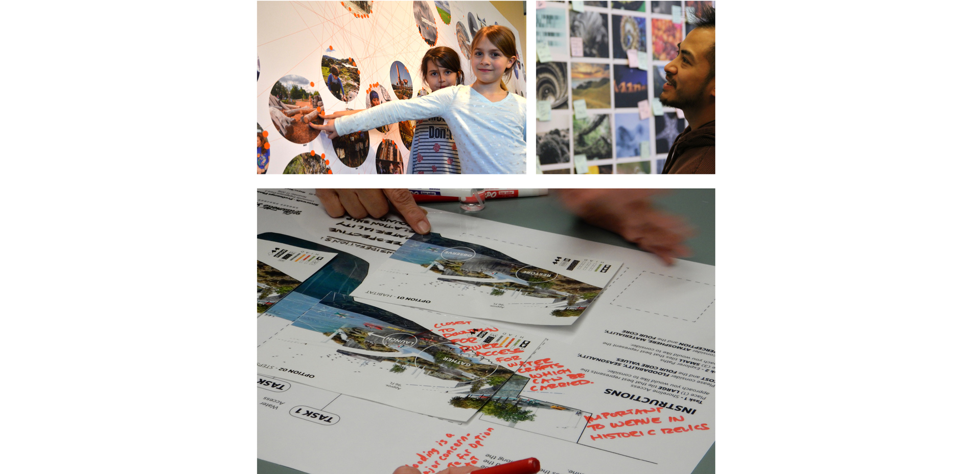
The design is the culmination of a complex two-year design process, underpinned by a significant public engagement effort that has reached thousands of unique participants. The planning process engaged a complex group of numerous stakeholders that included the Project Partners, five confederated tribes who have historic and present-day ties to the Falls, Portland General Electric, a private land owner, and the local community. Through a series of large-scale, innovative public engagement meetings, the design team was able to collect and meaningfully integrate feedback from the public via in-person and online participation.
These public engagement planning and communication practices were successful in piquing interest, inspiring involvement, and providing feedback loops for stakeholders. The innovative, large-scale scope and success of the process—as shown by large participation numbers, positive stakeholder feedback, and broad public support of the final design—have made this project a model for intentional and meaningful public involvement.
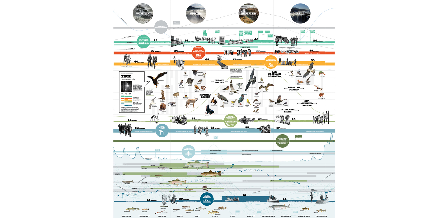
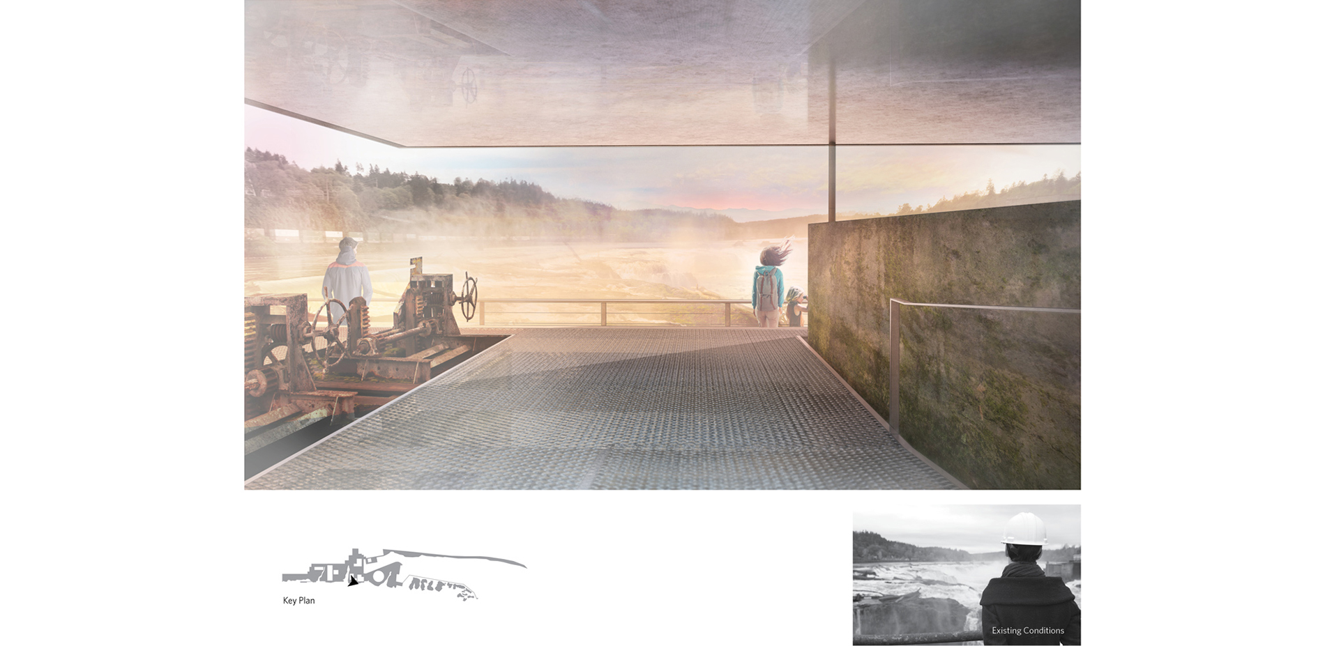
The community outreach data collected on the desired key riverwalk uses per season included: hiking trails, historic re-use, Willamette Falls viewing access, natural restoration, and water activities. Stakeholders expressed a consistent desire to "feel the power and mist of the Falls" and be able to "put their toes in the water." The design synthesized these key ideas by prioritizing a physical and emotional connection to the site, providing spaces where visitors can be close to the falling water, feel the spray, and access paths to the water.
Healthy Habitat
Home to endangered species and diverse flora and fauna, Willamette Falls' sensitive and powerful environment required the design team to calibrate a host of considerations. The design team worked closely with habitat scientists who identified the various habitat types throughout the Willamette River Watershed Region. This data allowed the design team to identify areas where these habitat types could be developed, creating opportunities to restore plant and bryophyte species on site.
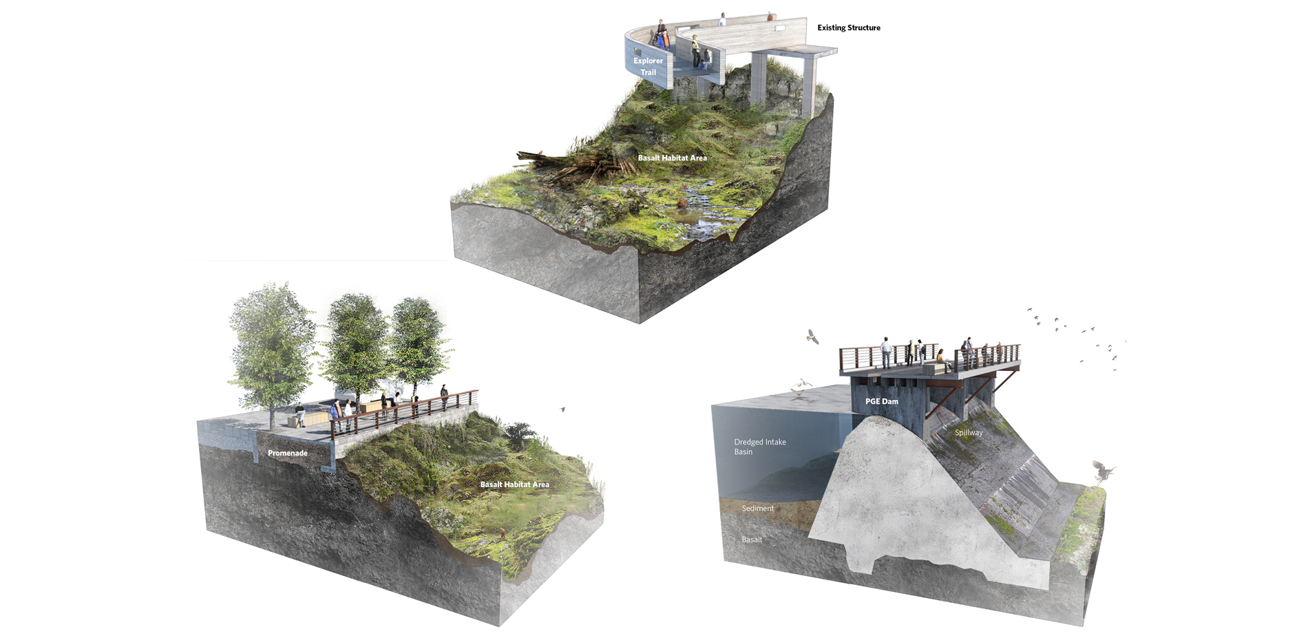
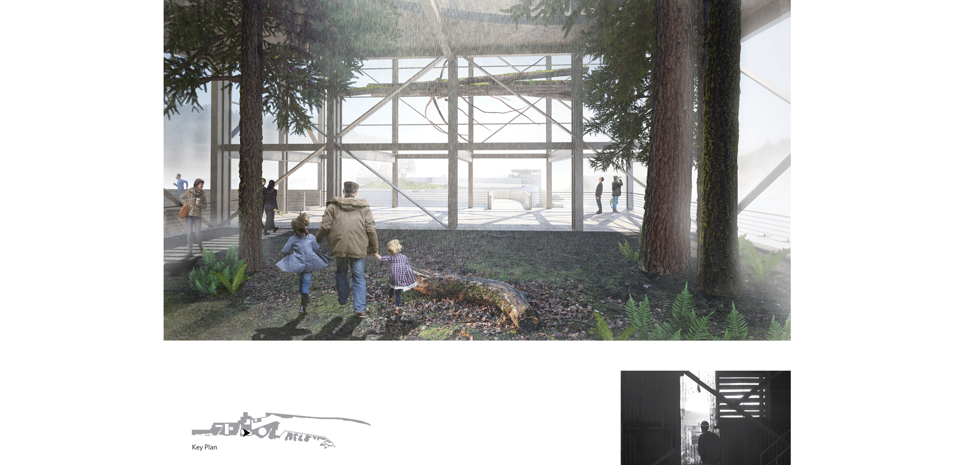
Various seasonal activities take place over the course of a calendar year at the Willamette Falls site. The project team collected data on breeding patterns of native bird, fish, and mammal species, existing habitat conditions, as well as PGE hydroelectric dam operations and waterflow. This allowed the design team to analyze and prioritize the site both in plan and in section, identifying areas where the design could selectively carve away industrial fill and structural platforms to restore region-specific ecosystems, such as alcove and riparian basalt habitats. Proposed inlets and exposed rock outcroppings provide critical off-channel moments for migratory salmon and other fish species to rest before they undertake their passage upstream beyond Willamette Falls. These efforts aim to establish an ecological vitality unique to the site and in service to endangered wildlife species. Within the site, five unique habitats will be restored, while protecting seven threatened, endangered, or sensitive species. Additionally, 60 fish species thrive in the Willamette River Basin, 31 of which are native species.
Over the course of a year, the river levels typically experience a fluctuation of approximately 25 feet. Expert hydrologists studied the effects of extreme flooding on the new design to help formulate a strategy to mitigate its potential impact. They created a hydrologic model of the existing site, calibrated to the 1996 flood event, against which each of the design options were tested. Thus, the public spaces and adaptively re-used structures of the project are designed to withstand and accommodate both regular flooding and extreme flood events. Further, the riverwalk sequence will be reinforced to withstand seismic activity within its location in a seismic zone. Pathway structures will be engineered to take advantage of existing site structures for support, minimizing the use of vertical construction and reducing impacts to the restored riparian basalt habitats below.
Historic and Cultural Interpretation
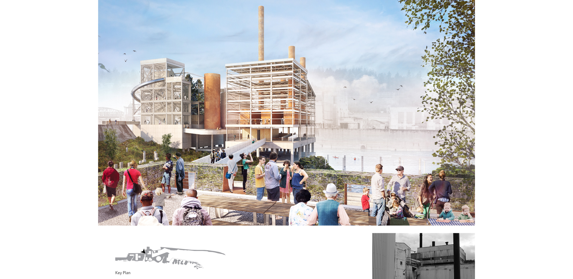
The selective removal of industrial structure not only aims to restore healthy animal and plant habitats within the retained structures and on the basalt bedrock of the site, but also provide public access and interpretation of a unique set of nationally important historic structures that charted the industrial history of the Pacific Northwest. This cultural understanding of the site extends to the five confederated tribes who will continue to annually fish the waters as they have done since time immemorial.
A Cultural Landscape Report provided a common knowledge base that focused on the site's history, combining extensive archival research, hundreds of historic photographs, and site investigations. Another report, the Interpretive Framework Plan, will guide the stories to be told on site through the riverwalk design. This rigorous cultural and historic resource analysis laid the groundwork for prioritizing the site. Through sensitive site editing, the project will make recognizable once again the history of the various industries that once harnessed the power of the Falls, including the woolen, flour, paper, and power operating structures; highlighting the site's historical, cultural, ecological and economic significance.
Economic Redevelopment
Unlike many post-industrial waterfront projects, Willamette Falls will remain as an operational, power-generating facility. PGE will remain in operation as an active component of the site and part of the authentic riverwalk experience. The project team collaborated closely with PGE to ensure that the design can accommodate dam closures for operations and maintenance, while still providing access to the Falls year-round.
Since the public release of the conceptual design, the design team has collaborated with the Project Partners to develop a framework for public infrastructure that will integrate the riverwalk with upland portions of the site. This holistic approach incorporates strategies for improved street design, site circulation, sewage, and stormwater management. Upgrades to public utilities will feed into the projects economic redevelopment goals. In tandem with the project's overall goals to improve public access, the design team is currently analyzing options that will extend Oregon City's Main Street into the site, reconnecting downtown Oregon City to the heart of its historic center while maintaining the character of the site.
